Namegawa, Saitama
| Namegawa 滑川町 | |||
|---|---|---|---|
| Town | |||
 Namegawa town office | |||
| |||
 Location of Namegawa in Saitama Prefecture | |||
 Namegawa | |||
| Coordinates: 36°3′57.6″N 139°21′39.5″E / 36.066000°N 139.360972°ECoordinates: 36°3′57.6″N 139°21′39.5″E / 36.066000°N 139.360972°E | |||
| Country | Japan | ||
| Region | Kantō | ||
| Prefecture | Saitama Prefecture | ||
| District | Hiki | ||
| Area | |||
| • Total | 29.68 km2 (11.46 sq mi) | ||
| Population (February 2016) | |||
| • Total | 18,295 | ||
| • Density | 616/km2 (1,600/sq mi) | ||
| Time zone | UTC+9 (Japan Standard Time) | ||
| - Tree | Pine | ||
| - Flower | Azalea | ||
| - Bird | Green pheasant | ||
| Phone number | 0493-56-2211 | ||
| Address | 750-1 Fukuda, Namekawa-machi, Hiki-gun, Saitama-ken 355-8585 | ||
| Website | http://www.town.namegawa.saitama.jp/ | ||


Namegawa (滑川町 Namegawa-machi) is a town located in Saitama Prefecture, Japan. As of 1 February 2016, the town had an estimated population of 18,294, and a population density of 616 persons per km². Its total area is 29.68 square kilometres (11.46 sq mi).
Geography
Namekawa is located in a hilly region of central Saitama Prefecture, approximately 60 kilometers from central Tokyo.
Surrounding municipalities
History
The village of Namegawa was created on November 3, 1954 by the merger of the villages of Fukuda and Miyamae in Hiki District, Saitama. It was elevated to town status on November 3, 1984. Proposals to merge Namegawa with one or more of its neighbors have been made in 2003, 2004, 2007 and 2008 without success.
Economy
The economy of Namegawa is largely agricultural, although it is also a bedroom community to a significant percentage of the working population, who commute to nearby Saitama City or Tokyo.
Education
Namegawa has three elementary schools, one middle school and one high school.
Transportation
Railway
Highway
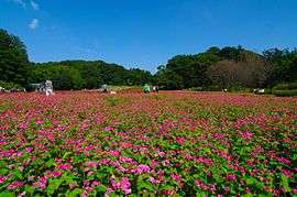
Local attractions
External links
![]()
- Official Website (in Japanese)