São Francisco do Conde
| São Francisco do Conde Município de São Francisco do Conde | |
|---|---|
| Municipality | |
 Location of São Francisco do Conde in Bahia | |
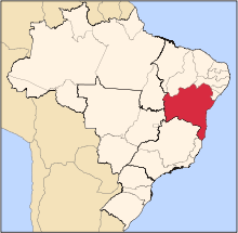
 São Francisco do Conde Location of São Francisco do Conde in Brazil | |
| Coordinates: 12°39′S 38°41′W / 12.650°S 38.683°WCoordinates: 12°39′S 38°41′W / 12.650°S 38.683°W | |
| Country |
|
| Region | Northeast |
| State |
|
| Founded | 1697 |
| Government | |
| • Mayor | Evandro Almeida1 (2013–2016) |
| Area | |
| • Total | 262.856 km2 (101.489 sq mi) |
| Population (2014) | |
| • Total | 38,838 |
| • Density | 150/km2 (380/sq mi) |
| Demonym(s) | franciscano |
| Time zone | UTC-3 (BRT) |
| Website |
saofranciscodoconde |
São Francisco do Conde is a municipality in the state of Bahia in the North-East region of Brazil. São Francisco do Conde covers 262.856 km2 (101.489 sq mi), and has a population of 38,838 with a population density of 150 inhabitants per square kilometer.[1] It is located 67 kilometres (42 mi) from the state capital of Salvador. According to the Brazilian Institute of Geography and Statistics São Francisco do Conde has the highest concentration of Brazilians of African descent (90%) in Bahia.[2]
São Francisco do Conde is home to Campus dos Malês, one of the campuses of the University of International Integration of African-Brazilian Lusophony. The campus opened in 2013.[1][2]
History
The Fernão Rodrigues, the Count of Linhares ordered the construction of a convent and church on a hilltop in the Bahian Recôncavo in 1618. The region was only settled by the Portuguese after wars with native people of the Paraguaçu and Jaguaribe rivers. Slavery existed in São Francisco do Conde as early as 1563. It later became the city of San Francisco do Conde. The city was named for the Count of Linhares, who inherited the land of the 3rd General Governor of Brazil, Mem de Sá (c. 1500 – 2 March 1572). His widow donated the plantations and land to Jesuit colleges in Lisbon and Salvador; the land and property were seized and sold by the Portuguese government during the expulsion of the Jesuits from Brazil in 1759.[3][1]
São Francisco do Conde was originally divided into approximately 20 freguesas; by the mid-18th century they were consolidated into three: São Gonçalo, the seat of the town; Nossa Senhora do Monte; and Nossa Senhora do Socorro. Numerous colonial-period buildings and ruins of the plantations remain in municipalities.[3][1]
Culture
São Francisco do Conde retains numerous cultural traditions due to its history of slavery and large Afro-Brazilian population. The town is noted as a center of the Candomblé religion, capoeira, and capa bode, masks created by Bantu slaves from Angola, now worn during Carnival.[4]
See also
References
- 1 2 3 4 "São Francisco do Conde" (in Portuguese). Brasília, Brazil: Instituto Brasileiro de Geografia e Estatstica. 2015. Retrieved 2015-06-14.
- 1 2 "Campus dos Malês" (in Portuguese). Redenção, CE, Brazil: Universidade da Integração Internacional da Lusofonia Afro-Brasileira. 2014. Retrieved 2015-07-21.
- 1 2 Dias, Maria da Graça Andrade (2015). Memórias e existências: Identidades e valores na representação social do patrimônio no Recôncavo da Bahia. Belo Horizonte, MG: Universidade Federal de Minas Gerais. pp. 46–53.
|access-date=requires|url=(help) - ↑ "Cultura" (in Portuguese). Prefeitura de São Francisco do Conde. 2017. Retrieved 2017-07-24.