Carinhanha
| Carinhanha Município de Carinhanha | ||
|---|---|---|
| Municipality | ||
 Carinhanha Square | ||
| ||
 Location of Carinhanha in Bahia | ||
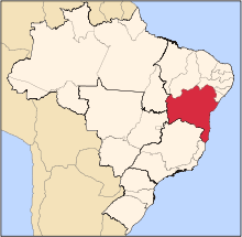
 Carinhanha Location of Carinhanha in the Brazil | ||
| Coordinates: 14°18′18″S 43°45′54″W / 14.30500°S 43.76500°WCoordinates: 14°18′18″S 43°45′54″W / 14.30500°S 43.76500°W | ||
| Country |
| |
| Region | Northeast | |
| State |
| |
| Founded | August 17, 1932 | |
| Government | ||
| • Mayor | Paulo Elisio Cotrim (2013-2016) | |
| Area | ||
| • Total | 2,529.45 km2 (976.63 sq mi) | |
| Elevation | 440 m (1,440 ft) | |
| Population (2014) | ||
| • Total | 29,864 | |
| • Density | 12/km2 (31/sq mi) | |
| Demonym(s) | Carinhanhense | |
| Time zone | UTC-3 (BRT) | |
| Website |
carinhanha | |

Carinhanha is a municipality in the state of Bahia in the North-East region of Brazil. Carinhanha covers 2,529.45 km2 (976.63 sq mi), and has a population of 29,864 with a population density of 12 inhabitants per square kilometer. It is located on the banks of the Rio São Francisco and the Carinhanha River, which also forms the border of the state of Minas Gerais.[1]
See also
References
- ↑ "Carinhanha" (in Portuguese). Brasília, Brazil: Instituto Brasileiro de Geografia e Estatística. 2015. Retrieved 2015-06-14.
This article is issued from
Wikipedia.
The text is licensed under Creative Commons - Attribution - Sharealike.
Additional terms may apply for the media files.