Mucuri
| Mucuri | |
|---|---|
| Municipality | |
| The Municipality of Mucuri | |
 Costa Dourada beach and its cliffs: the first beach in Bahia from south to north. | |
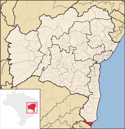 Location in Bahia | |
| Coordinates: 18°05′09″S 39°33′03″W / 18.08583°S 39.55083°WCoordinates: 18°05′09″S 39°33′03″W / 18.08583°S 39.55083°W | |
| Country | Brazil |
| Region | Northeast |
| State | Bahia |
| Founded | 1938 |
| Government | |
| • Mayor | Jose Carlos Simões (Dr Carlos) (PDT) |
| Area | |
| • Total | 1,774.763 km2 (685.240 sq mi) |
| Elevation | 7 m (23 ft) |
| Population (2017) | |
| • Total | 42,072 |
| • Density | 20.1/km2 (52/sq mi) |
| [1] | |
| Time zone | UTC-3 (UTC-3) |
| HDI (2000) | 0.626 – medium[2] |
Mucuri is a city in the state of Bahia in Brazil. The estimated population in 2017 is 42,072 inhabitants. It is the southernmost city in Bahia as well as Brazil's Northeast region, and the only one from that state to border Espírito Santo.
The city contains part of the 1,503.75 hectares (3,715.8 acres) Córrego Grande Biological Reserve. The climate is tropical, warm and mostly humid, with one or two dry months. Average annual temperature is 22 to 24 °C (72 to 75 °F), and average annual rainfall is 1,250 to 1,500 millimetres (49 to 59 in).[3]
References
- ↑ IBGE 2008 statistics
- ↑ UNDP
- ↑ "Reserva Biológica do Córrego Grande", Viarural (in Portuguese), retrieved 2016-04-15
This article is issued from
Wikipedia.
The text is licensed under Creative Commons - Attribution - Sharealike.
Additional terms may apply for the media files.