Paulo Afonso
| Paulo Afonso | |||
|---|---|---|---|
| Municipality | |||
| The Municipality of Paulo Afonso | |||
| |||
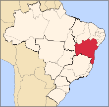
 Location in Bahia | |||
| Coordinates: 9°24′00″S 38°13′30″W / 9.40000°S 38.22500°WCoordinates: 9°24′00″S 38°13′30″W / 9.40000°S 38.22500°W | |||
| Country |
| ||
| Region | Northeast | ||
| State |
| ||
| Founded | 1958 | ||
| Government | |||
| • Mayor | Anilton Bastos (PDT) | ||
| Area | |||
| • Total | 1,579.723 km2 (609.934 sq mi) | ||
| Elevation | 243 m (797 ft) | ||
| Population (2014) | |||
| • Total | 118,323 | ||
| • Density | 74.9/km2 (194/sq mi) | ||
| [1] | |||
| Time zone | UTC-3 (UTC-3) | ||
| HDI (2010) | 0.674 – medium[2] | ||


Paulo Afonso is a city in Bahia, Brazil. It was founded in 1958.
The city is the seat of the Roman Catholic Diocese of Paulo Afonso. The city is served by Paulo Afonso Airport.
The municipality contains part of the Raso da Catarina ecoregion.[3] The municipality holds part of the 26,736 hectares (66,070 acres) Rio São Francisco Natural Monument, which protects the spectacular canyons of the São Francisco River between the Paulo Afonso Hydroelectric Complex and the Xingó Dam.[4] It contains part of the 104,842 hectares (259,070 acres) Raso da Catarina Ecological Station, created in 2001.[5]
References
- ↑ IBGE 2009 statistics
- ↑ - UNDP
- ↑ "Lampião e Conselheiro no Raso da Catarina", Bahia! (in Portuguese), retrieved 2016-11-03
- ↑ Unidade de Conservação: Monumento Natural do Rio São Francisco (in Portuguese), MMA: Ministério do Meio Ambiente, retrieved 2016-05-21
- ↑ Unidade de Conservação: Estação Ecológica Raso da Catarina (in Portuguese), MMA: Ministério do Meio Ambiente, retrieved 2016-04-19
...
This article is issued from
Wikipedia.
The text is licensed under Creative Commons - Attribution - Sharealike.
Additional terms may apply for the media files.