Lauro de Freitas
| Lauro de Freitas Município de Lauro de Freitas | |||
|---|---|---|---|
| Municipality | |||
 Aerial view of Lauro de Freitas | |||
| |||
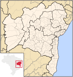 Location of Lauro de Freitas in Bahia | |||
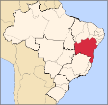
 Lauro de Freitas Location of Lauro de Freitas in Brazil | |||
| Coordinates: 12°53′38″S 38°19′37″W / 12.893889°S 38.326944°W | |||
| Country |
| ||
| Region | Northeast | ||
| State |
| ||
| Founded | July 31, 1962 | ||
| Government | |||
| • Mayor | Moema Gramacho | ||
| Area | |||
| • Total | 57.66 km2 (22.26 sq mi) | ||
| Population (2016) | |||
| • Total | 194,641 | ||
| • Density | 3,400/km2 (8,700/sq mi) | ||
| Demonym(s) | lauro-freitense | ||
| Time zone | UTC-3 (BRT) | ||


Lauro de Freitas is a municipality in Bahia, Brazil. It covers 57.66 km2 (22.26 sq mi) and a population of 194,641 (2016 est.). Lauro de Freitas has a population density of 3,376 inhabitants per square kilometer. It is located 15 km (9.3 mi) from the state capital of Bahia, Salvador.[1]
Until July 31, 1962 it was a district of Salvador, named Santo Amaro de Ipitanga; after acquiring city status, it changed its name as an homage to politician and engineer Lauro Farani Pedreira de Freitas (1901–1950), who lived there most of his life and died in a plane crash. Vilas do Atlântico, a wealthy neighborhood, is located in Lauro de Freitas.
The city is notable for being the birthplace of famous outsider musician Damião Experiença.
Services
The monastery of Priorado São Norberto runs the Centro Comunitário Cristo Libertador, which supports various charities throughout the region.
References
- ↑ "Lauro de Freitas" (in Portuguese). Brasília, Brazil: Instituto Brasileiro de Geografia e Estatística. 2017. Retrieved 2017-07-02.
Coordinates: 12°53′38″S 38°19′37″W / 12.89389°S 38.32694°W