Firmino Alves
| Firmino Alves Município de Firmino Alves | |
|---|---|
| Municipality | |
 Location of Firmino Alves in Bahia | |
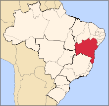
 Firmino Alves Location of Firmino Alves in Brazil | |
| Coordinates: 14°59′06″S 39°55′26″W / 14.98500°S 39.92389°WCoordinates: 14°59′06″S 39°55′26″W / 14.98500°S 39.92389°W | |
| Country |
|
| Region | Northeast |
| State |
|
| Founded | August 27, 1962 |
| Government | |
| • Mayor | Lero Cunha (PSB, 2013-2016) |
| Area | |
| • Total | 172.35 km2 (66.54 sq mi) |
| Population (2014) | |
| • Total | 5,766 |
| • Density | 33/km2 (87/sq mi) |
| Demonym(s) | Firmino-alvense |
| Time zone | UTC-3 (BRT) |
| Website | x |
Firmino Alves is a municipality in the state of Bahia in the North-East region of Brazil. It covers 172.35 km2 (66.54 sq mi), and has a population of 5,766 with a population density of 1.28 inhabitants per square kilometer. Remanso was originally inhabited by indigenous people of the Baiana or Paraguaçu ethnic group. Leonel Vieira Lima started a manioc farm and flour factory in 1935. Other families followed and formed the village Itamirim in 1938. Firmino Alves became an independent municipality on August 27, 1962 when it was separated from the municipality of Ibicaraí. It consists of two districts: Firmino Alves, the municipal seat, and Itaiá.[1]
See also
References
- ↑ "Firmino Alves" (in Portuguese). Brasília, Brazil: Instituto Brasileiro de Geografia e Estatística. 2015. Retrieved 2015-06-14.
This article is issued from
Wikipedia.
The text is licensed under Creative Commons - Attribution - Sharealike.
Additional terms may apply for the media files.