Hidden Valley, Placer County, California
| Hidden Valley | |
|---|---|
| Unincorporated community | |
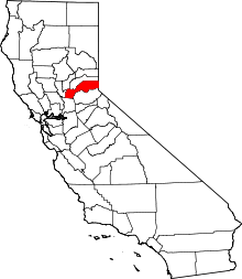
 Hidden Valley Location in California  Hidden Valley Hidden Valley (the US) | |
| Coordinates: 38°45′51″N 121°09′48″W / 38.76417°N 121.16333°WCoordinates: 38°45′51″N 121°09′48″W / 38.76417°N 121.16333°W | |
| Country |
|
| State |
|
| County | Placer County |
| Elevation[1] | 436 ft (133 m) |
Hidden Valley (formerly, Union House)[2] is an unincorporated community in Placer County, California.[1] Hidden Valley is located 4.25 miles (6.8 km) east-southeast of Rocklin.[2] It lies at an elevation of 436 feet (133 m).[1]
References
This article is issued from
Wikipedia.
The text is licensed under Creative Commons - Attribution - Sharealike.
Additional terms may apply for the media files.