The Cedars, California
| The Cedars | |
|---|---|
| Unincorporated community | |
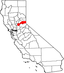
 The Cedars Location in California  The Cedars The Cedars (the US) | |
| Coordinates: 39°15′11″N 120°21′12″W / 39.25306°N 120.35333°WCoordinates: 39°15′11″N 120°21′12″W / 39.25306°N 120.35333°W | |
| Country |
|
| State |
|
| County | Placer County |
| Elevation[1] | 5,787 ft (1,764 m) |
The Cedars is an unincorporated community in Placer County, California.[1] The Cedars is located on Cedar Creek, 4.5 miles (7.2 km) south-southwest of Donner Pass.[2] It lies at an elevation of 5787 feet (1764 m).[1]
References
This article is issued from
Wikipedia.
The text is licensed under Creative Commons - Attribution - Sharealike.
Additional terms may apply for the media files.