Yankee Jims, California
| Yankee Jims | |
|---|---|
| Unincorporated community | |
 Yankee Jims Location in California  Yankee Jims Yankee Jims (the US) | |
| Coordinates: 39°01′46″N 120°51′42″W / 39.02944°N 120.86167°WCoordinates: 39°01′46″N 120°51′42″W / 39.02944°N 120.86167°W | |
| Country |
|
| State |
|
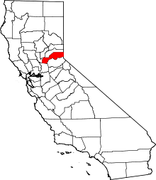
| County | Placer County |
| Elevation[1] | 2,582 ft (787 m) |
| Population (2016) | |
| • Total | 18 |
| Reference no. | 398 |
Yankee Jims (also, Yankee Jim and Yankee Jim's)[2] is a small community in Placer County, California.[1]
It lies at an elevation of 2582 feet (787 m) in the Sierra Nevada foothills.[1] Yankee Jims is located 2.5 miles (4.0 km) west-northwest of Foresthill.[2]
History
Yankee Jims was once one of the largest mining camps in Placer County during the California Gold Rush. The Yankee Jim's post office operated from 1852 to 1940.[2] The name comes from an Australian criminal who hid stolen horses at the site before gold was discovered there.[2]
The town site is marked by California Historical Landmark #398,[3] located on a ridge between the North and Middle forks of the American River.[4]
Yankee Jims today is a small town composed simply of a cluster of homes. Its population was 18 in 2016.
See also
- California Historical Landmarks in Placer County, California
- Mining communities of the California Gold Rush
References
- 1 2 3 U.S. Geological Survey Geographic Names Information System: Yankee Jims, California
- 1 2 3 4 Durham, David L. (1998). California's Geographic Names: A Gazetteer of Historic and Modern Names of the State. Clovis, Calif.: Word Dancer Press. p. 579. ISBN 1-884995-14-4.
- ↑ "Yankee Jims". Office of Historic Preservation, California State Parks. Retrieved 2012-10-11.
- ↑ Mildred Brooke Hoover, Douglas E. Kyle, Historic spots in California, Stanford University Press, Stanford, California, 2002. pp. 279-280
External links