Riva del Garda
| Riva del Garda | |
|---|---|
| Comune | |
| Comune di Riva del Garda | |
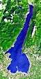
 Riva del Garda view with Lake Garda in the background | |
 Riva del Garda Location of Riva del Garda in Trentino-Alto Adige/Südtirol  Riva del Garda Riva del Garda (Italy) | |
| Coordinates: 45°53′N 10°51′E / 45.883°N 10.850°ECoordinates: 45°53′N 10°51′E / 45.883°N 10.850°E | |
| Country | Italy |
| Region | Trentino-Alto Adige/Südtirol |
| Province | Trentino (TN) |
| Frazioni | Campi, Pregasina, Rifugio Capanna Grassi, Rifugio Nino Pernici, San Nazzaro, Sant'Alessandro, Varone |
| Government | |
| • Mayor | Adalberto Mosaner |
| Area | |
| • Total | 40.73 km2 (15.73 sq mi) |
| Elevation | 70 m (230 ft) |
| Population (31 October 2017) | |
| • Total | 17,331 |
| • Density | 430/km2 (1,100/sq mi) |
| Demonym(s) | Rivani |
| Time zone | UTC+1 (CET) |
| • Summer (DST) | UTC+2 (CEST) |
| Postal code | 38066 |
| Dialing code | 0464 |
| Patron saint | Absumption of Mary |
| Saint day | August 15 |
| Website | Official website |
Riva del Garda is a town and comune in the northern Italian province of Trento of the Trentino Alto Adige region. It is also known simply as Riva and is located at the northern tip of the Lake Garda.
History
Riva del Garda belonged to the Republic of Venice, the Bishopric of Trent, the Napoleonic Kingdom of Italy and later (1815–1918) to the Austro-Hungarian empire (known as Reiff am Gartsee[1][2]). During the Third Italian War of Independence, Riva del Garda was an important supply base for the Austrian navy and was the only town on the lake captured by Italian forces. In 1918, after the end of World War I, Riva del Garda, with the rest of the Trentino, became part of the Kingdom of Italy.
Riva was the terminus for the 24 kilometres (15 miles) long Mori–Arco–Riva railway line, opened in 1891. However, the railway closed in 1936 and the railway terminus has been converted into a restaurant.
Geography
Riva del Garda is located at the north-western corner of Lake Garda, approximately 70 metres (230 feet) above sea level. The town is located at the southern edge of the Italian Alps near the Dolomites. It is bordered by Monte Rocchetta to the west and Monte Brione, 376 metres (1,234 ft) above sea level, to the east.[3] East of Riva del Garda is the village Torbole, bordered by Monte Baldo.
Climate
Winters are relatively cold, sunny and with some snow; summers are warm but rarely hot and/or muggy, mainly thanks to the local lake breeze in the afternoon.
Economy
Tourism is the most important activity of the town. The town is also home to industries such as paper manufacturing.
Main sights

.jpg)
The Museo Civico is located in the Rocca, a medieval fortress with quadrangular bastions, placed on the lake, bounded by a canal with drawbridge. It was the fortress of the noble family Scaligeri (1124), who became the Lords of Verona. It was rebuilt several times and it was used by the Austrians as barracks in the 18th century. It is frequently the seat of cultural activities, especially during the summer months. The medieval Torre Apponale was is a medieval tower first mentioned in 1273, but probably older. It belonged to the first fortress of Riva, that no longer exists. Modifications were made in 1555 and it was raised to 34 metres (112 ft). The Piazza III Novembre is situated between the tower and the harbour. The city hall comprises the Palazzo Pretorio from 1375 (the former cantonal courthouse) and the Palazzo del Provveditore (the governor's palace), built between 1472 and 1485.

The city gates Porta San Marco (11th century), built by the Venetians, and Porta San Michele (13th century), at the Piazza Cavour, are remnants of the medieval city walls. The Porta San Michele has a small battlemented belfry for the parochial church of Maria Assunta. This church was originally a romanesque-gothic building from the 14th century (attested by a medieval relief at its southern side), but was rebuilt in baroque style in 1728. It has a single nave and nine baroque altars. The altarpieces were made by local artists, such as Ignazio Martino Oliari da Riva, Giuseppe Craffonara da Riva and Giovanni Caliari da Verona. The fresco in the dome is by the 17th century Baroque painter Giuseppe Alberti.
The church Chiesa dell'Inviolata, dominating the Largo Marconi, is considered among the most beautiful baroque churches in Trentino. It is an octagonal building with the belfry next to it. It contains the altarpieces "San Carlo Borromeo" and "San Gerolamo" by the Mannerist painter Palma il Giovane. In the middle of the octagonal dome is a Baroque fresco "The coronation of Maria in Heaven".
Places of geological interest in the vicinity include Tenno Lake, Lago di Ledro (with its paleoethnographic museum), and the Varone falls.
Sport
With its two harbours, Riva del Garda is equipped for sailing and windsurfing. Rock climbing and mountain biking are also practiced. Basketball teams include Virtus Riva, playing in the "C1" division.
Via ferrata for rock climbing Via dell´Amicizia, which is 650 meters high, ends at the height of 1200 meters (route starts approximatively at the middle of the mountain at about 600 meters above the town) and lasts about 2:40 hrs. on average.[4]
Sister cities
References
- ↑ https://www.wien.gv.at/wiki/index.php?title=Riva_del_Garda
- ↑ https://www.hiwio.com/de/Artikel/Riva-del-Garda-Geschichte-442
- ↑ "The Biotope Mount Brione". gardatrentino. Retrieved 18 September 2015.
- ↑ "Via Ferratas - North Garda - VisitGarda". www.visitgarda.com. Retrieved 2015-09-13.
Sources
- Helders, Stefan (2010), "Riva", Profile of geographical entity including name variants, Germany: World Gazetteer, archived from the original on 2013-02-10
External links
| Wikimedia Commons has media related to Riva del Garda. |
- Official website (in Italian)
| Settlements |
|  |
|---|---|---|
| Islands |
| |
| Rivers | ||
| Wines | ||
| People | ||