Nago–Torbole
| Nago-Torbole | |
|---|---|
| Comune | |
| Comune di Nago-Torbole | |
 | |
 Nago-Torbole Location of Nago-Torbole in Italy | |
| Coordinates: 45°52′N 10°53′E / 45.867°N 10.883°ECoordinates: 45°52′N 10°53′E / 45.867°N 10.883°E | |
| Country | Italy |
| Region | Trentino-Alto Adige/Südtirol |
| Province | Trentino (TN) |
| Frazioni | Torbole, Nago, Tempesta |
| Government | |
| • Mayor | Gianni Morandi |
| Area | |
| • Total | 28.39 km2 (10.96 sq mi) |
| Elevation | 65 m (213 ft) |
| Population (30 November 2017)[1] | |
| • Total | 2,819 |
| • Density | 99/km2 (260/sq mi) |
| Demonym(s) | Torbolani, Naghesi |
| Time zone | UTC+1 (CET) |
| • Summer (DST) | UTC+2 (CEST) |
| Postal code | 38060, 38069 |
| Dialing code | 0464 |
| Website | Official website |
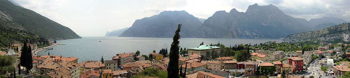
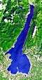
Nago–Torbole (German: Naag-Turbel) is a comune (municipality) in Trentino in the northern Italian region Trentino-Alto Adige/Südtirol, located about 30 kilometres (19 miles) southwest of Trento on the north shore of Lake Garda.
The municipality of Nago–Torbole contains the frazioni (subdivisions, mainly villages and hamlets) Torbole (Turbel), Nago (Naag), and Tempesta. The villages clings to the limestone rocks on the extreme north-west slope of Monte Baldo; it lies close to the mouth of the river Sarca and its houses are set as an anphitheatre around the small bay, in front of Monte Rocchetta and the Ledro Alps.
Nago–Torbole borders the following municipalities: Arco, Riva del Garda, Mori, Ledro, Brentonico, and Malcesine.
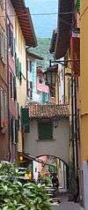
Torbole
Torbole, at 67 metres (220 ft) above sea level, is situated on the extreme north-western appendix of the Baldo chain and it is set as an amphitheatre on Lake Garda. The lake, once only valuable to fishermen and traders, is still the most precious resource together with 2,079-metre (6,821 ft) high Monte Baldo, which was once a seemingly inexhaustible mine of firewood and game though now it is a protected area for its rare flora, sometimes even endemic.
Nago
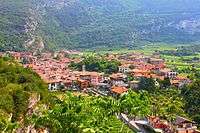
Situated on the hills above Torbole sits Nago. The parish church of Nago, San Vigilio, is located on the town's main road. The present building dates from the late 16th century, but the first church probably dates from the early Christian period. It is mentioned for the first time in 1203, in a document relating to a dispute between the people of Nago and the Bishop of Trento, Conrad II de Beseno. It is called "collegiate" in the document and its importance at the time must have been considerable.
History
Venetian domination (1440–1510) is evident in the old harbor: a typical toll house placed on a lake-front wharf. During Austrian domination (1810–1918), tourism grew during the Belle Époque. Goethe, who stopped here in September 1786, described in his writings a longing and passionate image of this place.

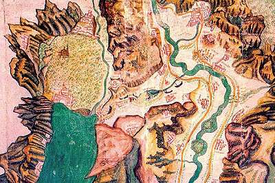
This area was populated in prehistoric times and colonized during the Imperial Roman times; it formed a community with Nago, castle residence of the Counts d'Arco. In 1439 Torbole was involved in the Third Lombard War (1438), between the Duchy of Milan and the Republic of Venice. The latter dominated the eastern side of the lake (the Riviera). In order to gain supremacy on Lake Garda and help the Venetian condottiero Gattamelata, in freeing Brescia from the Milanese siege, the Venetians transported twenty-five boats and six galleys from the Adriatic Sea up the River Adige until the fluvial harbour of Mori. Here the boats were hauled on carts by strength of arm and with oxen, launched then into Lake Loppio and finally lowered from the slopes of Monte Baldo into Lake Garda at Torbole. This exploit cost 240 oxen and 15,000 ducats. In April 1440 the small Venetian fleet destroyed Visconti's fleet and conquered Riva del Garda.

Torbole, as early as the 15th century, was a stop for European travelers passing through on the Atesina road from Germany to Italy. Montaigne visited it in 1580. Goethe arrived here from Rovereto in the afternoon of 12 September 1786, four days after having crossed Brenner Pass. Goethe was 37 years old and getting in touch with the blue expanse of Lake Garda and the silver olive-groves, he experienced for the first time the mild climate of the places extolled by the Classics, and he believed to have achieved happiness. The Brescian Cesare Arici, idyllic rural poet, exalted the "fishy Torbole". The painter Hans Lietzmann bought a large olive grove on the lake's shore (behind the Hotel Paradiso) and opened a school of nude art. The current tourist center evolved in the second half of the last century from an old village of fishermen, farmers and mountaineers, into a seasonal health-resort for European travellers, like the neighbouring Riva and Arco.
Main sights

The church of Sant'Andrea is first mentioned in a document dated 1175. In 1183 the Pope Lucius III assigned it, together with the surrounding olive grove, to the Cistercian Abbey of Saint Lorenzo in Trento. In 1497 some of the properties of the Church were given for the support of a priest who would look after the Torbole Community. In 1741 the curate of Torbole had been founded and in 1839 the church was officially consecrated. After being ravaged by French troops in 1703, the church was rebuilt in the Late Baroque style, but some architectural elements have been recovered, as testified by the dates sculptured on the base of the two rocky arches of the transept. The altar piece in the apse represents the martyrdom of Saint Andrea, by Giambettino Cignaroli. A painted vertical sundial can be seen on the church's lake facing wall and on the opposite side is a small cemetery. The parish Saint Andrea church is divided into three naves and keeps a wooden chorus. Another artwork is the 18th-century canvas by Giambettino Cignaroli representing the Saint Andrea martyrdom.
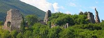
A walk brings to the ruins of Penede castle, which was destroyed in the 18th century. It had been owned by the Arco earls, by the Castelbanco's and by the Republic of Venice.

In the Hairpin bends of the road that brings to Nago are the so-called Giant's pot (Italian: Marmitte dei Giganti) representing the evidence of erosive phenomena from the glacial era, which occurred when a wide glacier covered the territories. Those so called Marmitte are sunken glacial era wells, set out by the stones and glacial, quick whirling, detritus coming down from the superior layers.
Cuisine
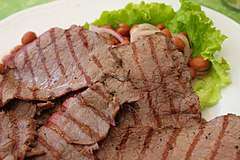
Local cuisine is based on some typical elements of the Trentino simple plain fare such as polenta and game.
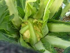
The broccoli di Torbole (Brassica oleracea var. botrytis) are a variety of cauliflower or broccoflower imported from Verona around the mid-18th century. Inside the large cabbage family, broccoli di Torbole has become separate variety in its cultivar group. After its seedling stage, it grows rapidly and without special care, but needs to be watered frequently. Maturation begins at the beginning of November and ends in April. It has a small estimated harvest of 30,000 heads per year.[2]
Sports
The is a windsurfing, kiteboarding and sailing destination, with many sports centres available to visitors and championships running throughout the year[3].
References
- ↑ All demographics and other statistics: Italian statistical institute Istat.
- ↑ "Broccolo di Torbole". 5 Esimple Ltd. Retrieved 2015-04-06.
- ↑ "Torbole sul Garda - Nago". www.visittrentino.info. Retrieved 2018-01-03.
| Wikimedia Commons has media related to Nago-Torbole. |
External links
| Settlements |
|  |
|---|---|---|
| Islands |
| |
| Rivers | ||
| Wines | ||
| People | ||