Regions of Tanzania
.svg.png)
Regions of Tanzania
History
In 1975, Tanzania had 25 regions. In 1970s, the name of the Ziwa Magharibi Region (West Lake Region) changed to Kagera Region. In 2002, Manyara Region was created out of part of Arusha Region.[1] In 2012, four regions were created: Geita, Katavi, Njombe, and Simiyu.[2] In 2016, Songwe Region was created from the western part of Mbeya Region.[3][4]
List of regions
| Region | Capital | Districts | Area | Population (2012) | Postcode | Zone | Map |
|---|---|---|---|---|---|---|---|
| Arusha Region | Arusha | 7 | 37,576 km2 (14,508 sq mi) | 1,694,310 | 23xxx | Northern | 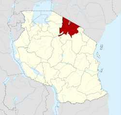 |
| Dar es Salaam Region | Dar es Salaam | 5 | 1,393 km2 (538 sq mi) | 4,364,541 | 11xxx | Coastal | 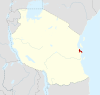 |
| Dodoma Region | Dodoma | 7 | 41,311 km2 (15,950 sq mi) | 2,083,588 | 41xxx | Central |  |
| Geita Region | Geita | 5 | 20,054 km2 (7,743 sq mi) | 1,739,530 | 30xxx | Lake | 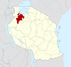 |
| Iringa Region | Iringa | 5 | 35,503 km2 (13,708 sq mi) | 941,238 | 51xxx | Southern Highlands | 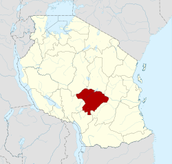 |
| Kagera Region | Bukoba | 8 | 25,265 km2 (9,755 sq mi) | 2,458,023 | 35xxx | Lake | 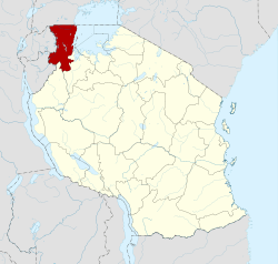 |
| Katavi Region | Mpanda | 3 | 45,843 km2 (17,700 sq mi) | 564,604 | 50xxx | Western |  |
| Kigoma Region | Kigoma | 8 | 37,040 km2 (14,300 sq mi) | 2,127,930 | 47xxx | Western | 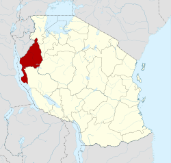 |
| Kilimanjaro Region | Moshi | 7 | 13,250 km2 (5,120 sq mi) | 1,640,087 | 25xxx | Northern |  |
| Lindi Region | Lindi | 6 | 66,040 km2 (25,500 sq mi) | 864,652 | 65xxx | Coastal | 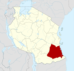 |
| Manyara Region | Babati | 6 | 44,522 km2 (17,190 sq mi) | 1,425,131 | 27xxx | Northern |  |
| Mara Region | Musoma | 7 | 21,760 km2 (8,400 sq mi) | 1,743,830 | 31xxx | Lake | 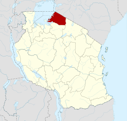 |
| Mbeya Region | Mbeya | 7 | 35,954 km2 (13,882 sq mi) | 2,707,410[lower-alpha 1] | 53xxx | Southern Highlands | 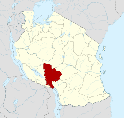 |
| Morogoro Region | Morogoro | 7 | 70,624 km2 (27,268 sq mi) | 2,218,492 | 67xxx | Coastal | 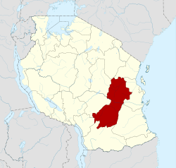 |
| Mtwara Region | Mtwara | 7 | 16,710 km2 (6,450 sq mi) | 1,270,854 | 63xxx | Coastal | 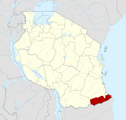 |
| Mwanza Region | Mwanza | 7 | 9,467 km2 (3,655 sq mi) | 2,772,509 | 33xxx | Lake |  |
| Njombe Region | Njombe | 6 | 21,347 km2 (8,242 sq mi) | 702,097 | 59xxx | Southern Highlands | 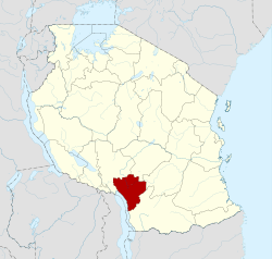 |
| Pemba North Region | Wete | 2 | 574 km2 (222 sq mi) | 211,732 | 75xxx | Zanzibar |  |
| Pemba South Region | Chake-Chake | 2 | 332 km2 (128 sq mi) | 195,116 | 74xxx | Zanzibar |  |
| Pwani Region | Kibaha | 7 | 32,547 km2 (12,566 sq mi) | 1,098,668 | 61xxx | Coastal |  |
| Rukwa Region | Sumbawanga | 4 | 22,792 km2 (8,800 sq mi) | 1,004,539 | 55xxx | Southern Highlands | 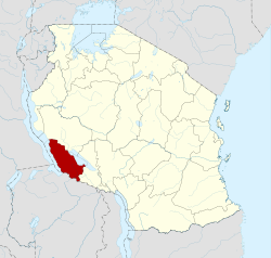 |
| Ruvuma Region | Songea | 6 | 63,669 km2 (24,583 sq mi) | 1,376,891 | 57xxx | Southern Highlands |  |
| Shinyanga Region | Shinyanga | 5 | 18,901 km2 (7,298 sq mi) | 1,534,808 | 37xxx | Lake | 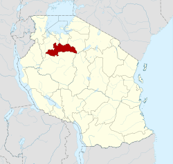 |
| Simiyu Region | Bariadi | 5 | 25,212 km2 (9,734 sq mi) | 1,584,157 | 39xxx | Lake | 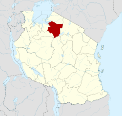 |
| Singida Region | Singida | 6 | 49,340 km2 (19,050 sq mi) | 1,370,637 | 43xxx | Central |  |
| Songwe Region | Vwawa | 5 | 27,656 km2 (10,678 sq mi) | –[lower-alpha 1] | – | Southern Highlands |  |
| Tabora Region | Tabora | 7 | 76,150 km2 (29,400 sq mi) | 2,291,623 | 45xxx | Central | 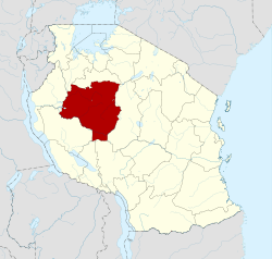 |
| Tanga Region | Tanga | 10 | 26,667 km2 (10,296 sq mi) | 2,045,205 | 21xxx | Northern | 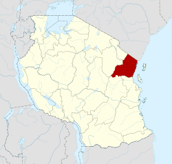 |
| Zanzibar North Region | Mkokotoni | 2 | 470 km2 (180 sq mi) | 187,455 | 73xxx | Zanzibar | 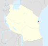 |
| Zanzibar South Region | Koani | 2 | 854 km2 (330 sq mi) | 115,588 | 72xxx | Zanzibar |  |
| Zanzibar Urban West Region | Zanzibar City | 2 | 230 km2 (89 sq mi) | 593,678 | 71xxx | Zanzibar |  |
See also
Notes
- 1 2 Songwe Region did not exist at the time of the 2012 Tanzanian census: it was split from the western part of Mbeya Region in 2016. The four districts and one town now comprising Songwe Region reported a combined population of 998,862 in the 2012 census. The seven districts now comprising Mbeya Region reported a combined population of 1,708,548 in the 2012 census.[5]
References
- 1 2 "Regions of Tanzania". Statoids. Retrieved 6 December 2014.
- ↑ "Tanzania: State Gazettes New Regions, Districts". Daily News. Dar es Salaam, Tanzania.
- ↑ "History". Songwe Regional Commissioner's Office. Retrieved 1 December 2017.
- ↑ "Welcome to Mbeya Region". Mbeya Regional Commissioner Office. Archived from the original on 22 February 2017. Retrieved 21 February 2017.
- ↑ "Sub-Divisional Population Projection for Year 2016 and 2017 Based on 2012 Population and Housing Census" (PDF). National Bureau of Statistics. Retrieved 1 December 2017.
| Mainland | ||
|---|---|---|
| Zanzibar | ||
This article is issued from
Wikipedia.
The text is licensed under Creative Commons - Attribution - Sharealike.
Additional terms may apply for the media files.