Dar es Salaam
| Dar es Salaam Mzizima | |
|---|---|
| City and Region | |
| City of Dar es Salaam | |
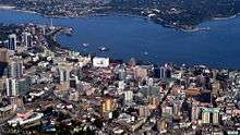
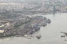
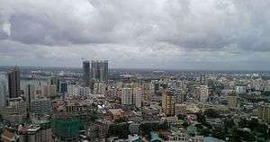 An aerial view of the Dar es Salaam city skyline during the day time. | |
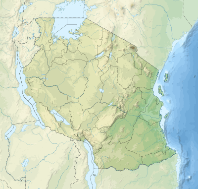 Dar es Salaam Location of Dar es Salaam  Dar es Salaam Dar es Salaam (Africa)  Dar es Salaam Dar es Salaam (Earth) | |
| Coordinates: 6°48′S 39°17′E / 6.800°S 39.283°ECoordinates: 6°48′S 39°17′E / 6.800°S 39.283°E | |
| Country | Tanzania |
| Zone | Coastal Indian Ocean |
| Districts | |
| Government | |
| • Regional Commissioner | Paul Makonda |
| • Lord Mayor | Isaya Mwita Charles |
| Area[1] | |
| • Total | 1,393 km2 (538 sq mi) |
| • Water | 0 km2 (0 sq mi) |
| Population (2012) | |
| • Total | 4,364,541 |
| • Density | 3,100/km2 (8,100/sq mi) |
| Time zone | UTC+3 (EAT) |
| Postcode | 11xxx |
| Area code(s) | 022 |
| Climate | Tropical savanna (Aw) |
| Website | City Website |
Dar es Salaam (Dar) (from Arabic: دار السلام Dār as-Salām, "the house of peace"; formerly Mzizima) is the former capital as well as the most populous city in Tanzania and a regionally important economic centre.[2] Located on the Swahili coast, the city is one of the fastest growing cities in the world.[3]
Until 1974, Dar es Salaam served as Tanzania’s capital city, at which point the capital city commenced transferring to Dodoma, which was officially completed in 1996. However, as of 2017, it continues to remain a focus of central government bureaucracy, although this is in the process of fully moving to Dodoma. In addition, it is Tanzania's most prominent city in arts, fashion, media, music, film and television and a leading financial centre. The city is the leading arrival and departure point for most tourists who visit Tanzania, including the national parks for safaris and the islands of Unguja and Pemba. Dar es Salaam is also the largest and most populous Swahili-speaking city in the world.
It is the capital of the co-extensive Dar es Salaam Region, which is one of Tanzania's 31 administrative regions and consists of five districts: Kinondoni in the north, Ilala in the centre, Ubungo, Temeke in the south and Kigamboni in the east across the Kurasini creek. The region had a population of 4,364,541 as of the official 2012 census.[4]:2
History
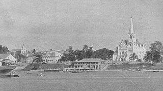
In the 19th century, Mzizima (Swahili for "healthy town") was a coastal fishing village on the periphery of Indian Ocean trade routes.[5][6] In 1865 or 1866, Sultan Majid bin Said of Zanzibar began building a new city very close to Mzizima[6] and named it Dar es Salaam. The name is commonly translated as "abode/home of peace", based on the Arabic dar ("house"), and the Arabic es salaam ("of peace").[6] Dar es Salaam fell into decline after Majid's death in 1870, but was revived in 1887 when the German East Africa Company established a station there. The town's growth was facilitated by its role as the administrative and commercial centre of German East Africa and industrial expansion resulting from the construction of the Central Railway Line in the early 1900s.
German East Africa was captured by the British during World War I and became Tanganyika, with Dar es Salaam remaining the administrative and commercial centre. Under British indirect rule, separate European (e.g., Oyster Bay) and African (e.g., Kariakoo and Ilala) areas developed at a distance from the city centre. The city's population also included a large number of workers from British India, many of whom came to dominate trade and commerce. After World War II, Dar es Salaam experienced a period of rapid growth.
Political developments, including the formation and growth of the Tanganyika African National Union, led to Tanganyika attaining independence from colonial rule in December 1961. Dar es Salaam continued to serve as its capital, even when in 1964 Tanganyika and Zanzibar merged to form Tanzania. In 1973, however, provisions were made to relocate the capital to Dodoma, a more centrally located city in the interior. The relocation process has not yet been completed, and Dar es Salaam remains Tanzania's primary city.
In 1967, the Tanzanian government declared the Ujamaa policy, that set Tanzania into a socialist path. The move slowed down the potential growth of the city as the government encouraged people not to move in cities but stay in Ujamaa socialist villages. But by the 1980s the Ujamaa policy proved to be a failure into combating increasing poverty, hunger, and delayed development that Tanzania faced. This led to the 1980s liberalization policy that virtually ended socialism and its spirit within the Tanzania's government.
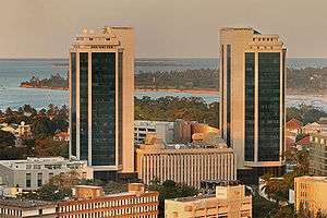
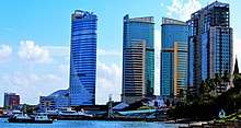
Until the late 1990s, Dar es Salaam was not put into the same category as Africa's leading cities like Nairobi, Johannesburg, Lagos, or Addis Ababa. But the 2000s decade became the turning point as the city experienced one of Africa's fastest urbanization rates as businesses were opened and prospered, growth in the construction sector with multi-storey building, bridges and roads,[7] Tanzanian banks headquartered in the city started to run more proper, the Dar es Salaam Stock Exchange expanded, and the Dar es Salaam harbour proved to be the most important in Tanzania and prominent for entrepot trade with landlocked countries like eastern Democratic Republic of Congo, Rwanda, Burundi, and Zambia. The CBD skyline hosts tall buildings, among them the 35-floor PSPF Tower, finished in 2015, and the Tanzania Ports Authority (TPA) Tower, currently under construction .[7]
Geography
Dar es Salaam is located at 6°48' South, 39°17' East (−6.8000, 39.2833),[8] on a natural harbour on the eastern coast of East Africa, with sandy beaches in some areas.
The region of Dar es Salaam is divided into five districts.
Districts of Dar es Salaam region
Dar es Salaam Region is divided into five[9] administrative districts. All five are governed as municipal councils, and so all of the city's suburbs or wards are affiliated with them. The regional commissioner is Paul Makonda.
| Districts of Dar es Salaam Region | |||
|---|---|---|---|
| District | Population (2012) | Area km² | |
| Ilala | 1,220,611 | 210 | |
| Kinondoni | 1,775,049 | 527 | |
| Temeke | 1,368,881 | 656 | |
| Kigamboni | NA | NA | |
| Ubungo | NA | NA | |
| Dar es Salaam Region | 4,364,541 | 1,393 | |
Kinondoni
Kinondoni is the most populated amongst the districts, with half of the city's population residing within it. It is also home to high-income suburbs. These include:
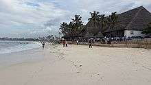
- Masaki, Oysterbay and Ada Estate are the high-income suburbs located along the central beach. During the Colonial Era, they were the major European suburbs of the city. Now diplomats and expatriates reside in these areas. Oysterbay Beach, also known as Coco Beach, is the only white sandy beach east of Kinondoni.
- Mikocheni and Regent Estate are also suburbs within the district. According to the 2012 census, the Mikocheni ward had a population of 32,947.[4]:75
- Msasani is a peninsula to the northeast of the city center. It is home to expatriates from the United Kingdom and other western countries. Msasani contains a mixture of traditional shops and western-oriented resorts and stores.
- Mbezi Beach is the beachfront suburb located along the northern Dar es Salaam Beach. It contains several tourist hotels, residences and further more a kite surfing area by Upepo Avenue.
- Sinza, Kijitonyama, Magomeni, Kinondoni and Mwenge are more ethnically mixed than the areas above. These are located west of Dar es Salaam's central business district.
- Tandale, Mwananyamala-Kisiwani and Kigogo are considered low-income neighborhoods characterized by poor settlement planning, low quality housing and social services.
Ilala
Ilala is the administrative district of Dar es Salaam where almost all government offices and ministries are housed. The Central Business District (locally called "Posta") is located in this district. It is the transportation hub of the city, as the Julius Nyerere International Airport, Central Railway Station and Tazara Railway Station are all within the district boundaries. The residential areas are mainly middle to high-income, and some of these are:
- Upanga & Kisutu had the highest concentration of Asian communities within Dar es Salaam, with residents of Indian and Arabian descent. These areas contain colonial houses and mansions built in Indian, Arabic and European styles. Upanga contains Upanga East and Upanga West.
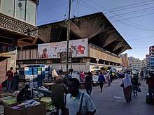
- Kariakoo is the shopping district of the city. Shops, bazaars and merchants dot the streets, selling products from foodstuffs to hardware materials. The Kariakoo Market, which is the largest, contains the only underground section of the city. It is the major supply point of the food consumed by all the residents of Dar es Salaam.
- Tabata, Segerea and Ukonga are located a bit farther west from the city center. They are becoming busier in terms of business and entertainment, which has caused serious traffic congestion.
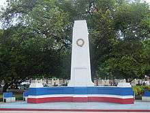
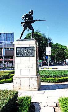
- Ilala is among the middle-income suburbs very near to the city center, and is marked by the Askari Monument. It suffers from gang activity.
Temeke
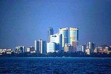
.jpg)
Temeke is the industrial district of the city, where the manufacturing centers (heavy and light industry) are located. The Port of Dar es Salaam, which is the largest in the country, is found east of Temeke.
Temeke is believed to have the largest concentration of low-income residents due to industry. Port officials, military and police officers live there.
- Kurasini located on the Dar es Salaam Harbour, is the home of the Dar es Salaam Port, The Police College, Mgulani Police Barracks and the Dar es Salaam International Trade Fair Grounds. Thus, the main residents are police officers and port officials.
- Chang'ombe is one of the only higher income areas in Temeke. It has maintained this status due to occupation by African high colonial officers and some industry owners from the colonial era. Chang'ombe is the home of the Dar es Salaam University College of Education, the National Stadium and Uhuru Stadium.
- Temeke, Mtoni and Tandika are middle to low-income suburbs.
- Mbagala and Kijichi are middle to low-income suburbs. Mbagala is the largest suburb in the whole district, and is also considered a slum.
Ubungo
The Ubungo terminal serves as a transportation link to most large Dar es Salaam urban nodes. The narrow-gauge commuter rail runs from there to the city centre, with ten level crossings along the route.
Kigamboni
- Kigamboni (South Beach), a beachfront suburb on a peninsula, is home to an economically diverse population. Access to the suburb is mainly by ferry, although the Kigamboni Bridge provides an alternative.
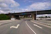 Railway tracks over Kurasini road, Dar es Salaam
Climate
Due to close proximity to the equator and the warm Indian Ocean, the city experiences tropical climatic conditions, typified by hot and humid weather throughout much of the year. It has a tropical wet and dry climate (Köppen: Aw). Annual rainfall is approximately 1,100 mm (43 in), and in a normal year there are two rainy seasons: "the long rains" in April and May and "the short rains" in November and December.
| Climate data for Dar es Salaam | |||||||||||||
|---|---|---|---|---|---|---|---|---|---|---|---|---|---|
| Month | Jan | Feb | Mar | Apr | May | Jun | Jul | Aug | Sep | Oct | Nov | Dec | Year |
| Record high °C (°F) | 35.0 (95) |
35.2 (95.4) |
35.0 (95) |
35.0 (95) |
32.9 (91.2) |
33.0 (91.4) |
31.8 (89.2) |
31.9 (89.4) |
33.8 (92.8) |
33.7 (92.7) |
34.0 (93.2) |
34.5 (94.1) |
35.2 (95.4) |
| Average high °C (°F) | 31.8 (89.2) |
32.4 (90.3) |
32.1 (89.8) |
30.7 (87.3) |
29.8 (85.6) |
29.3 (84.7) |
28.9 (84) |
29.4 (84.9) |
30.3 (86.5) |
30.9 (87.6) |
31.4 (88.5) |
31.6 (88.9) |
30.7 (87.3) |
| Average low °C (°F) | 23.5 (74.3) |
23.3 (73.9) |
22.8 (73) |
22.4 (72.3) |
21.3 (70.3) |
19.2 (66.6) |
18.2 (64.8) |
18.1 (64.6) |
18.4 (65.1) |
19.7 (67.5) |
21.3 (70.3) |
22.8 (73) |
20.9 (69.6) |
| Record low °C (°F) | 18.1 (64.6) |
18.4 (65.1) |
19.6 (67.3) |
19.6 (67.3) |
16.2 (61.2) |
14.4 (57.9) |
13.7 (56.7) |
12.8 (55) |
14.3 (57.7) |
15.8 (60.4) |
17.6 (63.7) |
18.8 (65.8) |
12.8 (55) |
| Average rainfall mm (inches) | 76.3 (3.004) |
54.9 (2.161) |
138.1 (5.437) |
254.2 (10.008) |
197.8 (7.787) |
42.9 (1.689) |
25.6 (1.008) |
24.1 (0.949) |
22.8 (0.898) |
69.3 (2.728) |
125.9 (4.957) |
117.8 (4.638) |
1,149.7 (45.264) |
| Average rainy days (≥ 1.0 mm) | 7 | 4 | 11 | 18 | 13 | 5 | 4 | 4 | 3 | 5 | 8 | 9 | 91 |
| Average relative humidity (%) | 77 | 76 | 80 | 84 | 81 | 78 | 77 | 76 | 75 | 76 | 78 | 78 | 79 |
| Mean monthly sunshine hours | 235.6 | 223.2 | 213.9 | 156.0 | 213.9 | 222.0 | 223.2 | 266.6 | 252.0 | 275.9 | 252.0 | 241.8 | 2,776.1 |
| Mean daily sunshine hours | 7.6 | 7.9 | 6.9 | 5.2 | 6.9 | 7.4 | 7.2 | 8.6 | 8.4 | 8.9 | 8.4 | 7.8 | 7.6 |
| Source #1: World Meteorological Organization[10] | |||||||||||||
| Source #2: Deutscher Wetterdienst (extremes, humidity, and sun)[11] | |||||||||||||

Government
"In 1949 the town became a municipality...[with] four honourable nominated Town Councillors who elected a Mayor."[12] "Until June 1996, Dar es Salaam was managed by the Dar es Salaam City Council...the highest policy-making body in the city."[13] As of 2017 Paul Makonda serves as the commissioner of Dar es Salaam Region.
Globalization
As any growing city Dar es Salaam is the city in Tanzania to which villagers flock for better opportunities. Westerners and Asians are also settling in Dar es Salaam, and the movement of foreigners has put a good work load on the relevant government body for developing better policies to accommodate the growing and the diverse population of the Dar es salaam together with its suburbs.
Population
Dar es Salaam is the most populous city in Tanzania. With a population increase of 5.6 percent per year from 2002 to 2012, it is the third-fastest-growing city in Africa, after Bamako and Lagos, and the ninth-fastest-growing in the world. The metro population is expected to reach 5.12 million by 2020 and predicted to be as high as 76 million by the year 2100, making it the third largest city on earth (after Lagos and Kinshasa), by 2100.[14][15]
According to the 2012 national census, the region had a population of 4,364,541, which was much higher than the pre-census projection of 3,270,255.[16]:page 2 For 2002–2012, the region's 5.6 percent average annual population growth rate was the highest in the country.[16]:page 4 It was also the most densely populated region with 3,133 people per square kilometer.[16]:page 6
The sprawling suburbs furthest from the city centre are generally populated by Tanzanians of African descent, with the exception of Oyster Bay, where there is a large population of foreign expatriates. The edges of Dar es Salaam are spreading rapidly, severely taxing the transportation network (which aside from ferries, lacks any kind of mass transit facilities)[17] and raising the prospect of future urban overcrowding.
| Year | Population |
|---|---|
| 1925: | 30,000 |
| 1948: | 69,000 |
| 1957: | 129,000 |
| 1972: | 396,000 |
| 2005: | 2,456,100 |
| 2012: | 4,364,541 |
| 2025: | 5,690,000 (projection) |
Economy and infrastructure
Dar es Salaam is Tanzania's most important city for both business and government. The city contains high concentrations of trade and other services and manufacturing compared to other parts of Tanzania, which has about 80 percent of its population in rural areas. Downtown includes small businesses, many of which are run by traders and proprietors whose families originated from the Middle East and the Indian sub-continent—areas of the world with which the settlements of the Tanzanian coast have had long-standing trading relations.
The Dar es Salaam Central Business District is made up of Kisutu, Kivukoni, Upanga and Kariakoo areas is Tanzania's largest city CBD. All three areas making up the downtown are found in the Ilala district. Kivukoni has the city's important fish market, the Magogoni fish market. Kivukoni also is the place where the Tanzania's central bank, The Bank of Tanzania is located, so is the Dar es Salaam Stock Exchange.[7] Kisutu has businesses and offices and is the location of Dar es Salaam central railway station, the PSPF Towers and the TPA tower.
Dar es Salaam has a problem with slums. According to a United Nations estimate, 70 percent of the city's population lives in informal settlements.[18] The poorer residents crowd into downtown areas or large slums, many without running water or basic services.[18] The more wealthy live in beachside mansions in the city's northern districts.[18]
Challenges facing the Dar es Salaam Economy and Infrastructure 05 July 2018
Dar es Salaam has had a major construction boom. The PSPF Twin Towers with more than 35 stories is the tallest building in the city and the country.[19] Dar es Salaam has major infrastructural challenges, including an outdated transport system and occasional power rationing.
Financial Services
The Dar es Salaam Stock Exchange (DSE) being the country's first and most important stock exchange market.[4]
Retail
Dar es Salaam hosts the Mlimani City shopping Mall.
Transportation
Dar es Salaam on a natural harbour on the Indian Ocean, is one of the hub of the Tanzanian transportation system as the main railways and several highways originate in or near the city to serve convenient means of transportation for commuters.
Local public transport
The most common form of transport in Dar es Salaam are the public buses, called dala dala, which are often found at the major bus terminals of Makumbusho and Ubungo. Since the introduction of motorcycle transit business known as "Bodaboda", most of the people prefer this type of transportation which allows them to get into the city faster compared to the minibuses which face a lot of traffic. Other types of transport include motorcycles and Bajaj.
Bus
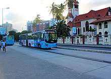
The government has been introducing a bus rapid transport or metro bus system under the Dar es Salaam bus rapid transit meaning 'mwendo kasi' in Kiswahili. The metro buses are managed by UDA (Usafiri Dar es Salaam).
The bus rapid transit system Phase 1 is completed and already in operation by the Dar es Salaam Rapid Transit Agency,[20] a government-private sector entity, and began operation on 10 May 2016. It is branded as UDA-RT (Usafiri Dar es Salaam Rapid Transit). The first section runs between Kimara in the northwest to Kivukoni on the northern headland of the harbour.[21] Phase 1 was funded by the World Bank, African Development Bank and the Tanzanian government.[22]
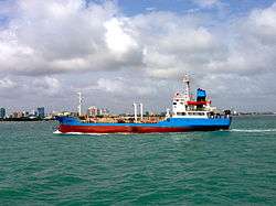
Maritime Transport
Port
The city has the country's busiest port: The port is located on the west of the Indian Ocean, Kurasini creek south east of Dar es Salaam's central business District. The Port of Dar es Salaam handles 90% of the country's cargo.
Future infrastructure government aspirations
Due to huge influx of cargo and the slow pace of expansion a new cargo port 60 kilometres (37 miles) northwest of Dar es Salaam is proposed at Bagamoyo.[23]
Ferry
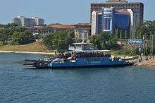
MV Kigamboni ferries are running between south east of Kivukoni and north west of Kigamboni in Dar es Salaam.[24]
Railway
Dar es Salaam commuter rail
Travel to Urban and sub urban parts of Dar es Salaam is provided by the Dar es Salaam commuter rail.
Intra City Railway
Tanzania Railways operates the Central Line from Dar es Salaam to Kigoma
International Railway
The city also hosts the head office of Tanzania Zambia Railways Authority (TAZARA) built in the late 1960s to early 1970s. The main terminal is located west of Dar es Salaam's central business district in north Yombo Vituka along Nelson Mandela road. The TAZARA Railway connects Dar es Salaam to Zambia.
Airport
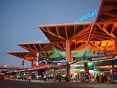
The Julius Nyerere International Airport is the principal airport serving the country with two operating terminals and one under construction; Terminal Three at Kipawa in Ilala Municipality. The airport is located west of Dar es Salaam's central business district.
Culture
Art
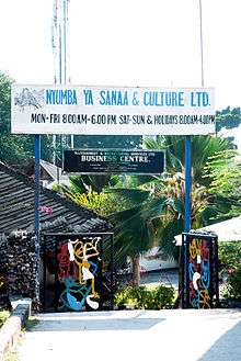
Dar es Salaam (and specifically the area of Oyster Bay) is home to the brightly coloured and tourist-oriented Tingatinga painting style. The Tingatinga Arts Cooperative Society is a cultural centre, workshop and shop dedicated to Tanzanian art, showcasing and promoting Tanzanian craftmanship. Prominent Tanzanian sculptor George Lilanga has donated some of his works to the centre, including decorations of the building's main entrance.
Music
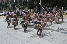
The music scene in Dar es Salaam is divided between several styles. The longest standing style is live dance music (muziki wa dansi) bands such as DDC Mlimani Park Orchestra and Malaika Musical Band as examples. Taarab which was traditionally strong in Zanzibar has also found a niche. However, it remains small compared both to dance music and "Bongo Flava", a broad category that represents the Tanzanian take on Hip Hop and R&B, which has quickly become the most popular locally produced music. Traditional music, which locally is used to refer to tribal music is still performed but typically only on family oriented occasions such as weddings. Recently there has been development of another music niche, a taste that is rising and to be prominent as BongoFlava known as Singeli with star singers such as Msaga Sumu and Man Fongo.
This rap scene is also present.[25]
In the 1970s, the Ministry of National Youth Culture aimed to create a national culture, which stressed the importance of music. Dar es Salaam became the music center in Tanzania, with the local radio showcasing new bands and dominating the music and cultural scene. With this ujamaa, or family, mentality governing culture and music a unified people’s culture was created, leading to the rise of hip hop music.[26] Throughout the years, the radio in Dar es Salaam has played a major role in the dissemination of music because many people don’t have television and cassettes are used over CDs.
Cuisines
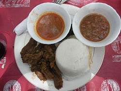
Due in part to the growth of the expatriate community and the increasing importance of tourism, the number of restaurants serving international cuisines has risen rapidly. The city offers a diversity of cuisine, ranging from traditional Tanzanian Barbecue-style options, such as Nyama Choma (Roasted meat—served with rice or ugali) and Mishkaki (Shish kebab—usually barbecued and served with salt, hot chili peppers, chapati, fries, and rice on the side), as well as the long-established traditional Indian and Zanzibari cuisine, to options from all corners of the globe, including Arab, Chinese, Thai, Turkish, Italian, and Japanese food. People who are looking for a light meal or a snack and prefer neither fast food nor a meal from the traditional restaurants buy their food from street vendors, who usually sell good food and snacks at low prices. Samosas (sambusas) with coconut chutney are the most common snack street food items within the city, as the area is largely influenced by the fresh food products and spices imported from India.
Tourism
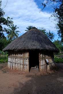
Dar es Salaam has two of the five museums comprising the National Museum of Tanzania consortium, namely the National Museum proper and the Makumbusho Cultural Centre & Village Museum. The National Museum is dedicated to the history of Tanzania; most notably, it exhibits some of the bones of Paranthropus boisei that were among the findings of Louis Leakey at Olduvai. The Makumbusho Cultural Centre & Village Museum,[27] located in the outskirts of the city on the road to Bagamoyo, showcases traditional huts from 16 different Tanzanian ethnic groups. There are also examples of traditional cultivations, and traditional music and dance shows are held daily. In 2016, there was a breakthrough discovery in Northern Tanzania by a scientist, from the University of Dar es Salaam, of footprints thought to be of a hominid that predates Homo sapiens.
Close to the National Museum are also the botanical gardens, with tropical plants and trees.
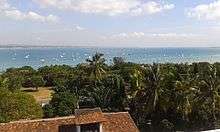
There are beaches on the Msasani peninsula north of Dar es Salaam and in Kigamboni to the south. Trips to the nearby islands of the Dar es Salaam Marine Reserve are a popular daytrip from the city and a spot for snorkeling, swimming and sunbathing. Bongoyo Island can be reached by boat from the Msasani Slipway.
Sports
Stadium
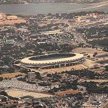
Dar es Salaam is the sports center of Tanzania. Dar es Salaam hosts the second largest stadium in East and Central Africa (National Stadium), which can accommodate up to 60,000 people.
Football (Soccer)
The National Stadium hosts Dar es Salaam's Young Africans Sports Club, Simba Sports Club, Azam F.C. and other Tanzanian football clubs, and international matches. There is a proposal to build a new stadium in Dodoma, much bigger in capacity than the present one in Dar es Salaam by the government as a donation from the Moroccan Kingdom.
Apart from the National Stadium, Dar es Salaam is home to the Uhuru Stadium (used mainly for local tournaments and political gatherings), Karume Memorial Stadium (the home of the Tanzania Football Federation). The stadium is situated west of Kurasini.
Golf
The Gymkhana Golf Courses located north west of the Kivukoni area (between the city centre looking on to the shores of the Indian Ocean in the east and Barack Obama Drive), also has tennis courts, squash courts, and a fitness club. Outside of the metropolitan districts, there is the Lugalo Military Golf Course (located in the Lugalo Military Barracks).
Acrobatics
Dar es Salaam's Mama Africa school, founded in 2003, is known for training some of Africa's finest acrobats.[28]
Squash
Dar es Salaam's Union Sports Club[29] hosts a single indoor squash court with a referees viewing gallery within the club grounds. The club has a yearly Squash tournament once a year during the muslim month of ramadhan.
Darts
Dar es Salaam's Union Sports Club[30] hosts a single room Darts room.The club has a yearly Darts tournament once a year during the muslim month of ramadhan.
Table Tennis
Dar es Salaam's Union Sports Club[31] hosts a single room Table Tennis. The club has a yearly Table Tennis tournament once a year during the muslim month of ramadhan.
Scrabble
Dar es Salaam's Union Sports Club[32] hosts an under the sky outdoor scrabble tournaments within the club grounds once a year during the muslim month of ramadhan.
Swimming
Dar es Salaam hosts numerous outdoor swimming clubs and also swimming opportunities offered to people for leisure on the sandy beaches of the Indian Ocean being a coastal city.
Media
Newspapers
Newspapers in Dar es Salaam are often sold by people prowling through stationary traffic at road intersections. English-language ones, with online presences, include The Citizen and The Guardian and the Kiswahili dailies, Tanzania Daima and Mwananchi. Business Times is the only financial and economic newspaper in the city. It was established in 1988 and became the first private newspaper in Tanzania. Business Times owns Majira, another Kiswahili newspaper.
Television stations
Dar es Salaam is home to ITV,[33] Channel Ten Television Station formerly known as Dar es Salaam Television (DTV) and Azam TV, a subscription-based service from the Azam group of companies.
Ayo TV, a television station,[34] is also based in Ubungo, Dar es Salaam, as is the Tanzania Broadcasting Corporation.
Internet access
Installation of a trans-Indian Ocean backbone cable in 2009 has, in theory, made Internet access much more readily available in Dar in particular and in East Africa in general. However, roll-out to end-users is slow, partly because of spotty telephone line coverage at the moment provided by the Tanzania Telecommunications Company Limited,[35] partly due to the substantial prices and long contracts demanded for purchase of bandwidth for small ISPs. Mobile-telephone access to the Internet via 3G and 3.75G is still relatively expensive. 4G is making its way through major cities and towns as of 2015 with plans to go countrywide in the advanced planning stages.
Internet cafés are found in the city centre and free wifi hotspots in various government and non government institutions as well as public transport.
The expressed aim of the SEACOM cable is to enable East Africa to develop economically through increased online trading.
Education
Dar es Salaam is the educational centre of Tanzania. The city is home to several institutions of higher learning. Below are 8 as follows:
Universities
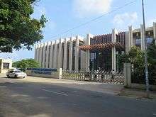
- The University of Dar es Salaam is the oldest and 2nd largest public university in Tanzania after the University of Dodoma. It is located in the western part of the city in north-east Ubungo, occupying 1,625 acres (6.58 km2) on the observation hill, 13 km (8 mi) from the city centre. The university has 16,400 undergraduate and 2,700 postgraduate students.[36]
- The Ardhi University (ARU) was established on 1 July 1996 after transforming the former University College of Lands and Architectural Studies (UCLAS) which was then a Constituent College of the University of Dar es Salaam. Historically, Ardhi University, dates back to 1956 when it started as Surveying Training School offering land surveying technician certificate courses at the present location of Mgulani Salvation Army Camp in Dar es Salaam. In 1958, the School was moved to the present location (i.e. the Observation Hill). In 1972, the School was transformed to Ardhi Institute. Then the Institute offered two-year diploma programmes in the fields of Land Surveying and Land Management and Valuation. In the same year, a three-year Diploma program in Urban and Rural Planning was introduced. Later in 1975, all the three-year diploma programmes were upgraded to Advanced Diplomas. The Building Design and Building Economics courses started in 1976 and 1978 respectively. As pointed out earlier, in 1996 Ardhi Institute was affiliated to the University of Dar es Salaam as a Constituent College of the University; subsequently its name changed to the University College of Lands and Architectural Studies (UCLAS). Within ten (10) years, UCLAS increased the number of academic programmes from six (6) to thirty nine (39). The programmes ranging from diplomas to PhDs were offered by two faculties, that is, the Faculty of Architecture and Planning (FAP) and the Faculty of Lands and Environmental Engineering (FLEE). As a result of these changes, student enrollment increased from only 400 in 1996 to about 1,400 in 2007. At the same time, the number of academic staff with PhD increased from 3 in 1996 to over 60 in 2012. At present there are over 80 PhD holders who have graduated from over 25 universities worldwide. In 2007 Ardhi University came into being following the signing of the Ardhi University Charter by His Excellency the President of The United Republic of Tanzania. Concurrently, the structure and number of programmes and academic units has increased significantly. At present, the University comprises four Schools, one Institute and several centres. Schools includes; The School of Architecture,Construction Economics and Management(SACEM), The School of Earth Sciences, Real Estates, Business and Informatics(SERBI), The School of Environmental Science and Technology(SEST), and The School of Spatial Planning and Social Science(SSPSS), alongside Institute of Human Settlements Studies (IHSS). The university offers Undergraduate and Postgraduate studies with Postgraduate, Bachelors, Masters and PhD degrees in various disciplines.[37]
- The Muhimbili University of Health and Allied Sciences has two campuses; Muhimbili Campus and Mloganzila Campus. Muhimbili Campus is situated in Ilala Municipality, in Upanga along United Nations Road. Mloganzila Campus occupies 3,800 acres (15 km2) and is located 3 km (2 mi) off Dar es Salaam-Morogoro highway, 25 km (16 mi) from Dar es Salaam.[38]
- The Open University of Tanzania is a fully fledged and accredited public institution of higher learning, running programmes leading to certificates, diplomas, undergraduate and postgraduate qualifications. Since it was founded, the university has enrolled students from Malawi, Uganda, Kenya, Namibia, Hungary, Burundi, Libya, Ethiopia, Rwanda, Saudi Arabia, Lesotho, Botswana and most of Tanzania. As of 2008, the total enrollment at the university was 44,099, the majority of whom were Tanzanian.[39]
- The Hubert Kairuki Memorial University is a private institution located on plot No. 322 Regent Estate in the Mikocheni area, some 7-km from the Dar es Salaam City centre, off Ali Hassan Mwinyi and Old Bagamoyo roads.[40]
- The International Medical and Technological University is a privately owned institute of higher education institution operating in Dar es Salaam.[41]
- The Kampala International University—began operations in 2009. The University Centre is situated on 60 acres (240,000 m2) of land in the Gongo la Mboto area, Ilala District, 7 km (4 mi) from Mwalimu Julius Nyerere International Airport along Pugu Road.[42]
- The National institute of Transport
Notable people
Below is a list of nineteen notable people who lived in Dar es Salaam:
- David Adjaye, London-based architect, born in Dar es Salaam in 1966.
- C.A. "Peter" Bransgrove (1914–1966), architect in Dar es Salaam 1947–1966.
- Joaquim Chissano, former president of Mozambique, headed the FRELIMO headquarters in Dar es Salaam where he lived before returning to Mozambique after the country won independence. He was the first head of state to address the African Union (AU) in Swahili before Swahili became one of the official languages of the AU. He learned the language during the years he spent in Tanzania as a member of FRELIMO and became fluent in it.
- Kanyama Chiume, one of the main leaders in the independence struggle in Nyasaland (renamed Malawi after the country won independence) where he served as minister of education and then as minister of foreign affairs before going into exile in Tanzania, lived in Dar es Salaam for decades. He grew up in Tanganyika. He spent his childhood in Morogoro and in Dar es Salaam and attended primary school and secondary school in Tanganyika (later renamed Tanzania). When he was in boarding school in Dar es Salaam, he lived in the same dormitory with Rashidi Kawawa who later became vice president of Tanganyika, later Tanzania, after the country won independence. He also attended Tabora Secondary School (then known as Upper School) with Oscar Kambona who became Tanganyika's first minister of defence and foreign affairs after the country became independent. Chiume graduated from Makerere University College in Uganda and went to teach at Alliance Secondary School in Dodoma, Tanganyika. After he left Malawi in 1964 to go into exile in Tanzania (1964 - 1994), he went to live in Dar es Salaam again. He also worked in Dar es Salaam for many years as a journalist at The Nationalist, a newspaper of the ruling party TANU, together with Benjamin Mkapa who was then the editor and who later became president of Tanzania.
- Roald Dahl, writer, lived in Dar es Salaam 1934–1939.
- Jane Goodall, scientist, and primatologist.
- Marin Hinkle, actress, Two and a Half Men TV Show.
- Rachel Luttrell, actress, Stargate Atlantis, born in Dar es Salaam in 1971.
- Nairn McEwan, Scotland rugby union player and second national coach was born in Dar es Salaam.[43]
- Yoweri Museveni, president of Uganda, lived in Dar es Salaam for many years, first as a student and later as a political refugee. He attended the University of Dar es Salaam where he studied economics and political science. One of his professors was Walter Rodney, a scholar from Guyana who wrote the book How Europe Underdeveloped Africa, in the early seventies when he was teaching at the University of Dar es Salaam.
- Godfrey Mwakikagile, a prominent Tanzanian author and Africanist. He attended school in Dar es Salaam and worked in the same city as an information officer at the Ministry of Information and Broadcasting and as a news reporter at the Daily News before going to the United States for further studies. He later became an author of non-fiction books about Africa and the African diaspora and an Africanist scholar.
- Juma Mwapachu, a Tanzanian diplomat, lawyer and author of a number of books about African politics and economics who once served as secretary-general of the East African Community (EAC).
- Herieth Paul, fashion model.
- Walter Rodney, Guyanese historian, political activist and scholar. He was the author of How Europe Underdeveloped Africa. He taught at the University of Dar es Salaam in Tanzania from 1966 to 1967 and later at his alma mater, the University of the West Indies, Mona campus, Kingston, Jamaica. In 1969, Rodney returned to the University of Dar es Salaam where he served as a professor of history until 1974 before going back to Guyana where he was assassinated in June 1980.
- Justinian Rweyemamu, Tanzanian economist, author and professor of economics at the University of Dar es Salaam. He worked at the United Nations and served as an economic adviser to Tanzania's first president, Julius Nyerere.
- Issa G. Shivji, a Tanzanian academic and author and one of Africa's experts on constitutional law and development issues. He served as professor of law at the University of Dar es Salaam for many years and was the first to hold the Mwalimu Julius Nyerere Research Chair in Pan-African Studies at the university. He also taught at a number of universities around the world.
- Hasheem Thabeet, Oklahoma City Thunder basketball centre.
- Paul von Lettow-Vorbeck, commander of the German East Africa Army, composed of European German officers and senior non-commissioned officers and native black African askaris, undefeated by the British and South Africans between the Great War's outbreak in August, 1914 and the Armistice in November, 1918.
- Mbwana Samatta, African footballer of the year 2015 for the domestic players.
Sister cities
References
- ↑ Statistical Abstract 2011, Tanzania National Bureau of Statistics
- ↑ "Major urban areas - population". cia.gov. Retrieved 18 November 2014.
- ↑ "Where is the fastest growing city in the world?". theguardian.com. Retrieved 21 May 2017.
- 1 2 Population Distribution by Administrative Units, United Republic of Tanzania, 2013 Archived May 2, 2013, at the Wayback Machine.
- ↑ United Nations Human Settlements Programme (2009). The State of African Cities 2008. UN-HABITAT. p. 130. ISBN 92-1-132015-1.
- 1 2 3 Brennan, James R.; Burton, Andrew (2007). "The Emerging Metropolis: A history of Dar es Salaam, circa 1862–2000". Dar es Salaam: histories from an emerging African metropolis. African Books Collective. p. 13. ISBN 9987-449-70-0.
- 1 2 3 "allAfrica.com: Tanzania: Construction Booms As Public, Private Sector Investments Soar". allAfrica.com. Retrieved 25 May 2015.
- ↑ NGA: Country Files Archived May 4, 2012, at the Wayback Machine., NGA.mil
- ↑ "Govt creates new region, 6 districts". Retrieved 2017-05-21.
- ↑ "World Weather Information Service – Dar es Salaam". World Meteorological Organization. Retrieved 13 May 2016.
- ↑ "Klimatafel von Daressalam (Flugh.) / Tansania" (PDF). Baseline climate means (1961-1990) from stations all over the world (in German). Deutscher Wetterdienst. Retrieved 13 May 2016.
- ↑ John Iliffe (1979). Modern History of Tanganyika. African Studies Series. Cambridge University Press. ISBN 978-0-521-29611-3.
- ↑ R. Mhamba; C. Titus (2001). "Reactions to Deteriorating Provision of Public Services in Dar es Salaam". In Arne Tostensen; et al. Associational Life in African Cities: Popular Responses to the Urban Crisis. Sweden: Nordiska Afrikainstitutet. p. 218+. ISBN 978-91-7106-465-3.
- ↑ "City Mayors: World's fastest growing urban areas (1)". Retrieved 25 May 2015.
- ↑ http://media.wix.com/ugd/672989_62cfa13ec4ba47788f78ad660489a2fa.pdf
- 1 2 3 Population Distribution by Administrative Units, United Republic of Tanzania, 2013 Archived May 2, 2013, at the Wayback Machine.
- ↑ "A Taxi Ride to the Client Office in Dar es Salaam, Tanzania". A Taxi Ride to the Client Office in Dar es Salaam, Tanzania. Retrieved 2011-06-11.
- 1 2 3 "Dar es Salaam: Africa's next megacity?", BBC News, reported by Joe Boyle, 30 July 2012
- ↑ "Dar skyscraper boom: Here's the untold story - National". Retrieved 25 May 2015.
- ↑ "Dar Rapid Transit - DART". dart.go.tz. dart.go.tz. Retrieved 23 February 2015.
- ↑ Coach & Bus Week, 23 August 2016
- ↑ "Additional Financing for Tanzania's Bus Rapid Transit System to benefit 300,000 Commuters and Create 80,000 Jobs". Retrieved 25 May 2015.
- ↑ "Railpage". Railpage. Retrieved 25 May 2015.
- ↑ http://www.mwtc.go.tz/
- ↑ "Africanhiphop.com presents: Hali Halisi—the Real Situation". Archived from the original on 2008-12-05. Retrieved 2008-03-06.
- ↑ Lemelle, Sidney J. (2006). "Ni wapi Tunakwenda': Hip Hop Culture and the Children of Arusha". In Basu, Dipannita; Lemelle, Sidney J. The Vinyl Ain't Final: Hip Hop and the Globalization of Black Popular Culture. London; Ann Arbor, MI: Pluto Press. pp. 230–254. ISBN 0-7453-1940-8.
- ↑ makumbushovillage.blogspot.de
- ↑ "In pictures: Tanzanian acrobat school". BBC News. 2014-12-31. Retrieved 2015-02-08.
- ↑ https://en-gb.facebook.com/UnionSportsClub/
- ↑ https://en-gb.facebook.com/UnionSportsClub/
- ↑ https://en-gb.facebook.com/UnionSportsClub/
- ↑ https://en-gb.facebook.com/UnionSportsClub/
- ↑ http://www.ippmedia.co.tz/
- ↑ http://www.millardayo.com/
- ↑ http://www.ttcl.co.tz/
- ↑ http://www.udsm.ac.tz/about_us/index.php
- ↑ Ardhi University www.aru.ac.tz
- ↑ http://www.muhas.ac.tz/index.php?option=com_content&task=view&id=16&Itemid=30
- ↑ "The Open University of Tanzania". Retrieved 25 May 2015.
- ↑ "Hubert Kairuki Memorial University - Who We Are - Introduction to Hubert Kairuki Memorial University". Retrieved 25 May 2015.
- ↑ "Welcome to International Medical and Technological University, Tanzania". Archived from the original on 24 April 2015. Retrieved 25 May 2015.
- ↑ "Archived copy". Archived from the original on 2011-02-15. Retrieved 2011-03-13.
- ↑ "Nairn MacEwan - Rugby Union - Players and Officials - ESPN Scrum". ESPN scrum. Retrieved 25 May 2015.
- ↑ TVTA, True Vision Tanzania. "NGO". truevisiontz.org. TVTA. Retrieved 8 March 2012.
- ↑ Holtermann, Hannes (2011-03-30). "Looking at the sister city agreement between Hamburg and Dar es Salaam from a Tanzanian perspective". Werkstatt.imch.eu. Retrieved 2013-07-29.
Bibliography
External links
| Wikivoyage has a travel guide for Dar es Salaam. |

| |
|
| Mainland | ||
|---|---|---|
| Zanzibar | ||