Rukwa Region
| Rukwa Region Mkoa wa Rukwa (Swahili) | |
|---|---|
| Region | |
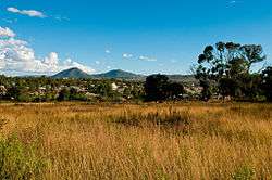 Sumbawanga Municipality | |
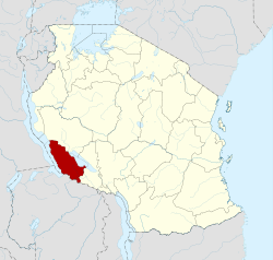 Regional map before partition in 2012 | |
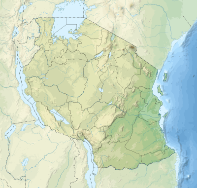 Rukwa Region Location of Rukwa Region  Rukwa Region Rukwa Region (Africa) | |
| Coordinates: 7°00′S 31°30′E / 7.000°S 31.500°ECoordinates: 7°00′S 31°30′E / 7.000°S 31.500°E | |
| Country | Tanzania |
| Zone | Southern Highlands |
| Capital | Sumbawanga |
| Government | |
| • Regional Commissioner | Joackim Wangabo |
| Area | |
| • Total | 22,792 km2 (8,800 sq mi) |
| Population (2012) | |
| • Total | 1,004,539 |
| • Density | 44/km2 (110/sq mi) |
| Time zone | UTC+3 (EAT) |
| Postcode | 55xxx |
| Area code(s) | 025 |
| Website |
www |
Rukwa Region is one of Tanzania's 31 administrative regions with a postcode number 55000 . The regional capital is the municipality of Sumbawanga. According to the 2012 national census, the region had a population of 1,004,539.[1]:page 2 For 2002-2012, the region's 3.2 percent average annual population growth rate was tied for the third highest in the country.[1]:page 4 It was also the twentieth most densely populated region with 44 people per square kilometer.[1]:page 6
The region is bordered to the north by the Katavi Region, to the east by the Mbeya Region, to the south by Zambia, and to the west by Lake Tanganyika, which forms a border between Tanzania and the Democratic Republic of the Congo.
History
The region's name comes from Lake Rukwa, which harbours the largest population of crocodiles in the nation. It is the region of the Fipa people, who maintain themselves by subsistence agriculture and livestock keeping.
The Rukwa Region was established in 1975 by President Julius Nyerere by taking Mpanda District from Tabora and the former unified Sumbawanga District from the Mbeya Region. Nkasi District was established in 1984.[2] In 2012, the region was reorganized with the Mpanda District going to the new Katavi Region.
Districts
The region is administratively divided into four districts:
| Districts of Rukwa Region | |||
|---|---|---|---|
| District | Admin. Ctr. | Population (2012) | |
| Kalambo | Matai | 207,700 | |
| Lyamba lya Mfipa | Mtowisa | 162,557[3] | |
| Nkasi | Namanyere | 281,200 | |
| Sumbawanga | Sumbawanga | 353,082[3] | |
| Total | 1,004,539 | ||
Economy
Mining
While there are extensive mineral resources in the Rukwa Region,[4] there are no active large mines. Gem stones, including emerald, moonstone, aquamarine, amethyst, ruby, and topaz, have been recovered from a number of locations.[4] There are coal seams in the Muze, Namwele, and Mkomolo areas, and some mining has occurred there.[4]
References
- 1 2 3 Population Distribution by Administrative Units, United Republic of Tanzania, 2013
- ↑ "Jamhuri ya Muungano wa Tanzania - Ofisi ya Waziri Mkuu - Tawala za Mikoa na Serikali za Mitaa: (The United Republic of Tanzania - Prime Minister's Office - Regional Administration and Local Government) Nkasi District - Introduction". Rukwa Regional Commissioner's Office. 2008.
- 1 2 2012 census included Lyamba lya Mfipa District in Sumbawanga District's total of 515,639. Siyame, Peti (30 April 2014). "Council approves division of S'wanga district". Daily News. Dar es Salaam, Tanzania. Archived from the original on 2 August 2014.
- 1 2 3 "Jamhuri ya Muungano wa Tanzania - Ofisi ya Waziri Mkuu - Tawala za Mikoa na Serikali za Mitaa: (The United Republic of Tanzania - Prime Minister's Office - Regional Administration and Local Government) Natural Resources - Mining". Rukwa Regional Commissioner's Office. 2008.
| Mainland | ||
|---|---|---|
| Zanzibar | ||