Ruvuma Region
| Ruvuma Region Mkoa wa Ruvuma (Swahili) | |
|---|---|
| Region | |
 Ponds in Songea | |
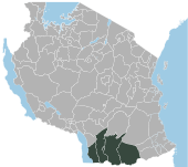
 Location in Tanzania | |
| Country | Tanzania |
| Zone | Southern Highlands |
| Capital | Songea |
| Area | |
| • Total | 63,669 km2 (24,583 sq mi) |
| Population (2012) | |
| • Total | 1,376,891 |
| • Density | 22/km2 (56/sq mi) |
| Time zone | UTC+3 (EAT) |
| Postcode | 57xxx |
| Area code(s) | 025 |
| Website | Regional website |
Ruvuma Region is one of Tanzania's 31 administrative regions. The regional capital is the municipality of Songea. According to the 2012 national census, the region had a population of 1,376,891, which was lower than the pre-census projection of 1,449,830.[1]:page 2 For 2002–2012, the region's 2.1 percent average annual population growth rate was the twentieth highest in the country.[1]:page 4 It was also the 28th most densely populated region with 22 people per square kilometer.[1]:page 6
The region is named after the Ruvuma River, which forms most of its southern boundary with Portuguese-speaking Mozambique (where it is known as «Rovuma»). The region is also bordered to the north by the Morogoro Region, to the northeast by the Lindi Region, to the east by the Mtwara Region, and to the northwest by the Njombe Region. Ruvuma has many different tribes, such as the Mpoto.
The regional commissioner of the Ruvuma Region is Christina Solomon Mndeme.[2]
Administrative divisions
Districts
The region is administratively divided into five districts:
| Districts of Ruvuma Region | |||||
|---|---|---|---|---|---|
| Map | District | Population (2012) | |||
 |
Mbinga | 353,683 | |||
| Namtumbo | 201,639 | ||||
| Nyasa | 146,160 | ||||
| Songea | 377,130 | ||||
| Tunduru | 298,279 | ||||
| Total | 1,376,891 | ||||
Constituencies
For parliamentary elections, Tanzania is divided into constituencies. As of the 2010 elections, the Ruvuma Region had six constituencies:[3]
- Mbinga Magharibi Constituency
- Mbinga Mashariki Constituency
- Namtumbo Constituency
- Peramiho Constituency
- Songea Mjini Constituency
- Tunduru Constituency
References
- 1 2 3 Population Distribution by Administrative Units, United Republic of Tanzania, 2013 Archived 2013-05-02 at the Wayback Machine.
- ↑ Kitabu cha Mawasiliano Serikalini, Tanzania Government Directory, 2012, page 188
- ↑ "Organisations located in Ruvuma Region - Tanzania". African Development Information.