Oze River
| Oze River | |
| 小瀬川 | |
| River | |
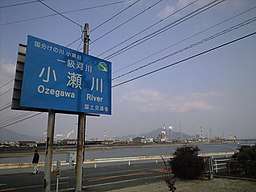 Oze River in 2007 | |
| Country | Japan |
|---|---|
| State | Honshu |
| Region | Hiroshima, Yamaguchi |
| Source | Onigajoyama (鬼ヶ城山)[1] |
| - location | Hatsukaichi, Hiroshima[2] |
| - elevation | 1,031[2] m (3,383 ft) |
| Mouth | Seto Inland Sea[2] |
| - location | Waki, Yamaguchi; Ōtake, Hiroshima[2] |
| - coordinates | 34°12′39″N 132°14′47″E / 34.2108°N 132.2463°ECoordinates: 34°12′39″N 132°14′47″E / 34.2108°N 132.2463°E |
| Length | 59 km (37 mi) [3] |
| Basin | 340 km2 (131 sq mi) [3] |
The Oze River (Japanese:
See also
References
- 1 2 "小瀬川(おぜがわ)とは - コトバンク" (in Japanese). kotobank. Retrieved December 31, 2017.
- 1 2 3 4 "小瀬川水系河川整備計画" (PDF) (in Japanese). Ministry of Land, Infrastructure, Transport and Tourism. p. 1. Retrieved December 31, 2017.
- 1 2 3 "日本の川 - 中国 - 小瀬川 - 国土交通省水管理・国土保全局" (in Japanese). Ministry of Land, Infrastructure, Transport and Tourism. Retrieved December 31, 2017.
| |||||||||||||||||
| |||||||||||||||||
| |||||||||||||||||
| |||||||||||||||||
| |||||||||||||||||
This article is issued from
Wikipedia.
The text is licensed under Creative Commons - Attribution - Sharealike.
Additional terms may apply for the media files.