Jinzū River
| Jinzū River 神通川 | |
|---|---|
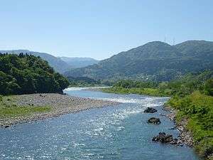 Jinzū River in Toyama Prefecture | |
| Country | Japan |
| Physical characteristics | |
| Main source |
Kaoredake 1,626 m (5,335 ft) |
| River mouth | Toyama Bay |
| Length | 120 km (75 mi) |
| Discharge |
|
| Basin features | |
| River system | Jinzū River |
| Basin size | 2,720 km2 (1,050 sq mi) |
The Jinzū River (神通川 Jinzū-gawa) is a river that flows from Gifu Prefecture to Toyama Prefecture in Japan. It is called Miya River (宮川 Miya-gawa) in Gifu. It is 120 km (75 mi) in length and has a watershed of 2,720 km2 (1,050 sq mi).
Geography
The river flows from Mount Kaore in Gifu and meets the Takahara River at the border between Gifu and Toyama. Then it flows straight to the north and pours into Toyama Bay and the Sea of Japan. It once meandered through the city of Toyama, but the new waterway was constructed in the west of the city to avoid floods. Toyama City Hall and other governments are located on the reclaimed land of the old river.
Pollution
The river was polluted with cadmium due to mining and caused the itai-itai disease in the downstream towns around World War II.
Naming
The Japanese Navy cruiser Jintsū was named after this river.
External links
36°45′42″N 137°13′19″E / 36.761787°N 137.222042°ECoordinates: 36°45′42″N 137°13′19″E / 36.761787°N 137.222042°E (mouth)
| |||||||||||||||||
| |||||||||||||||||
| |||||||||||||||||
| |||||||||||||||||
| |||||||||||||||||