Ohio State Route 7
| ||||
|---|---|---|---|---|
|
SR 7 highlighted in red | ||||
| Route information | ||||
| Maintained by ODOT | ||||
| Length | 292.20 mi[1] (470.25 km) | |||
| Existed | 1912[2] – present | |||
| Major junctions | ||||
| South end |
| |||
| ||||
| North end |
| |||
| Location | ||||
| Counties | Lawrence, Gallia, Meigs, Athens, Washington, Monroe, Belmont, Jefferson, Columbiana, Mahoning, Trumbull, Ashtabula | |||
| Highway system | ||||
| ||||

State Route 7 (SR 7), formerly known as Inter-county Highway 7 until 1921[3] and State Highway 7 in 1922,[4] is a north–south state highway in the southern and eastern portions of the U.S. state of Ohio. At just over 292 miles (470 km) in length, it is the longest state route in Ohio.[1] Its southern terminus is an interchange with U.S. Route 52 (US 52) just west of Chesapeake. Its northern terminus also serves as the eastern terminus of SR 531 in Conneaut. The path of SR 7 stays within five miles (8.0 km) of the Ohio River (Ohio's border with West Virginia) for the southern portion, with the river being visible from much of the route. The road also remains within 10 miles (16 km) of the Pennsylvania state line for the northern portion.
Route description
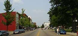
SR 7 starts in Chesapeake and for about 100 miles (160 km) it runs along the Ohio River. Then it heads north along SR 11 & US 30 from East Liverpool to Rogers. After it turns north in Rogers, it heads up to Youngstown. Then the highway heads east overlapped with US 62. After that shared alignment, the highway then heads north again in Hubbard through a lot of small towns to its northern terminus in Conneaut.
History
In 1912, Intercounty Highway 7 ran along the Ohio River, from Elizabethtown to the Pennsylvania state line at Pomeroy [2]
In 1923, the route was at its greatest extent, the northern terminus of the route was extended from East Liverpool to Conneaut.[5]
In 1927, the southern segment running from Chesapeake to the Indiana state line near Elizabethtown was deleted to make way for US 52 and a small segment of US 50[6]
A tunnel was constructed north of Stratton in 1982. The $27 million project was necessitated for the expansion of the W. H. Sammis Power Plant.[7]
Chesapeake and Proctorville bypass

The Chesapeake bypass was first proposed in 1953.[8]
In 1961, the US 52 expressway opened from Chesapeake westward towards Sheridan. The original eastern terminus of the four-lane divided highway was at the current Chesapeake northbound-only exit ramp east of Tallow Ridge Road.[9] US 52 originally crossed at the present-day Robert C. Byrd Bridge that connects Chesapeake to Huntington, West Virginia. In 1979, the US 52 designation moved to the Nick Joe Rahall II Bridge as tolls on that span were removed that year; the segment east of the Rahall Bridge to the Chesapeake interchange was renumbered to SR 7.
Ten years later, the four-lane expressway was extended eastward to an incomplete trumpet interchange just east of Big Branch Road.[10] A four-lane connector route from the partially complete interchange to the foot of the Robert C. Byrd Bridge at SR 527 was completed. At the same time, the two-lane Chesapeake interchange ramp just east of Tallow Ridge Road was converted to a northbound-only exit ramp. The abrupt terminus at Chesapeake was envisioned to connect to Proctorville.
On May 31, 2002,[11] ground was broken for Phase 1-A of the Proctorville bypass.[12] Phase 1-A entailed a two-lane connector road from the East Huntington Bridge to Irene Road, with the original loop ramp from the bridge to State Route 7 being modified into an access road. Phase 1-B was designated from Irene Road to State Route 7 near Fairland East Elementary in Rome. Phase 2 was envisioned from Irene Road west to Chesapeake. The total cost was originally estimated to be at $165 million.[11]
On April 27, 2003, Phase 1-A of the Proctorville bypass opened to traffic.[13] The $6.5 million,[11] one-mile (1.6 km) section of three-lane roadway was opened from the foot of the East Huntington Bridge to Irene Road and signed as SR 607.
On June 3, 2003, bids were opened for Phase 1-B from Irene Road to SR 7 near Fairland East Elementary.[14] The projected cost of the 4.5-mile (7.2 km) segment was originally $27 million, however, when the bids were let, the cost had decreased to $24.3 million. The lowest bid, which was also accepted, came in at $22.1 million.[15] The road was designed as a two-lane limited-access facility on a four-lane right-of-way. Construction began on August 4,[16] with an original estimated completion date of June 30, 2005.
An unusual amount of rain, blamed on two hurricanes, caused major delays.[17] More than one-dozen major slips along Phase 1-B required an additional $30 million in repairs and the purchase of additional land for highwall excavations. Another change was the design of the roadway; originally projected to be widened in the future when higher traffic counts warrant the expansion, it was designed on wide right-of-way with no grade separation between the opposing lanes. During the repair of the slips, a terraced roadway was constructed to separate the future southbound lanes from the northbound by a highwall when the roadway is expanded to four lanes.
Other cost overruns had pushed the cost of construction to $62 million total, which included Phases 1-A and 1-B, up from the original estimates of $32 million. The primary cause was rapidly increasing land values and "unchecked zoning" along the project's projected right-of-way along with geo-technical problems with rocky soil.[14] Property values along the projected route, for instance, increased 91.5% from 1992 to 2001 alone.
In October 2006, a small 1⁄2-mile (0.80 km) segment of the Phase 1-B bypass opened to traffic between SR 607 and Irene Road intersection to SR 775.[18] The remainder, east to SR 7 near Fairland East Elementary, opened on December 8, 2006. It includes intersections with SR 775, Kinley Avenue, and SR 7. Upon completion, phases 1-A and 1-B were signed as SR 7; the bypass from the SR 775 junction to the loop at the East Huntington Bridge was co-numbered with SR 775.

Phase 2 of the bypass, from the Chesapeake bypass to Irene Road at Proctorville, has not been funded. Funding which had been previously promised by the Ohio Department of Transportation (ODOT) was later denied.[8] Phase 2 is estimated to cost $76 million to complete.[14] Also due to the construction delays (slips) on the bypass from SR 775 to Fairland East Elementary School (Phase 1-B), the design of Phase 2 may be realigned to prevent slips during construction.
Pomeroy Bypass
The Pomeroy bypass from Middleport east to US 33 was completed in 1968. At the time of completion, the bypass was two lanes but was upgraded to four lanes, divided, in 1976 from SR 143 to US 33 near Rock Springs. The bypass was extended east in 2000 from Rock Springs to a partial diamond interchange with SR 7 as a four-lane divided expressway. It was initially signed just SR 7. The diamond interchange was later completed with all connections, and the highway was extended eastward to Ravenswood, West Virginia as US 33.
Major intersections
| County | Location | mi | km | Exit | Destinations | Notes |
|---|---|---|---|---|---|---|
| Lawrence | Union Township | 0.00 | 0.00 | Full-access interchange; southern terminus of SR 7 and its ORSB concurrency | ||
| 1.40 | 2.25 | — | Chesapeake | Northbound exit | ||
| 2.28 | 3.67 | — | SR 7 exits freeway; western end of SR 527 concurrency; northbound exit; southbound entrance | |||
| 2.83 | 4.55 | Eastern end of SR 527 concurrency | ||||
| 5.09 | 8.19 | Western end of SR 243 | ||||
| 6.08 | 9.78 | Western end of SR 775 concurrency | ||||
| Proctorville | 6.75 | 10.86 | Eastern end of SR 775 concurrency | |||
| Rome Township | 7.55 | 12.15 | Western end of SR 243 concurrency | |||
| 9.96 | 16.03 | Eastern terminus of SR 243 | ||||
| 15.97 | 25.70 | Eastern terminus of SR 217 | ||||
| Gallia | Crown City | 20.15 | 32.43 | Southern terminus of SR 553 | ||
| Gallipolis Township | 38.68 | 62.25 | Northern terminus of SR 218 | |||
| Gallipolis | 41.05 | 66.06 | Eastern terminus of SR 141 | |||
| 41.78 | 67.24 | Eastern terminus of SR 588 | ||||
| 42.36 | 68.17 | Southern terminus of SR 160 | ||||
| Gallipolis Township | 45.41 | 73.08 | Access to eastbound and from westbound US 35 only | |||
| Addison Township | 46.08 | 74.16 | Eastern terminus of SR 735; provides access to westbound and from eastbound US 35 | |||
| Cheshire | 53.50 | 86.10 | Eastern terminus of SR 554 | |||
| Meigs | Middleport | 57.44 | 92.44 | Ohio River Scenic Byway / Hobson Drive | Northern end of ORSB concurrency;[19] former routing of SR 7 | |
| Salisbury Township | 59.79 | 96.22 | Western end of SR 124 concurrency | |||
| 60.82 | 97.88 | Southern terminus of SR 143 | ||||
| 63.62 | 102.39 | — | Eastern end of US 33 and SR 124 concurrencies; eastern terminus of SR 833 | |||
| 66.14 | 106.44 | — | Interchange; end of US 33 concurrency | |||
| 65.84 | 105.96 | Accessible via northbound SR 7 | ||||
| Chester Township | 69.87 | 112.44 | Western terminus of SR 248 | |||
| Orange Township | 77.98 | 125.50 | ||||
| Athens | Troy Township | 81.53 | 131.21 | — | End of US 50/SR 32 concurrency | |
| Coolville | 82.99 | 133.56 | ||||
| Troy Township | 85.99 | 138.39 | Eastern terminus of SR 124; southern end of ORSB concurrency[20] | |||
| Washington | Belpre Township | 89.86 | 144.62 | Southern terminus of SR 555 | ||
| 91.23 | 146.82 | — | Western terminus of SR 618; northbound exit, southbound entrance | |||
| 92.08 | 148.19 | — | End of US 50 concurrency;two separate interchanges on southbound side | |||
| Belpre | 96.70 | 155.62 | — | End of SR 32 concurrency; eastbound exit, westbound entrance | ||
| 97.14 | 156.33 | — | Eastern terminus of SR 618; southbound exit, northbound entrance | |||
| Warren Township | 107.62 | 173.20 | — | Interchange; eastern terminus of SR 550; northbound exit, southbound entrance | ||
| 107.62 | 173.20 | Eastern terminus of SR 550 | ||||
| Marietta | 108.64 | 174.84 | Eastern terminus of SR 676 | |||
| 109.08 | 175.55 | End of SR 60 concurrency | ||||
| 109.94 | 176.93 | End of SR 26 concurrency; southern terminus of SR 26 | ||||
| 110.12 | 177.22 | End of SR 60 concurrency | ||||
| 110.28 | 177.48 | End of SR 26 concurrency | ||||
| Marietta Township | 111.34 | 179.18 | — | I-77 exit 1 | ||
| Newport Township | 126.02 | 202.81 | Northern terminus of SR 807 | |||
| New Matamoras | 139.03 | 223.75 | Southern terminus of SR 260 | |||
| Monroe | Jackson Township | 143.44 | 230.84 | Southern terminus of SR 800 | ||
| 143.54 | 231.01 | To WV 18 | ||||
| Lee Township | 149.98 | 241.37 | Eastern terminus of SR 255 | |||
| Ohio Township | 154.31 | 248.34 | End of SR 536 concurrency | |||
| 154.71 | 248.98 | End of SR 536 concurrency | ||||
| Clarington | 163.00 | 262.32 | Eastern terminus of SR 78 | |||
| 163.54 | 263.19 | Eastern terminus of SR 556 | ||||
| Belmont | Powhatan Point | 170.87 | 274.99 | |||
| 171.86 | 276.58 | Eastern terminus of SR 148 | ||||
| Mead Township | Southern end of Ohio River Scenic Byway (southern freeway section) | |||||
| 178.03 | 286.51 | — | Western terminus of SR 872 | |||
| 181.41 | 291.95 | — | Central Avenue | Former routing of SR 7; northbound exit, southbound entrance | ||
| Pultney Township | 183.48 | 295.28 | — | Central Avenue | Former routing of SR 7; southbound exit, northbound entrance | |
| Bellaire | 183.99 | 296.10 | — | Pinch Run / Belmont Street | ||
| 185.42 | 298.40 | — | 27th Street to | |||
| 186.53 | 300.19 | — | 48th Street / North Guernsey Street | |||
| Pultney Township | 188.19 | 302.86 | — | Inverted SPUI, leading to a trumpet interchange at I-470 exit 6 | ||
| Bridgeport | 189.64 | 305.20 | — | Exit 225 on I-70; northbound exit, southbound entrance (to SR 7A) | ||
| 189.83 | 305.50 | — | Exit 225 on I-70; southbound exit, northbound entrance (to SR 7A and SR 767) | |||
| Northern end of Ohio River Scenic Byway (southern freeway section) | ||||||
| Martins Ferry | 191.77 | 308.62 | Southern terminus of SR 647 | |||
| Southern end of Ohio River Scenic Byway (central freeway section) | ||||||
| 194.76 | 313.44 | — | Pattons Run / Picoma Road | |||
| Jefferson | Yorkville | 196.16 | 315.69 | — | Public Road / Yorkville | |
| Tiltonsville | 197.31 | 317.54 | — | Farm Lane / Tiltonsville | ||
| Rayland | 198.71 | 319.79 | — | |||
| Wells Township | 203.26 | 327.12 | — | Salt Run Road / Riddles Run Road | Former routing of SR 7; northbound exit | |
| 204.50 | 329.11 | — | Brilliant / Riddles Run Road | Former routing of SR 7 | ||
| Brilliant | 205.92 | 331.40 | — | Brilliant | Southbound exit and entrance; northbound entrance | |
| Steubenville Township | 208.18 | 335.03 | — | Eastern terminus of SR 151 | ||
| 208.77 | 335.98 | — | Commercial Avenue | |||
| 208.93 | 336.24 | — | Murdock Avenue | |||
| 209.68 | 337.45 | — | Logan Avenue | |||
| Steubenville | 211.74 | 340.76 | — | Lincoln Avenue | Northbound exit, southbound entrance | |
| Northern end of Ohio River Scenic Byway (central freeway section) | ||||||
| 212.88 | 342.60 | Southern terminus of SR 43 | ||||
| 214.24 | 344.79 | Closed; former routing of SR 822 across the now-demolished Fort Steuben Bridge; was inverted SPUI.[21][22][23] | ||||
| 213.98 | 344.37 | Partial Interchange; end of US 22 concurrency; 0.23-mile (0.37 km) SR 822 concurrency; southbound exit; northbound SR 7 to US 22 east via University Boulevard | ||||
| Island Creek Township | 215.23 | 346.38 | Full-access interchange; end of US 22 concurrency; southern terminus of SR 213 | |||
| Southern end of Ohio River Scenic Byway (northern freeway section) | ||||||
| 216.12 | 347.81 | — | CR 44 / Pottery Addition (Kingsdale Road) | Northbound exit, southbound entrance; former routing of SR 7 | ||
| 217.17 | 349.50 | — | CR 44 / Pottery Addition (Kingsdale Road) | Southbound exit, northbound entrance; former routing of SR 7 | ||
| 218.42 | 351.51 | — | CR 56 / Costonia | |||
| Toronto | 220.09 | 354.20 | — | Franklin Street | ||
| 224.52 | 361.33 | — | 4th Street | |||
| Empire | 224.96 | 362.04 | — | |||
| Northern end of Ohio River Scenic Byway (northern freeway section) | ||||||
| Saline Township | 230.02 | 370.18 | Northern terminus of SR 213 | |||
| Columbiana | Wellsville | 232.15 | 373.61 | — | End of SR 39 concurrency | |
| 233.64 | 376.01 | — | Southern terminus of SR 45 | |||
| East Liverpool | 236.86 | 381.19 | — | End of US 30/SR 11/SR 39 concurrency; southern terminus of SR 267; full-access interchange except from eastbound US 30/southbound SR 7/southbound SR 11 to SR 267; northern terminus of ORSB concurrency | ||
| St. Clair Township | 240.19 | 386.55 | — | Southern terminus of SR 170 | ||
| Madison Township | 242.68 | 390.56 | — | End of US 30/SR 11 concurrency; northern terminus of SR 267 | ||
| Rogers | 250.90 | 403.78 | ||||
| Fairfield Township | 253.13 | 407.37 | Eastern terminus of SR 517 | |||
| 256.18 | 412.28 | End of SR 46 concurrency | ||||
| Columbiana | 257.70 | 414.73 | End of SR 46 concurrency | |||
| Mahoning | Beaver Township | 261.89 | 421.47 | |||
| 262.19 | 421.95 | |||||
| 263.45 | 423.98 | Access via ramps here; turnpike passes over SR 7 northwest–southeast 0.30 miles (0.48 km) later; I-76 exit 232 | ||||
| 264.94 | 426.38 | Northern terminus of SR 626 | ||||
| Boardman Township | 267.46 | 430.44 | ||||
| Youngstown | 270.00 | 434.52 | ||||
| 270.86 | 435.91 | End of US 62 concurrency | ||||
| 271.83 | 437.47 | Market Street | Former routing of SR 7 | |||
| Southern end of freeway | ||||||
| 272.16 | 438.00 | — | Access from southbound US 62/SR 7 to I-680 and from I-680 to northbound US 62/SR 7 only; I-680 exit 6 | |||
| 273.42 | 440.03 | — | Northbound exit, southbound entrance only | |||
| — | ||||||
| Northern end of freeway | ||||||
| Trumbull | Hubbard | 279.94 | 450.52 | End of SR 304 concurrency | ||
| 280.78 | 451.87 | Northern terminus of SR 616 | ||||
| Hubbard Township | 282.06 | 453.93 | Elmwood Road | Former routing of US 62 | ||
| 282.16 | 454.09 | I-80 exit 234 | ||||
| 282.92 | 455.32 | End of US 62 concurrency | ||||
| 283.35 | 456.01 | Connector provides access from southbound on either route to northbound on the other route | ||||
| Brookfield Township | 285.81 | 459.97 | ||||
| Brookfield Center | 286.19 | 460.58 | Warren–Sharon Road | Former routing of SR 82 | ||
| Hartford Township | 291.49 | 469.11 | ||||
| Vernon Township | 296.75 | 477.57 | ||||
| Kinsman Township | 300.74 | 483.99 | End of SR 5 concurrency | |||
| 301.93 | 485.91 | Eastern terminus of SR 87 | ||||
| 302.28 | 486.47 | End of SR 5 concurrency | ||||
| Ashtabula | Williamsfield Township | 307.42 | 494.74 | |||
| Andover | 312.55 | 503.00 | End of US 6 concurrency; western terminus of SR 85 | |||
| Richmond Township | 320.00 | 514.99 | End of US 6 concurrency | |||
| Pierpont Township | 322.56 | 519.11 | End of SR 167 concurrency | |||
| 323.47 | 520.57 | End of SR 167 concurrency | ||||
| Monroe Township | 330.24 | 531.47 | ||||
| Conneaut | 333.95 | 537.44 | I-90 exit 241 | |||
| 335.93 | 540.63 | End of US 20 concurrency | ||||
| 336.15 | 540.98 | End of US 20 concurrency | ||||
| 337.37 | 542.94 | Eastern terminus of SR 531 | ||||
1.000 mi = 1.609 km; 1.000 km = 0.621 mi
| ||||||
Auxiliary routes
State Route 7 Alternate in Bridgeport
| |
|---|---|
| Location | Bridgeport |
| Length | 0.72 mi[24] (1.16 km) |

State Route 7 Alternate (SR 7A) is a short 0.72-mile-long (1.16 km)[24] connecting loop signed as SR 7[25][26] that serves as a link from SR 7, US 40, and US 250 to I-70 in Bridgeport. Its western (southern) terminus is at SR 767, and its eastern (northern) terminus is along US 40 at its intersection with US 250 and the northern terminus of SR 767. SR 7A begins at the intersections of Howard Street and SR 767 (South Lincoln Avenue). SR 7A continues west as Howard Street until it intersects Marion Street. It then runs north as Marion Street, intersects I-70, and then intersects US 40, Main Street. SR 7A continues east on US 40 until it ends at US 250 and SR 767, just 370 feet (110 m) west of the West Virginia state line.
The entire route is in Bridgeport, Belmont County.
| mi[24] | km | Destinations | Notes | ||
|---|---|---|---|---|---|
| 0.00 | 0.00 | Interchange with SR 7 | |||
| 0.37– 0.42 | 0.60– 0.68 | Exit 225 (I-70) | |||
| 0.46 | 0.74 | Western end of US 40 concurrency | |||
| 0.72 | 1.16 | Eastern end of US 40 concurrency; northern terminus of SR 767 | |||
1.000 mi = 1.609 km; 1.000 km = 0.621 mi
| |||||
State Route 767
| |
|---|---|
| Location | Bridgeport |
| Length | 0.30 mi[24] (0.48 km) |
State Route 767 (SR 767) is a north–south state highway in the eastern portion of the U.S. state of Ohio. Currently, it is signed as an alternate route of SR 7.[27][28][29] Its southern terminus is at an exit ramp on SR 7 in Bridgeport. The route serves as a connector from northbound SR 7 to SR 7 Alternate, US 40, and US 250. The route's northern terminus is where these U.S. routes overlap eastbound to cross the Ohio River into West Virginia. SR 7A serves as a connector for all of these routes to I-70.
Business State Route 7 from Middleport to Pomeroy
| |
|---|---|
| Location | Middleport-Pomeroy |
Business State Route 7 stretched from 1 3⁄4 miles (2.8 km) west of Middleport to about 4 miles (6.4 km) east of Pomeroy. The route followed the former alignment of State Route 7 that was replaced by the Pomeroy Bypass, and ran through the downtown areas of Middleport and Pomeroy. It joined with State Route 833 (the former alignment of U.S. Route 33) from one mile (1.6 km) west of Pomeroy to 1 3⁄4 miles (2.8 km) east of Pomeroy, including a brief concurrency with State Route 124, and then headed northeast to the eastern U.S. Route 33/State Route 7 interchange. The route was deleted between 2013 and 2015.[30][31]
Route 7T
| State Route 7T | |
|---|---|
| Location | Youngstown |
| Length | 0.36 mi[32] (0.58 km) |
State Route 7T (SR 7T) was a 0.36-mile-long (0.58 km)[32] future route beginning at US 62 in Youngstown. The entire route was concurrent with US 62T. SR 7T and US 62T were removed on May 2, 2007.[33]
See also
References
Route map:
- 1 2 Transportation System Development (May 13, 2008). "RI82B: Centerline Miles, Lane Miles, and VMT by Route and County". Ohio Department of Transportation. Retrieved August 4, 2009.
- 1 2 Ohio State Highway Department (1912). Map of Ohio Showing Inter-County Highways (PDF) (Map). c. 1:563,200. Columbus: Ohio State Highway Department. OCLC 13716556.
- ↑ Ohio Department of Highways and Public Works (September 1921). Highway Map of Ohio Showing Conditions for Travel (PDF) (Map). c. 1:563,200. Columbus: Ohio Department of Highways and Public Works.
- ↑ Ohio Department of Highways and Public Works (April 1922). Map of Ohio State Highways Showing All Improved Roadways and Indicating System Constructed Under Administration of Gov. Harry L. Davis (PDF) (Map). c. 1:563,200. Columbus: Ohio Department of Highways and Public Works.
- ↑ Ohio Department of Highways and Public Works (July 1923). Map of Ohio Showing State Routes (PDF) (Map). 1:760,320. Columbus: Ohio Department of Highways and Public Works.
- ↑ Ohio Department of Highways and Public Works (June 1, 1927). Map of Ohio Showing State Routes (PDF) (Map). 1:760,320. Columbus: Ohio Department of Highways and Public Works. OCLC 5673562.
- ↑ "Ohio Edison cleans up Ohio River". The Akron Beacon Journal. February 22, 1982. p. 4. Retrieved September 1, 2018 – via https://www.newspapers.com/.
- 1 2 Malloy, David (2004). "Chesapeake Bypass on hold indefinitely". Herald-Dispatch. Huntington, OH.
- ↑ Google. "Ohio State Route 7" (Map). Google Maps. Google.
- ↑ Google. "Ohio State Route 7" (Map). Google Maps. Google.
- 1 2 3 Malloy, David (2002). "Chesapeake bypass gets aid from feds". Herald-Dispatch. Huntington, OH.
- ↑ Blair, Allen (2002). "Bypass construction set in Lawrence, Ohio". Daily Independent. Ashland, OH.
- ↑ Malloy, David (April 27, 2003). "Traffic eased in Proctorville, but congested elsewhere". Herald-Dispatch. Huntington, OH. Retrieved February 11, 2007.
- 1 2 3 Malloy, David (May 23, 2003). "Overruns raise concerns about bypass". Herald-Dispatch. Huntington, OH. Retrieved February 11, 2007.
- ↑ Malloy, David (June 5, 2003). "Bids opened for Chesapeake Bypass project". Herald-Dispatch. Huntington, OH. Retrieved February 11, 2007.
- ↑ Malloy, David (July 11, 2003). "Chesapeake Bypass construction to start". Herald-Dispatch. Huntington, OH. Retrieved Feb 11, 2007.
- ↑ Malloy, David (April 15, 2005). "Bridge work may be bid on in fall". Herald-Dispatch. Huntington, OH. Retrieved February 11, 2007.
- ↑ Malloy, David (October 21, 2006). "Section of new Chesapeake Bypass could open next week". Herald-Dispatch. Huntington, OH. Retrieved February 11, 2007.
- ↑ Google. Google Street View https://www.google.com/maps/@38.9915537,-82.0767103,3a,15y,314.78h,84.99t/data=!3m6!1e1!3m4!1siFmibafUBIkZZKEGFHadLg!2e0!7i13312!8i6656. Retrieved April 18, 2018. Missing or empty
|title=(help) - ↑ Google. Google Street View. Google https://www.google.com/maps/@39.2371957,-81.7452856,3a,41.1y,116.54h,88.28t/data=!3m6!1e1!3m4!1sw2HzEObVADO_xL2xmi2Gnw!2e0!7i13312!8i6656. Retrieved April 18, 2018. Missing or empty
|title=(help) - ↑ Scott, Warren (February 25, 2012). "Last of bridge removed". The Herald-Star. Archived from the original on June 15, 2012. Retrieved October 27, 2013.
- ↑ Technical Services. "Straight Line Diagrams: Jefferson County, SR 7" (PDF) (PDF). Ohio Department of Transportation. Archived (PDF) from the original on October 27, 2013. Retrieved October 27, 2013.
- ↑ Ohio Department of Transportation (2010). "Jefferson County Traffic Survey Report" (PDF) (PDF). Archived (PDF) from the original on October 27, 2013. Retrieved October 27, 2013.
- 1 2 3 4 Staff (July 16, 2013). "Roadway Description Inventory Report - DESTAPE (Belmont County)" (PDF). ODOT. Retrieved February 13, 2014.
- ↑ "Southbound SR 7A". Google Maps. Retrieved 25 February 2016.
- ↑ "Northbound SR 7A". Google Maps. Retrieved 25 February 2016.
- ↑ "Northbound SR 767". Google Maps. Retrieved 2016-02-25.
- ↑ "Ramp to Northbound SR 7 and SR 767 Southbound". Google Maps. Retrieved 2016-02-25.
- ↑ "Southbound SR 767". Google Maps. Retrieved 2016-02-25.
- ↑ "Northern terminus of B. SR 7 in 2013". Google Maps. Retrieved 2016-02-25.
- ↑ "Western terminus of B. SR 7 in 2015". Google Maps. Retrieved 2016-02-25.
- 1 2 Staff. "Traffic Counts (Traffic Survey Reports & Maps): Mahoning County 2005" (PDF). ODOT. Retrieved February 13, 2014.
- ↑ "County Update Table (Mahoning County)". ODOT. 2008. Retrieved February 13, 2014.
SR 0007T - Route Deleted, J.E. 5/2/2007