List of Interstate Highways in Ohio
| Interstate Highways of Ohio | |
|---|---|
   Highway markers for I-71, I-275, and BL-75 | |
 A map of all the Interstate Highways in Ohio | |
| System information | |
| Length | 1,572.35 mi[1] (2,530.45 km) |
| Formed | June 29, 1956[2] |
| Highway names | |
| Interstates | Interstate nn (I-nn) |
| Business Loops: | Business Loop Interstate nn (BL I-nn) |
| System links | |
There are a total of 21 Interstate Highways in Ohio, including both primary and auxiliary routes. All of the Interstate Highways are owned and maintained by the U.S. state of Ohio through the Ohio Department of Transportation (ODOT); however, they were all built with money from the U.S. federal government.[3] The road miles of these 21 Interstates add up to a total of 1,572.35 miles (2,530.45 km). Ohio has more route miles than this, most of which comes from Interstate 80 (I-80) running concurrently with I-90 for 142.80 miles (229.81 km). The Interstate Highways in Ohio range in length from I-71, at 248.15 miles (399.36 km), all the way down to I-471, at 0.73 miles (1.17 km).[1]
As of 2006, out of all the states, Ohio has the fourth-largest Interstate Highway System. Ohio also has the fifth-largest traffic volume and the third-largest quantity of truck traffic. Ohio ranks second in the nation in terms of the number of bridges for its Interstates.[2]
History
On June 29, 1956, President Dwight D. Eisenhower signed the Federal Aid Highway Act of 1956, which called for the construction of up to 41,000 miles (66,000 km) of Interstate Highways. Of that, up to 1,500 miles (2,400 km) were to be built in Ohio. The same year, Ohio passed a law which raised the state's speed limit to 60 mph (97 km/h), and in 1957, Ohio began the construction of its Interstate Highway allotment. By 1958, Ohio had spent more money on its Interstate Highways than either New York or California. In 1960, Ohio had completed the construction of 522 miles (840 km) of pavement; in 1962, Ohio had completed the construction of 684 miles (1,101 km) of pavement; and in 1970, Ohio had completed the construction of 1,000 miles (1,600 km) of pavement. By the end of 1971, Ohio had only 167 miles (269 km) of Interstate still to build. On September 19, 2003, Ohio finally finished the originally planned Interstate Highway System.[2]
Primary Interstates
| Number | Length (mi)[4] | Length (km) | Southern or western terminus | Northern or eastern terminus | Formed | Removed | Notes |
|---|---|---|---|---|---|---|---|
| 225.60 | 363.07 | I-70 at the Indiana state line | I-70 at the West Virginia state line | 1960 | current | ||
| 248.15 | 399.36 | I-71/I-75 at the Kentucky state line | I-90 at Cleveland | 1960 | current | ||
| 19.47 | 31.33 | I-74 at the Indiana state line | I-75 at Cincinnati | 1962 | current | Will extend into West Virginia | |
| 211.55 | 340.46 | I-71/I-75 at the Kentucky state line | I-75 at the Michigan state line | 1960 | current | ||
| 81.65 | 131.40 | I-71 near Lodi | I-76 at the Pennsylvania state line | 1972 | current | ||
| 163.03 | 262.37 | I-77 at the West Virginia state line | I-90 at Cleveland | 1964 | current | ||
| 237.48 | 382.19 | I-80/I-90 at the Indiana state line | I-80 at the Pennsylvania state line | 1960 | current | 218 miles (351 km) of I-80 is part of the Ohio Turnpike | |
| 244.75 | 393.89 | I-80/I-90 at the Indiana state line | I-90 at the Pennsylvania state line | 1960 | current |
.jpg) I-70 at the I-71 interchange near Columbus
I-70 at the I-71 interchange near Columbus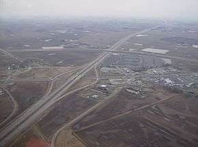 I-71 near West Lancaster and Octa
 I-75 near the Lockland Miami and Erie Canal
 I-76 in Portage County
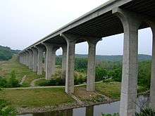 I-80 over the Cuyahoga River
Auxiliary Interstates
| Number | Length (mi)[4] | Length (km) | Southern or western terminus | Northern or eastern terminus | Formed | Removed | Notes | |
|---|---|---|---|---|---|---|---|---|
| 54.97 | 88.47 | I-71 at Grove City | US 23 at Columbus | 1964 | current | Beltway around Columbus | ||
| 46.06 | 74.13 | I-71 at Medina | I-90 at Willoughby Hills | 1964 | current | I-271 is east of Cleveland | ||
| 56.041 | 90.189 | I-275 at the Indiana state line | I-275 at the Kentucky state line | 1962 | current | Beltway around Cincinnati | ||
| 4.14 | 6.66 | I-76 at Akron | I-77/US 224 at Akron | 1970 | current | |||
| 12.41 | 19.97 | I-80/I-90 at Lake Township | I-75 at Toledo | 1959 | current | First completed interstate in Ohio | ||
| — | — | I-90 in Cleveland | I-90/I-271 in Willoughby Hills | 1964 | 1968 | Signed along I-271 concurrency | ||
| — | — | I-90 in Cleveland | I-271 in Beachwood | 1971 | 1973 | Completed segment never opened (redesignated as I-490) | ||
| 6.69 | 10.77 | I-70 at Blaine | I-470 at the West Virginia state line | 1976 | current | |||
| 0.73 | 1.17 | I-471 at the Kentucky state line | I-71 at Cincinnati | 1981 | current | |||
| 20.37 | 32.78 | I-75 at Perrysburg | I-75 at Toledo | 1964 | current | Half beltway around Toledo | ||
| 41.77 | 67.22 | I-80 at North Ridgeville | I-80 at Streetsboro | 1971 | current | |||
| 2.43 | 3.91 | I-71/I-90 at Cleveland | I-77 at Cleveland | 1990 | current | Will extend into SR 10 | ||
| 10.43 | 16.79 | I-70 at Columbus | I-270 at Gahanna | 2003 | current | |||
| 26.53 | 42.70 | I-75 near Miamisburg | I-70 near Fairborn | 1987 | current | |||
| 16.43 | 26.44 | I-76 at North Lima | I-80 near Mineral Ridge | 1964 | current | |||
| ||||||||
 Cloverleaf interchange between I-270 and SR-161
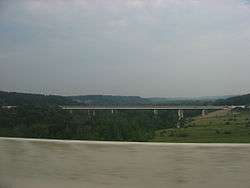 A picture of the I-271 bridge over the Cuyahoga River
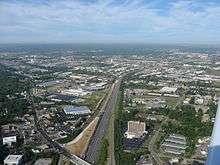 I-275 in the Sharonville neighborhood
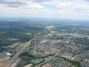 The I-675 double interchange southeast of Dayton
Suffixed Interstates
| Number | Length (mi) | Length (km) | Southern or western terminus | Northern or eastern terminus | Formed | Removed | Notes | |
|---|---|---|---|---|---|---|---|---|
| — | — | I-90/I-80 in Lorain County | I-80S/SR 5 in Braceville Township | 1960 | 1962 | Redesignated as I-80 | ||
| 81.65 | 131.40 | I-71 near Lodi | I-80S at the Pennsylvania state line | 1960 | 1971 | Redesignated as I-76 | ||
| 1.99 | 3.20 | I-480 in Maple Heights | US 422 in Warrensville Heights | 1974 | current | Spur of I-480 | ||
| ||||||||
Proposed Interstates
| Number | Southern or western terminus | Northern or eastern terminus | Notes |
|---|---|---|---|
| I-73 at West Virginia state line | I-73 at Michigan state line | Proposed highway that would enter from West Virginia along U.S. Route 52 to Portsmouth, then use US 23 and other highways to Toledo before crossing into Michigan.[5] | |
| I-76/I-77 in Akron | I-271/SR 8 in Macedonia | Planned redesignation of the SR 8 freeway |
Business routes
| Number | Length (mi) | Length (km) | Southern or western terminus | Northern or eastern terminus | Formed | Removed | Notes |
|---|---|---|---|---|---|---|---|
| — | — | — | — | — | — | ||
| — | — | — | — | — | — | ||
| — | — | — | — | — | — |
See also


References
- 1 2 Adderly, Kevin (January 27, 2016). "Table 3: Interstate Routes in Each of the 50 States, District of Columbia, and Puerto Rico". Route Log and Finder List. Federal Highway Administration. Retrieved June 7, 2016.
- 1 2 3 Ohio Department of Transportation (n.d.). "Ohio's Timeline". Ohio Department of Transportation. Retrieved January 20, 2011.
- ↑ Federal Highway Administration (November 18, 2015). "Frequently Asked Questions". Celebrating the Eisenhower Interstate Highway System. Federal Highway Administration. Retrieved June 7, 2016.
- 1 2 Adderly, Kevin (January 27, 2016). "Table 1: Main Routes of the Dwight D. Eisenhower National System of Interstate and Defense Highways as of December 31, 2015". Route Log and Finder List. Federan Highway Administration. Retrieved June 7, 2016.
- ↑ Staff (December 18, 1991). "Intermodal Surface Transportation Efficiency Act of 1991". U.S. Congress. Retrieved September 28, 2010.
§1105(c)(5) I-73/74 North–South Corridor from Charleston, South Carolina, through Winston-Salem, North Carolina, to Portsmouth, Ohio, to Cincinnati, Ohio, and Detroit, Michigan.
External links
| Wikimedia Commons has media related to Interstate Highways in Ohio. |