Rome, Ohio
| Rome, Ohio | |
|---|---|
| Village | |
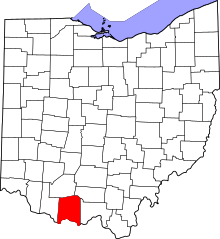
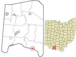 Location in Adams County and the state of Ohio. | |
| Coordinates: 38°39′51″N 83°22′50″W / 38.66417°N 83.38056°WCoordinates: 38°39′51″N 83°22′50″W / 38.66417°N 83.38056°W | |
| Country | United States |
| State | Ohio |
| County | Adams |
| Township | Green |
| Area[1] | |
| • Total | 0.26 sq mi (0.67 km2) |
| • Land | 0.23 sq mi (0.60 km2) |
| • Water | 0.03 sq mi (0.08 km2) |
| Population (2010)[2] | |
| • Total | 98 |
| • Estimate (2012[3]) | 94 |
| • Density | 408.7/sq mi (157.8/km2) |
| Time zone | UTC-5 (Eastern (EST)) |
| • Summer (DST) | UTC-4 (EDT) |
| FIPS code | 39-68196[4] |
Rome is a village in Green Township, Adams County, Ohio, United States, along the Ohio River. The population was 94 at the 2010 census.
Gallery
 Corporation limit sign
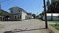 Looking east at the intersection of Second and Main Streets
 Post office
Geography
Rome is located at 38°39′51″N 83°22′50″W / 38.66417°N 83.38056°W (38.664266, -83.380456).[5]
According to the United States Census Bureau, the village has a total area of 0.26 square miles (0.67 km2), of which 0.23 square miles (0.60 km2) is land and 0.03 square miles (0.08 km2) is water.[1]
U.S. Route 52 passes to the north of Rome.
History
Rome was laid out in 1835 by William Stout.[6] The village was named after Rome, Italy, according to local history.[7] While the village is officially named Rome, it is often called "Stout";[8] even the community's post office is named "Stout," not "Rome."[9] A post office called Stout has been in operation since 1893.[10]
Government
In 2016, the Ohio Auditor of State deemed Rome to be "unauditable" due to recordkeeping issues and a lack of elected village leadership.[11]
Demographics
| Historical population | |||
|---|---|---|---|
| Census | Pop. | %± | |
| 1870 | 471 | — | |
| 1880 | 225 | −52.2% | |
| 1910 | 243 | — | |
| 1920 | 200 | −17.7% | |
| 1930 | 188 | −6.0% | |
| 1940 | 169 | −10.1% | |
| 1950 | 151 | −10.7% | |
| 1960 | 149 | −1.3% | |
| 1970 | 90 | −39.6% | |
| 1980 | 135 | 50.0% | |
| 1990 | 99 | −26.7% | |
| 2000 | 117 | 18.2% | |
| 2010 | 94 | −19.7% | |
| Est. 2017 | 92 | [12] | −2.1% |
| U.S. Decennial Census[13] | |||
2010 census
As of the census[2] of 2010, there were 94 people, 45 households, and 26 families residing in the village. The population density was 408.7 inhabitants per square mile (157.8/km2). There were 64 housing units at an average density of 278.3 per square mile (107.5/km2). The racial makeup of the village was 95.7% White, 2.1% Native American, and 2.1% from two or more races. Hispanic or Latino of any race were 1.1% of the population.
There were 45 households of which 20.0% had children under the age of 18 living with them, 35.6% were married couples living together, 11.1% had a female householder with no husband present, 11.1% had a male householder with no wife present, and 42.2% were non-families. 37.8% of all households were made up of individuals and 22.3% had someone living alone who was 65 years of age or older. The average household size was 2.09 and the average family size was 2.73.
The median age in the village was 49.3 years. 21.3% of residents were under the age of 18; 1.1% were between the ages of 18 and 24; 22.3% were from 25 to 44; 30.8% were from 45 to 64; and 24.5% were 65 years of age or older. The gender makeup of the village was 50.0% male and 50.0% female.
2000 census
As of the census[4] of 2000, there were 117 people, 46 households, and 31 families residing in the village. The population density was 439.8 people per square mile (167.3/km²). There were 58 housing units at an average density of 218.0 per square mile (82.9/km²). The racial makeup of the village was 94.02% White, 4.27% Native American, and 1.71% from two or more races.
There were 46 households out of which 43.5% had children under the age of 18 living with them, 43.5% were married couples living together, 15.2% had a female householder with no husband present, and 32.6% were non-families. 28.3% of all households were made up of individuals and 15.2% had someone living alone who was 65 years of age or older. The average household size was 2.54 and the average family size was 3.06.
In the village, the population was spread out with 29.9% under the age of 18, 7.7% from 18 to 24, 28.2% from 25 to 44, 22.2% from 45 to 64, and 12.0% who were 65 years of age or older. The median age was 33 years. For every 100 females, there were 82.8 males. For every 100 females age 18 and over, there were 86.4 males.
The median income for a household in the village was $31,136, and the median income for a family was $31,944. Males had a median income of $19,167 versus $30,500 for females. The per capita income for the village was $12,026. There were 28.9% of families and 24.4% of the population living below the poverty line, including 30.3% of under eighteens and none of those over 64.
See also
References
- 1 2 "US Gazetteer files 2010". United States Census Bureau. Archived from the original on 2012-01-24. Retrieved 2013-01-06.
- 1 2 "American FactFinder". United States Census Bureau. Retrieved 2013-01-06.
- ↑ "Population Estimates". United States Census Bureau. Archived from the original on 2013-06-17. Retrieved 2013-06-17.
- 1 2 "American FactFinder". United States Census Bureau. Retrieved 2008-01-31.
- ↑ "US Gazetteer files: 2010, 2000, and 1990". United States Census Bureau. 2011-02-12. Retrieved 2011-04-23.
- ↑ Evans, Nelson Wiley (1900). A History of Adams County, Ohio: From Its Earliest Settlement to the Present Time. E B. Stivers. p. 423.
- ↑ Overman, William Daniel (1958). Ohio Town Names. Akron, OH: Atlantic Press. p. 120.
- ↑ U.S. Geological Survey Geographic Names Information System: Rome, Ohio
- ↑ U.S. Geological Survey Geographic Names Information System: Stout Post Office
- ↑ "Adams County". Jim Forte Postal History. Retrieved 12 December 2015.
- ↑ "Village of Rome Financial Records "Unauditable"". Ohio State Auditor. Retrieved 2016-10-21.
- ↑ "Population and Housing Unit Estimates". Retrieved May 26, 2018.
- ↑ "Census of Population and Housing". Census.gov. Retrieved June 4, 2015.