| [2] |
Name on the Register[3] |
Image |
Date listed[4] |
Location |
City or town |
Description |
|---|
| 1 |
Agriculture Building-University of Arkansas, Fayetteville |
|
September 4, 1992
(#92001098) |
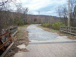
Campus Dr.
36°04′09″N 94°10′22″W / 36.069167°N 94.172778°W / 36.069167; -94.172778 (Agriculture Building-University of Arkansas, Fayetteville) |
Fayetteville |
|
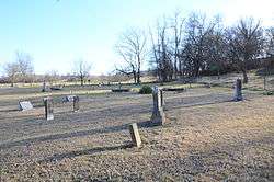
| 2 |
Bean Cemetery |
|
March 7, 1994
(#94000152) |
Northern side of U.S. Highway 62, about 2.2 miles (3.5 km) west of its junction with Highway 45
35°56′56″N 94°25′01″W / 35.948889°N 94.416944°W / 35.948889; -94.416944 (Bean Cemetery) |
Lincoln |
|
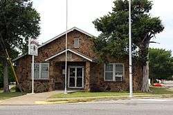
| 3 |
Beely-Johnson American Legion Post 139 |
|
May 30, 2007
(#07000474) |
200 N. Spring St.
36°11′11″N 94°07′47″W / 36.186389°N 94.129722°W / 36.186389; -94.129722 (Beely-Johnson American Legion Post 139) |
Springdale |
|
| 4 |
Bethlehem Cemetery |
|
November 15, 2000
(#00001365) |
Approximately 4 miles (6.4 km) southwest of Cane Hill on Highway 45, near its junction with County Road 442
35°52′21″N 94°27′31″W / 35.872369°N 94.458631°W / 35.872369; -94.458631 (Bethlehem Cemetery) |
Canehill |
|
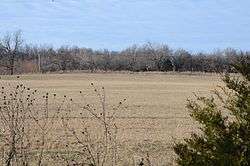
| 5 |
Black Oak Cemetery |
|
June 3, 1998
(#98000619) |
Off AR 265, 4 miles (6.4 km) southwest of Greenland[5]
35°58′48″N 94°13′44″W / 35.980107°N 94.228808°W / 35.980107; -94.228808 (Black Oak Cemetery) |
Greenland |
A part of the ghost town of Black Oak[6] |
| 6 |
Blackburn House |
|
November 17, 1982
(#82000940) |
Main at College Sts.
35°54′37″N 94°23′46″W / 35.910278°N 94.396111°W / 35.910278; -94.396111 (Blackburn House) |
Canehill |
|
| 7 |
Borden House |
|
March 17, 1977
(#77000278) |
Northeast of Prairie Grove on U.S. Highway 62
35°58′33″N 94°18′10″W / 35.975833°N 94.302778°W / 35.975833; -94.302778 (Borden House) |
Prairie Grove |
|
| 8 |
Brown Bluff (3WA10) |
|
June 24, 1987
(#86002946) |
Address Restricted
|
Woolsey |
|
| 9 |
Business Administration Building-University of Arkansas, Fayetteville |
|
September 4, 1992
(#92001099) |
Campus Dr.
36°04′03″N 94°10′15″W / 36.0675°N 94.170833°W / 36.0675; -94.170833 (Business Administration Building-University of Arkansas, Fayetteville) |
Fayetteville |
|
| 10 |
Butterfield Overland Mail Route Fayetteville Segments Historic District |
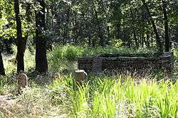
|
June 18, 2009
(#09000456) |
West of Highway 265 in Lake Fayetteville Park
36°08′22″N 94°07′37″W / 36.139378°N 94.126889°W / 36.139378; -94.126889 (Butterfield Overland Mail Route Fayetteville Segments Historic District) |
Fayetteville |
Segment of the Butterfield Overland Mail route |
| 11 |
Butterfield Overland Mail Route Segment |
|
June 9, 2010
(#10000347) |
Bugscuffle Rd. south of Strickler and Old Cove City Rd. north of Chester
35°47′22″N 94°20′21″W / 35.7894°N 94.3393°W / 35.7894; -94.3393 (Butterfield Overland Mail Route Segment) |
Strickler |
Segment of the Butterfield Overland Mail route; extends into Crawford County |
| 12 |
Cane Hill Battlefield |
|
March 7, 1994
(#94000132) |
Area surrounding Highway 45 and County Roads 291, 8, 284, and 285
35°51′16″N 94°22′25″W / 35.854444°N 94.373611°W / 35.854444; -94.373611 (Cane Hill Battlefield) |
Canehill |
|
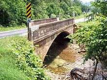
| 13 |
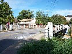
Cane Hill Road Bridge |
|
January 21, 2010
(#09001261) |
Highway 170 over the Little Red River
36°00′01″N 94°16′30″W / 36.000233°N 94.274886°W / 36.000233; -94.274886 (Cane Hill Road Bridge) |
Prairie Grove |
Replaced in 2014 |
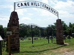
| 14 |
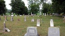
Canehill Cemetery |
|
November 17, 1982
(#82000941) |
Highway 13
35°54′50″N 94°23′55″W / 35.913889°N 94.398611°W / 35.913889; -94.398611 (Canehill Cemetery) |
Canehill |
|
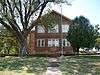
| 15 |
Cane Hill College Building |
|
November 17, 1982
(#82000942) |
McClellan and College St.
35°54′39″N 94°23′51″W / 35.910833°N 94.3975°W / 35.910833; -94.3975 (Cane Hill College Building) |
Canehill |
|
| 16 |
Ella Carnall Hall |
|
December 22, 1982
(#82000943) |
Arkansas Ave. and Maple St.
36°04′10″N 94°10′08″W / 36.069444°N 94.168889°W / 36.069444; -94.168889 (Ella Carnall Hall) |
Fayetteville |
|
| 17 |
A.R. Carroll Building |
|
November 17, 1982
(#82000944) |
Main St.
35°54′32″N 94°23′48″W / 35.908889°N 94.396667°W / 35.908889; -94.396667 (A.R. Carroll Building) |
Canehill |
|
| 18 |
Chemistry Building-University of Arkansas, Fayetteville |
|
September 4, 1992
(#92001100) |
Campus Dr.
36°04′04″N 94°10′22″W / 36.067778°N 94.172778°W / 36.067778; -94.172778 (Chemistry Building-University of Arkansas, Fayetteville) |
Fayetteville |
|
| 19 |
Chi Omega Chapter House |
|
April 20, 1995
(#95000456) |
940 Maple St.
36°04′13″N 94°10′24″W / 36.070278°N 94.173333°W / 36.070278; -94.173333 (Chi Omega Chapter House) |
Fayetteville |
|
| 20 |
Chi Omega Greek Theatre-University of Arkansas, Fayetteville |
|
September 4, 1992
(#92001101) |
Dickson St.
36°04′01″N 94°10′25″W / 36.066944°N 94.173611°W / 36.066944; -94.173611 (Chi Omega Greek Theatre-University of Arkansas, Fayetteville) |
Fayetteville |
|
| 21 |
Clack House |
|
March 2, 2006
(#06000077) |
725 E. Dogwood Ln.
36°04′09″N 94°08′54″W / 36.069167°N 94.148333°W / 36.069167; -94.148333 (Clack House) |
Fayetteville |
|
| 22 |
Clinton House |
|
January 21, 2010
(#09000800) |
930 West Clinton Drive (formerly California Blvd.)
36°03′48″N 94°10′25″W / 36.063225°N 94.173619°W / 36.063225; -94.173619 (Clinton House) |
Fayetteville |
|
| 23 |
Nathan Combs House |
|
December 12, 1976
(#76000472) |
Address Restricted
|
Fayetteville |
|
| 24 |
County Road 6 Bridge |
|
September 24, 2004
(#04001043) |
On County Road 6, approximately 0.5 miles (0.80 km) south of its junction with County Road 820
36°04′15″N 94°28′30″W / 36.070833°N 94.475°W / 36.070833; -94.475 (County Road 6 Bridge) |
Cincinnati |
|
| 25 |
Deepwood House |
|
May 21, 2018
(#100002459) |
4697 W Finger Rd.
36°02′10″N 94°12′43″W / 36.0362°N 94.2120°W / 36.0362; -94.2120 (Deepwood House) |
Fayetteville |
|
| 26 |
Devil's Den State Park Historic District |
|
July 24, 1994
(#92000071) |
Highway 74 west of Winslow
35°46′44″N 94°15′12″W / 35.778889°N 94.253333°W / 35.778889; -94.253333 (Devil's Den State Park Historic District) |
Winslow |
|
| 27 |
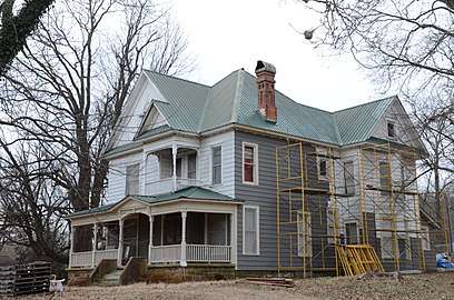
David and Mary Margaret Durst House |
|
May 28, 2015
(#15000288) |
857 Fairview Dr.
36°03′51″N 94°10′22″W / 36.0641°N 94.1729°W / 36.0641; -94.1729 (David and Mary Margaret Durst House) |
Fayetteville |
|
| 28 |
Earle House |
|
November 17, 1982
(#82000945) |
Highway 45
35°54′18″N 94°23′45″W / 35.905°N 94.395833°W / 35.905; -94.395833 (Earle House) |
Canehill |
|
| 29 |
D.N. Edmiston House |
|
November 17, 1982
(#82000946) |
Main St.
35°54′39″N 94°23′45″W / 35.910833°N 94.395833°W / 35.910833; -94.395833 (D.N. Edmiston House) |
Canehill |
|
| 30 |
John Edmiston House |
|
November 17, 1982
(#82000947) |
Off Highway 45
35°54′49″N 94°23′46″W / 35.913611°N 94.396111°W / 35.913611; -94.396111 (John Edmiston House) |
Canehill |
|
| 31 |
Zeb Edmiston House |
|
November 17, 1982
(#82000948) |
Main St.
35°54′30″N 94°23′45″W / 35.908333°N 94.395833°W / 35.908333; -94.395833 (Zeb Edmiston House) |
Canehill |
|
| 32 |
Evansville-Dutch Mills Road Bridge |
|
January 24, 2008
(#07001436) |
County Road 464
35°51′55″N 94°29′59″W / 35.865278°N 94.499722°W / 35.865278; -94.499722 (Evansville-Dutch Mills Road Bridge) |
Dutch Mills |
|
| 33 |
Evergreen Cemetery |
|
October 30, 1997
(#97001279) |
Junction of University and William Sts.
36°03′51″N 94°10′09″W / 36.064167°N 94.169167°W / 36.064167; -94.169167 (Evergreen Cemetery) |
Fayetteville |
|
| 34 |
Fayetteville Confederate Cemetery |
|
June 3, 1993
(#93000481) |
Rock St., approximately 800 feet north of its junction with Willow St.
36°03′40″N 94°09′08″W / 36.061111°N 94.152222°W / 36.061111; -94.152222 (Fayetteville Confederate Cemetery) |
Fayetteville |
|
| 35 |
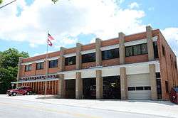
Fayetteville Fire Department Fire Station 1 |
|
June 2, 2015
(#15000289) |
303 W. Center
36°03′45″N 94°09′48″W / 36.0625°N 94.1634°W / 36.0625; -94.1634 (Fayetteville Fire Department Fire Station 1) |
Fayetteville |
|
| 36 |
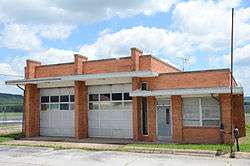
Fayetteville Fire Department Fire Station 3 |
|
June 2, 2015
(#15000290) |
4140 S. School St.
36°00′35″N 94°10′23″W / 36.009706°N 94.173055°W / 36.009706; -94.173055 (Fayetteville Fire Department Fire Station 3) |
Fayetteville |
|
| 37 |
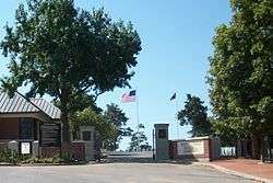
Fayetteville National Cemetery |
|
July 28, 1999
(#99000892) |
700 Government Ave.
36°03′09″N 94°10′04″W / 36.0525°N 94.167778°W / 36.0525; -94.167778 (Fayetteville National Cemetery) |
Fayetteville |
|
| 38 |
Fayetteville Veterans Administration Hospital |
|
February 15, 2012
(#12000024) |
1100 N. College Ave.
36°04′50″N 94°09′35″W / 36.080512°N 94.159699°W / 36.080512; -94.159699 (Fayetteville Veterans Administration Hospital) |
Fayetteville |
|
| 39 |
Fishback School |
|
September 4, 1992
(#92001120) |
Butterfield Coach Road
36°10′12″N 94°05′41″W / 36.17°N 94.094722°W / 36.17; -94.094722 (Fishback School) |
Springdale |
|
| 40 |
Fitzgerald Station and Farmstead |
|
May 29, 2003
(#03000465) |
2327 Old Wire Rd. and 1567 Dodd Ave.
36°12′19″N 94°06′49″W / 36.205278°N 94.113611°W / 36.205278; -94.113611 (Fitzgerald Station and Farmstead) |
Springdale |
c. 1870 Greek Revival house and outbuildings associated with Butterfield Overland Mail Company |
| 41 |
Vernon Fitzhugh House |
|
June 5, 2017
(#100001015) |
1551 E. Hope St.
36°04′43″N 94°08′18″W / 36.078729°N 94.138378°W / 36.078729; -94.138378 (Vernon Fitzhugh House) |
Fayetteville |
|
| 42 |
Adrian Fletcher Residence |
|
May 28, 2013
(#13000317) |
6725 Washington Road
36°02′37″N 94°03′39″W / 36.043620°N 94.060706°W / 36.043620; -94.060706 (Adrian Fletcher Residence) |
Fayetteville |
|
| 43 |
Frisco Depot |
|
December 8, 1988
(#88002819) |
550 W. Dickson St.
36°04′00″N 94°09′17″W / 36.066667°N 94.154722°W / 36.066667; -94.154722 (Frisco Depot) |
Fayetteville |
|
| 44 |
Goff Farm Stone Bridge |
|
January 21, 2010
(#09001262) |
Goff Farm Rd. approximately 0.5 miles (0.80 km) east of Dead Horse Mountain Rd.
36°02′38″N 94°06′35″W / 36.043978°N 94.109794°W / 36.043978; -94.109794 (Goff Farm Stone Bridge) |
Fayetteville |
|
| 45 |
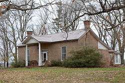
Troy Gordon House |
|
December 1, 1978
(#78000635) |
9 E. Township Rd.
36°05′40″N 94°10′11″W / 36.094444°N 94.169722°W / 36.094444; -94.169722 (Troy Gordon House) |
Fayetteville |
|
| 46 |
Gregg House |
|
September 17, 1974
(#74000502) |
339 N. Gregg St.
36°04′04″N 94°10′01″W / 36.067778°N 94.166944°W / 36.067778; -94.166944 (Gregg House) |
Fayetteville |
|
| 47 |
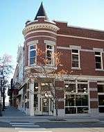
Guisinger Building |
|
September 20, 1984
(#84000910) |
E. Mountain St.
36°03′41″N 94°09′34″W / 36.061389°N 94.159444°W / 36.061389; -94.159444 (Guisinger Building) |
Fayetteville |
|
| 48 |
Hantz House |
|
November 19, 2001
(#01001233) |
855 Fairview Dr.
36°03′51″N 94°10′21″W / 36.0641°N 94.1725°W / 36.0641; -94.1725 (Hantz House) |
Fayetteville |
|
| 49 |
Happy Hollow Farm |
|
August 6, 1986
(#86002241) |
2099 Aqua Crossing
36°03′47″N 94°07′51″W / 36.063056°N 94.130833°W / 36.063056; -94.130833 (Happy Hollow Farm) |
Fayetteville |
|
| 50 |
Headquarters House |
|
June 24, 1971
(#71000129) |
118 E. Dickson St.
36°03′58″N 94°09′04″W / 36.066111°N 94.151111°W / 36.066111; -94.151111 (Headquarters House) |
Fayetteville |
|
| 51 |
Hemingway House and Barn |
|
August 12, 1982
(#82002148) |
3310 Old Missouri Rd.
36°06′42″N 94°07′54″W / 36.111667°N 94.131667°W / 36.111667; -94.131667 (Hemingway House and Barn) |
Fayetteville |
|
| 52 |
Highway B-29 Bridge |
|
September 24, 2008
(#08000945) |
County Road 623 over the Illinois River
35°59′42″N 94°17′53″W / 35.994994°N 94.298167°W / 35.994994; -94.298167 (Highway B-29 Bridge) |
Prairie Grove |
|
| 53 |
Home Economics Building-University of Arkansas, Fayetteville |
|
September 4, 1992
(#92001102) |
West of Campus Dr.
36°04′09″N 94°10′25″W / 36.069167°N 94.173611°W / 36.069167; -94.173611 (Home Economics Building-University of Arkansas, Fayetteville) |
Fayetteville |
|
| 54 |
House at 712 N. Mill Street |
|
September 4, 1992
(#92001157) |
712 N. Mill St.
36°11′32″N 94°07′48″W / 36.192222°N 94.13°W / 36.192222; -94.13 (House at 712 N. Mill Street) |
Springdale |
|
| 55 |
Illinois River Bridge at Phillips Ford |
|
January 22, 2009
(#08001344) |
County Road 848 over the Illinois River
36°08′06″N 94°21′29″W / 36.135067°N 94.358089°W / 36.135067; -94.358089 (Illinois River Bridge at Phillips Ford) |
Savoy |
|
| 56 |
Jackson House |
|
August 17, 1982
(#82002149) |
1617 North Jordan Lane
36°04′57″N 94°08′34″W / 36.0826°N 94.1427°W / 36.0826; -94.1427 (Jackson House) |
Fayetteville |
|
| 57 |
Johnson Barn |
|
June 21, 1990
(#90000896) |
Cato Springs Rd. north of Round Top Mtn.
36°00′55″N 94°12′21″W / 36.015278°N 94.205833°W / 36.015278; -94.205833 (Johnson Barn) |
Fayetteville |
|
| 58 |
Johnson House and Mill |
|
December 12, 1976
(#76000473) |
West of Johnson on Johnson Rd.
36°08′14″N 94°10′41″W / 36.137222°N 94.178056°W / 36.137222; -94.178056 (Johnson House and Mill) |
Johnson |
|
| 59 |
Johnson Switch Building |
|
February 26, 1999
(#99000251) |
3201 Main St.
36°08′01″N 94°10′00″W / 36.133611°N 94.166667°W / 36.133611; -94.166667 (Johnson Switch Building) |
Johnson |
|
| 60 |
E. Fay and Gus Jones House |
|
April 28, 2000
(#97000453) |
1330 N. Hillcrest
36°04′51″N 94°09′10″W / 36.080833°N 94.152778°W / 36.080833; -94.152778 (E. Fay and Gus Jones House) |
Fayetteville |
|
| 61 |
Lafayette Street Overpass |
|
May 26, 1995
(#95000653) |
Lafayette St. over the St. Louis – San Francisco railroad tracks
36°04′06″N 94°09′57″W / 36.068333°N 94.165833°W / 36.068333; -94.165833 (Lafayette Street Overpass) |
Fayetteville |
|
| 62 |
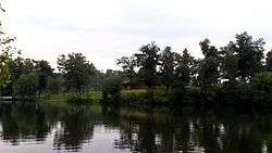
Lake Wedington Historic District |
|
September 11, 1995
(#94001612) |
Junction of Highway 16 and Forest Service Rd. 1750 in the Ozark-St. Francis National Forest
36°05′23″N 94°22′15″W / 36.089722°N 94.370833°W / 36.089722; -94.370833 (Lake Wedington Historic District) |
Savoy |
|
| 63 |
Lake-Bell House |
|
November 8, 1974
(#74000504) |
North of Prairie Grove
36°00′03″N 94°18′12″W / 36.000833°N 94.303333°W / 36.000833; -94.303333 (Lake-Bell House) |
Prairie Grove |
|
| 64 |
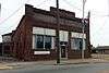
R.L. Leach Grocery Store |
|
January 26, 2018
(#100002013) |
W side of Dutch Mills Rd., 175 ft. from Cty. Rd. 418
35°52′34″N 94°29′29″W / 35.876244°N 94.491301°W / 35.876244; -94.491301 (R.L. Leach Grocery Store) |
Dutch Mills |
|
| 65 |
Lewis Brothers Building |
|
August 17, 1987
(#86003334) |
1 S. Block
36°03′44″N 94°09′34″W / 36.062222°N 94.159444°W / 36.062222; -94.159444 (Lewis Brothers Building) |
Fayetteville |
|
| 66 |
Magnolia Company Filling Station |
|
November 15, 1978
(#78000636) |
492 W. Lafayette St.
36°04′07″N 94°09′54″W / 36.068611°N 94.165°W / 36.068611; -94.165 (Magnolia Company Filling Station) |
Fayetteville |
|
| 67 |
Maguire-Williams House |
|
September 7, 1995
(#95001093) |
19105 Highway 74
36°01′31″N 94°00′35″W / 36.025278°N 94.009722°W / 36.025278; -94.009722 (Maguire-Williams House) |
Elkins |
|
| 68 |
Maple Street Overpass |
|
May 26, 1995
(#95000654) |
Maple St. over the St. Louis – San Francisco railroad tracks
36°04′12″N 94°10′00″W / 36.07°N 94.166667°W / 36.07; -94.166667 (Maple Street Overpass) |
Fayetteville |
|
| 69 |
E.W. McClellan House |
|
November 17, 1982
(#82000949) |
Southwest of Canehill off Highway 45
35°54′39″N 94°23′51″W / 35.910833°N 94.3975°W / 35.910833; -94.3975 (E.W. McClellan House) |
Canehill |
|
| 70 |
Wiley P. McNair House |
|
September 20, 2016
(#16000654) |
301 Mountain St.
36°03′43″N 94°09′48″W / 36.061948°N 94.163276°W / 36.061948; -94.163276 (Wiley P. McNair House) |
Fayetteville |
|
| 71 |
Men's Gymnasium-University of Arkansas, Fayetteville |
|
September 4, 1992
(#92001103) |
Garland Ave.
36°04′10″N 94°10′33″W / 36.069444°N 94.175833°W / 36.069444; -94.175833 (Men's Gymnasium-University of Arkansas, Fayetteville) |
Fayetteville |
|
| 72 |
Methodist Manse |
|
November 17, 1982
(#82000950) |
Main and Spring Sts.
35°54′29″N 94°23′48″W / 35.908056°N 94.396667°W / 35.908056; -94.396667 (Methodist Manse) |
Canehill |
|
| 73 |
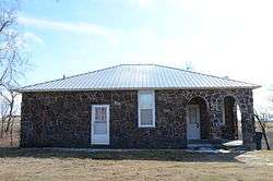
Mineral Springs Community Building |
|
May 29, 1998
(#98000580) |
County Road 34, east of West Fork
35°55′37″N 94°08′06″W / 35.926944°N 94.135°W / 35.926944; -94.135 (Mineral Springs Community Building) |
West Fork |
|
| 74 |
Moore House |
|
November 17, 1982
(#82000951) |
Northwest of Canehill on CR 13
35°54′55″N 94°24′19″W / 35.915278°N 94.405278°W / 35.915278; -94.405278 (Moore House) |
Canehill |
|
| 75 |
Mack Morton Barn |
|
February 15, 2005
(#05000047) |
11516 Appleby Rd.
36°01′15″N 94°14′42″W / 36.020833°N 94.245°W / 36.020833; -94.245 (Mack Morton Barn) |
Appleby |
|
| 76 |
Mount Nord Historic District |
|
September 16, 1982
(#82002150) |
Mount Nord Ave.
36°04′10″N 94°09′38″W / 36.069444°N 94.160556°W / 36.069444; -94.160556 (Mount Nord Historic District) |
Fayetteville |
|
| 77 |
Mount Sequoyah Cottages |
|
August 6, 2012
(#12000278) |
808 & 810 E. Skyline Dr.
36°03′53″N 94°08′37″W / 36.06459°N 94.143564°W / 36.06459; -94.143564 (Mount Sequoyah Cottages) |
Fayetteville |
|
| 78 |
Willis Noll House |
|
January 20, 2005
(#04001498) |
531 N. Sequoyah Dr.
36°04′07″N 94°26′40″W / 36.068611°N 94.444444°W / 36.068611; -94.444444 (Willis Noll House) |
Fayetteville |
|
| 79 |
North Mock Street Historic District |
|
June 22, 2018
(#100002566) |
114 & 116 N Mock St.
35°58′34″N 94°19′02″W / 35.9762°N 94.3173°W / 35.9762; -94.3173 (North Mock Street Historic District) |
Prairie Grove |
|
| 80 |
Old Bank of Fayetteville Building |
|
March 7, 1994
(#94000144) |
100 W. Center St.
36°03′46″N 94°09′38″W / 36.062778°N 94.160556°W / 36.062778; -94.160556 (Old Bank of Fayetteville Building) |
Fayetteville |
|
| 81 |
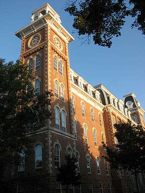
Old Main, University of Arkansas |
|
June 15, 1970
(#70000131) |
Arkansas Ave.
36°04′07″N 94°10′17″W / 36.068611°N 94.171389°W / 36.068611; -94.171389 (Old Main, University of Arkansas) |
Fayetteville |
|
| 82 |
Old Post Office |
|
August 27, 1974
(#74000503) |
City Sq.
36°03′44″N 94°09′35″W / 36.062222°N 94.159722°W / 36.062222; -94.159722 (Old Post Office) |
Fayetteville |
|
| 83 |
Old Springdale High School |
|
May 19, 1994
(#94000469) |
Johnson St.
36°11′14″N 94°08′14″W / 36.187222°N 94.137222°W / 36.187222; -94.137222 (Old Springdale High School) |
Springdale |
|
| 84 |
Old US 71, Greenland Segment |
|
September 24, 2004
(#04001041) |
County Road 1194 (S. Main Ave.)
35°58′54″N 94°10′28″W / 35.981573°N 94.174582°W / 35.981573; -94.174582 (Old US 71, Greenland Segment) |
Greenland |
|
| 85 |
Dr. James Patrick House |
|
January 31, 2017
(#100000592) |
370 N. Williams Dr.
36°04′04″N 94°08′35″W / 36.067686°N 94.143078°W / 36.067686; -94.143078 (Dr. James Patrick House) |
Fayetteville |
|
| 86 |
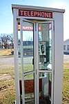
Prairie Grove Airlight Outdoor Telephone Booth |
|
November 9, 2015
(#15000291) |
SW. corner of E. Douglas and Parker Sts.
35°58′57″N 94°18′36″W / 35.982611°N 94.31°W / 35.982611; -94.31 (Prairie Grove Airlight Outdoor Telephone Booth) |
Prairie Grove |
The first telephone booth listed on the National Register. |
| 87 |
Prairie Grove Battlefield Park |
|
September 4, 1970
(#70000133) |
Within a triangle formed by North Rd. on the northwest and U.S. Highway 62 on the south; also the northern side of US 62, east of Prairie Grove; also north of US 62, east of Prairie Grove
35°59′09″N 94°18′51″W / 35.985833°N 94.314167°W / 35.985833; -94.314167 (Prairie Grove Battlefield Park) |
Prairie Grove |
Second and third sets of boundaries represent boundary increases of November 9, 1992 and October 27, 2005 |
| 88 |
Prairie Grove Cemetery Historic Section |
|
January 8, 2016
(#15000292) |
Bounded by Kate Smith, W. Buchanan, & Parks Sts.
35°58′34″N 94°19′08″W / 35.976131°N 94.319010°W / 35.976131; -94.319010 (Prairie Grove Cemetery Historic Section) |
Prairie Grove |
|
| 89 |
Prairie Grove Commercial Historic District |
|
June 25, 2018
(#100002567) |
Odd numbers 107-305 E Buchanan & 123 S Neal Sts.
35°58′33″N 94°18′56″W / 35.9757°N 94.3155°W / 35.9757; -94.3155 (Prairie Grove Commercial Historic District) |
Prairie Grove |
|
| 90 |
Price Produce and Service Station |
|
September 23, 2011
(#11000694) |
413, 415 & 417 E. Emma Ave.
36°11′05″N 94°07′35″W / 36.184722°N 94.126389°W / 36.184722; -94.126389 (Price Produce and Service Station) |
Springdale |
|
| 91 |
Pyeatte Mill Site |
|
November 17, 1982
(#82000954) |
South of Canehill on Highway 45
35°53′54″N 94°24′07″W / 35.898333°N 94.401944°W / 35.898333; -94.401944 (Pyeatte Mill Site) |
Canehill |
|
| 92 |
Henry Pyeatte House |
|
November 17, 1982
(#82000952) |
North of Canehill on Highway 45
35°55′05″N 94°23′39″W / 35.918056°N 94.394167°W / 35.918056; -94.394167 (Henry Pyeatte House) |
Canehill |
|
| 93 |
Rabbits Foot Lodge |
|
September 11, 1986
(#86002421) |
3600 Silent Grove Rd.
36°12′35″N 94°09′29″W / 36.209722°N 94.158056°W / 36.209722; -94.158056 (Rabbits Foot Lodge) |
Springdale |
|
| 94 |
Ridge House |
|
November 2, 1972
(#72000211) |
230 W. Center St.
36°03′46″N 94°09′23″W / 36.062778°N 94.156389°W / 36.062778; -94.156389 (Ridge House) |
Fayetteville |
|
| 95 |
Routh-Bailey House |
|
September 28, 1989
(#89001592) |
Old Wire Rd. 3 miles (4.8 km) east of Fayetteville
36°06′37″N 94°07′06″W / 36.110278°N 94.118333°W / 36.110278; -94.118333 (Routh-Bailey House) |
Fayetteville |
|
| 96 |
St. Joseph Catholic Church |
|
March 2, 2006
(#06000080) |
110 E. Henri de Tonti Boulevard
36°10′43″N 94°14′06″W / 36.178611°N 94.235°W / 36.178611; -94.235 (St. Joseph Catholic Church) |
Tontitown |
|
| 97 |
Warren Segraves House |
|
June 5, 2017
(#100001016) |
217 N. Oklahoma Way
36°03′54″N 94°08′55″W / 36.064869°N 94.148545°W / 36.064869; -94.148545 (Warren Segraves House) |
Fayetteville |
|
| 98 |
Lynn Shelton American Legion Post No. 27 |
|
January 4, 1996
(#95001480) |
28 S. College Ave.
36°03′43″N 94°09′26″W / 36.061944°N 94.157222°W / 36.061944; -94.157222 (Lynn Shelton American Legion Post No. 27) |
Fayetteville |
|
| 99 |
Shiloh Church |
|
June 5, 1975
(#75000418) |
Huntsville and Main Sts.
36°11′17″N 94°07′52″W / 36.188056°N 94.131111°W / 36.188056; -94.131111 (Shiloh Church) |
Springdale |
|
| 100 |
Shiloh Historic District |
|
August 31, 1978
(#78000640) |
Roughly bounded by Spring Creek, Shiloh, Johnson, Mill, and Spring Sts.
36°11′19″N 94°07′53″W / 36.188611°N 94.131389°W / 36.188611; -94.131389 (Shiloh Historic District) |
Springdale |
|
| 101 |
Skillern House |
|
January 27, 2015
(#14001203) |
3470 E. Skillern Rd.
36°06′05″N 94°06′22″W / 36.1015°N 94.1060°W / 36.1015; -94.1060 (Skillern House) |
Fayetteville |
|
| 102 |
Tom Smith House |
|
October 8, 1992
(#92001344) |
Highway 74 west of its junction with Highway 295, northeast of Elkins
36°02′17″N 93°57′41″W / 36.038056°N 93.961389°W / 36.038056; -93.961389 (Tom Smith House) |
Elkins |
|
| 103 |
Peter Smyth House |
|
October 4, 2002
(#02001080) |
1629 Crossover St.
36°04′56″N 94°07′17″W / 36.082222°N 94.121389°W / 36.082222; -94.121389 (Peter Smyth House) |
Fayetteville |
|
| 104 |
Son's Chapel |
|
September 25, 2003
(#03000949) |
5480 E. Mission
36°06′06″N 94°04′56″W / 36.101667°N 94.082222°W / 36.101667; -94.082222 (Son's Chapel) |
Fayetteville |
|
| 105 |
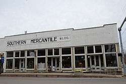
Southern Mercantile Building |
|
June 14, 1990
(#90000898) |
107 E. Buchanan
35°58′31″N 94°19′00″W / 35.975278°N 94.316667°W / 35.975278; -94.316667 (Southern Mercantile Building) |
Prairie Grove |
|
| 106 |
Spring Valley School District 120 Building |
|
September 4, 1992
(#92001119) |
County Road 379
36°10′39″N 93°55′56″W / 36.1775°N 93.932222°W / 36.1775; -93.932222 (Spring Valley School District 120 Building) |
Spring Valley |
|
| 107 |
Springdale Poultry Industry Historic District |
|
September 23, 2011
(#11000695) |
317 & 319 E. Emma & 316 E. Meadow Aves.
36°11′04″N 94°07′40″W / 36.184444°N 94.127778°W / 36.184444; -94.127778 (Springdale Poultry Industry Historic District) |
Springdale |
|
| 108 |
Stokenbury Cemetery |
|
February 4, 2010
(#09000799) |
Highway 16
36°00′52″N 94°00′31″W / 36.014389°N 94.008564°W / 36.014389; -94.008564 (Stokenbury Cemetery) |
Elkins |
|
| 109 |
Stone House |
|
September 4, 1970
(#70000132) |
207 Center St.
36°03′17″N 94°09′56″W / 36.054722°N 94.165556°W / 36.054722; -94.165556 (Stone House) |
Fayetteville |
|
| 110 |
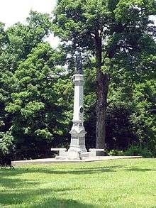
Strengthen the Arm of Liberty Monument |
|
July 31, 2012
(#12000279) |
3215 North Northhills Boulevard
36°06′37″N 94°09′35″W / 36.11017°N 94.159743°W / 36.11017; -94.159743 (Strengthen the Arm of Liberty Monument) |
Fayetteville |
Originally listed on the National Register November 1, 2000 (refnum 00001264), but removed January 27, 2012 due to improper relocation.[7] Relisted August 16, 2012. |
| 111 |
Student Union Building-University of Arkansas, Fayetteville |
|
September 4, 1992
(#92001104) |
Southeastern corner of the junction of Campus Dr. and Maple St.
36°04′11″N 94°10′15″W / 36.069722°N 94.170833°W / 36.069722; -94.170833 (Student Union Building-University of Arkansas, Fayetteville) |
Fayetteville |
|
| 112 |
Tharp House |
|
January 21, 2004
(#03001461) |
15 N. West Ave.
36°03′48″N 94°09′56″W / 36.063333°N 94.165556°W / 36.063333; -94.165556 (Tharp House) |
Fayetteville |
|
| 113 |
John Tilley House |
|
November 2, 1978
(#78000639) |
West of Prairie Grove on Stonewall Rd.
35°59′34″N 94°23′08″W / 35.992778°N 94.385556°W / 35.992778; -94.385556 (John Tilley House) |
Prairie Grove |
|
| 114 |
Tontitown School Building |
|
September 4, 1992
(#92001117) |
U.S. Highway 412
36°10′36″N 94°14′00″W / 36.176667°N 94.233333°W / 36.176667; -94.233333 (Tontitown School Building) |
Tontitown |
|
| 115 |
Twin Bridges Historic District |
|
March 7, 1994
(#94000162) |
County Road 3412 across an unnamed creek and Old County Road 11 across Baron Fork
35°52′35″N 94°27′12″W / 35.876389°N 94.453333°W / 35.876389; -94.453333 (Twin Bridges Historic District) |
Morrow |
|
| 116 |
United Presbyterian Church of Canehill |
|
November 17, 1982
(#82000955) |
Main St.
35°54′36″N 94°23′46″W / 35.91°N 94.396111°W / 35.91; -94.396111 (United Presbyterian Church of Canehill) |
Canehill |
|
| 117 |
University of Arkansas Campus Historic District |
|
September 23, 2009
(#09000745) |
Roughly bounded by Garland Ave., Maple St., Arkansas Ave., and Dickson St.
36°04′05″N 94°10′19″W / 36.068186°N 94.172047°W / 36.068186; -94.172047 (University of Arkansas Campus Historic District) |
Fayetteville |
|
| 118 |
John S. Vest House |
|
November 27, 1979
(#79003103) |
21 N. West St.
36°03′48″N 94°09′56″W / 36.063333°N 94.165556°W / 36.063333; -94.165556 (John S. Vest House) |
Fayetteville |
|
| 119 |
Villa Rosa |
|
December 27, 1990
(#90001946) |
617 W. Lafayette
36°04′05″N 94°10′03″W / 36.068056°N 94.1675°W / 36.068056; -94.1675 (Villa Rosa) |
Fayetteville |
|
| 120 |
Wade-Heerwagen House |
|
June 15, 1978
(#78000637) |
338 Washington Ave., N.
36°04′03″N 94°09′20″W / 36.0675°N 94.155556°W / 36.0675; -94.155556 (Wade-Heerwagen House) |
Fayetteville |
|
| 121 |
Walker Family Plot |
|
September 24, 2012
(#12000807) |
514 E. Rock St.
36°03′39″N 94°09′11″W / 36.060861°N 94.153027°W / 36.060861; -94.153027 (Walker Family Plot) |
Fayetteville |
|
| 122 |
Walker House |
|
June 10, 1975
(#75000417) |
Knerr Rd.
36°03′29″N 94°08′59″W / 36.058056°N 94.149722°W / 36.058056; -94.149722 (Walker House) |
Fayetteville |
|
| 123 |
Vol Walker Library-University of Arkansas, Fayetteville |
|
September 4, 1992
(#92001105) |
Campus Dr.
36°04′07″N 94°10′21″W / 36.068611°N 94.1725°W / 36.068611; -94.1725 (Vol Walker Library-University of Arkansas, Fayetteville) |
Fayetteville |
|
| 124 |
Walnut Grove Presbyterian Church |
|
December 7, 1995
(#95001411) |
Highway 170
36°00′08″N 94°16′03″W / 36.002222°N 94.2675°W / 36.002222; -94.2675 (Walnut Grove Presbyterian Church) |
Farmington |
|
| 125 |
Washington County Courthouse |
|
February 23, 1972
(#72000212) |
4 S. College Ave.
36°03′45″N 94°09′27″W / 36.0625°N 94.1575°W / 36.0625; -94.1575 (Washington County Courthouse) |
Fayetteville |
|
| 126 |
Washington County Jail |
|
December 1, 1978
(#78000638) |
College and County Aves.
36°03′42″N 94°09′27″W / 36.061667°N 94.1575°W / 36.061667; -94.1575 (Washington County Jail) |
Fayetteville |
|
| 127 |
Washington County Road 35 Bridge |
|
June 9, 2000
(#00000637) |
County Road 35
35°53′01″N 94°09′53″W / 35.883611°N 94.164722°W / 35.883611; -94.164722 (Washington County Road 35 Bridge) |
Woolsey |
|
| 128 |
Washington-Willow Historic District |
|
May 23, 1980
(#80000789) |
Roughly bounded by College and Walnut Aves. and Rebecca and Spring Sts.; also roughly Spring, Dickson, Sutton, and Lafayette Sts. from Olive Ave. to Willow Ave., and the junction of Rebecca St. and Willow
36°04′08″N 94°09′19″W / 36.068889°N 94.155278°W / 36.068889; -94.155278 (Washington-Willow Historic District) |
Fayetteville |
Second set of boundaries represents a boundary increase of March 28, 1995 |
| 129 |
Waterman-Archer House |
|
June 25, 1999
(#99000730) |
2148 Markham
36°04′10″N 94°11′21″W / 36.069444°N 94.189167°W / 36.069444; -94.189167 (Waterman-Archer House) |
Fayetteville |
|
| 130 |
William Welch House |
|
November 17, 1982
(#82000956) |
Main St.
35°54′29″N 94°23′45″W / 35.908056°N 94.395833°W / 35.908056; -94.395833 (William Welch House) |
Canehill |
|
| 131 |
West Dickson Street Commercial Historic District |
|
October 1, 2007
(#07001028) |
Dickson St. between Arkansas and St. Charles Aves., and West Ave. between Dickson and Lafayette Sts.
36°03′59″N 94°09′52″W / 36.066389°N 94.164444°W / 36.066389; -94.164444 (West Dickson Street Commercial Historic District) |
Fayetteville |
|
| 132 |
White River Bridge at Elkins |
|
January 24, 2008
(#07001437) |
County Road 44.
36°00′03″N 94°00′14″W / 36.0008719°N 94.0037763°W / 36.0008719; -94.0037763 (White River Bridge at Elkins) |
Elkins |
|
| 133 |
Wilson Park Historic District |
|
March 31, 1995
(#95000365) |
Roughly bounded by College Ave., Maple St., Wilson Ave., and Louise St.
36°04′15″N 94°09′44″W / 36.070833°N 94.162222°W / 36.070833; -94.162222 (Wilson Park Historic District) |
Fayetteville |
|
| 134 |
Wilson-Pittman-Campbell-Gregory House |
|
May 6, 1980
(#80000790) |
405 E. Dickson St.
36°03′55″N 94°09′07″W / 36.065278°N 94.151944°W / 36.065278; -94.151944 (Wilson-Pittman-Campbell-Gregory House) |
Fayetteville |
|
| 135 |
Mrs. Young Building |
|
June 25, 1999
(#99000731) |
5 S. Block Ave.
36°03′51″N 94°10′13″W / 36.064167°N 94.170278°W / 36.064167; -94.170278 (Mrs. Young Building) |
Fayetteville |
|

.jpg)
.png)
.JPG)

.JPG)


.jpg)
.jpg)
.JPG)