National Register of Historic Places listings in Hot Spring County, Arkansas
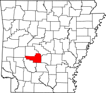
Location of Hot Spring County in Arkansas
This is a list of the National Register of Historic Places listings in Hot Spring County, Arkansas.
This is intended to be a complete list of the properties and districts on the National Register of Historic Places in Hot Spring County, Arkansas, United States. The locations of National Register properties and districts for which the latitude and longitude coordinates are included below, may be seen in a map.[1]
There are 28 properties and districts listed on the National Register in the county.
- This National Park Service list is complete through NPS recent listings posted October 4, 2018.[2]
Current listings
Former listings
| [3] | Name on the Register | Image | Date listed | Date removed | Location | City or town | Summary |
|---|---|---|---|---|---|---|---|
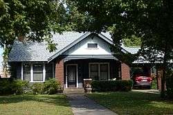
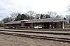
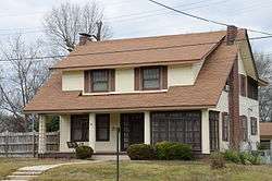
| 1 | Bethel African Methodist Episcopal Church | May 26, 2004 (#04000496) | June 12, 2013 | 519 West Page Street 34°21′35″N 92°48′58″W / 34.359722°N 92.816111°W |
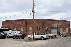
Malvern | ||
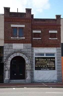
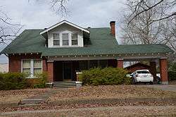
| 2 | Burks Service Station | June 9, 2000 (#00000630) | October 18, 2002 | Jct. of Page Ave. and Sullenberger |
Malvern | ||
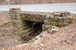
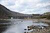
| 3 | Old Rockport Bridge | 1982 (#82000829) | August 11, 1999 | W of Rockport across Ouachita River |
Rockport vicinity | Damaged by flooding in 1987, completely destroyed by another flood in 1990. |
See also
| Wikimedia Commons has media related to National Register of Historic Places in Hot Spring County, Arkansas. |
References
- ↑ The latitude and longitude information provided in this table was derived originally from the National Register Information System, which has been found to be fairly accurate for about 99% of listings. For about 1% of NRIS original coordinates, experience has shown that one or both coordinates are typos or otherwise extremely far off; some corrections may have been made. A more subtle problem causes many locations to be off by up to 150 yards, depending on location in the country: most NRIS coordinates were derived from tracing out latitude and longitudes from USGS topographical quadrant maps created under the North American Datum of 1927, which differs from the current, highly accurate WGS84 GPS system used by most on-line maps. Chicago is about right, but NRIS longitudes in Washington are higher by about 4.5 seconds, and are lower by about 2.0 seconds in Maine. Latitudes differ by about 1.0 second in Florida. Some locations in this table may have been corrected to current GPS standards.
- ↑ "National Register of Historic Places: Weekly List Actions". National Park Service, United States Department of the Interior. Retrieved on October 4, 2018.
- 1 2 Numbers represent an ordering by significant words. Various colorings, defined here, differentiate National Historic Landmarks and historic districts from other NRHP buildings, structures, sites or objects.
- ↑ National Park Service (2009-03-13). "National Register Information System". National Register of Historic Places. National Park Service.
- ↑ The eight-digit number below each date is the number assigned to each location in the National Register Information System database, which can be viewed by clicking the number.
- ↑ Location derived from the Couchwood Historic District article of the Encyclopedia of Arkansas History and Culture; the NRIS lists the site as "Address Restricted"
| Topics | |
|---|---|
| Lists by states |
|
| Lists by insular areas | |
| Lists by associated states | |
| Other areas | |
| |
Municipalities and communities of Hot Spring County, Arkansas, United States | ||
|---|---|---|
| Cities | | |
| Towns | ||
| Census-designated place | ||
| Unincorporated communities |
| |
| Townships |
| |
| Ghost towns |
| |
This article is issued from
Wikipedia.
The text is licensed under Creative Commons - Attribution - Sharealike.
Additional terms may apply for the media files.