Blackburn, Arkansas
| Blackburn, Arkansas | |
|---|---|
| Unincorporated community | |
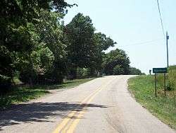 Entrance to Blackburn on Highway 74 | |
 Blackburn, Arkansas Blackburn's position in Arkansas. | |
| Coordinates: 35°48′59″N 94°13′11″W / 35.81639°N 94.21972°WCoordinates: 35°48′59″N 94°13′11″W / 35.81639°N 94.21972°W | |
| Country | United States |
| State | Arkansas |
| County | Washington |
| Township | Lee's Creek |
| Elevation[1] | 1,890 ft (576 m) |
| Time zone | UTC-6 (Central (CST)) |
| • Summer (DST) | UTC-5 (CDT) |
| Area code(s) | 479 |
| GNIS feature ID | 70703 |
| U.S. Geological Survey Geographic Names Information System: Blackburn, Arkansas | |
Blackburn is an unincorporated community in Lee's Creek Township, Washington County, Arkansas, United States.[1] It is located on Arkansas Highway 74, northeast of Devil's Den State Park.[2]
A post office called Blackburn was established in 1880, and remained in operation until 1952.[3][4]
References
- 1 2 "Feature Detail Report for: Blackburn, Arkansas." USGS. U.S. Geological Survey Geographic Names Information System: Blackburn, Arkansas Retrieved April 26, 2011.
- ↑ Arkansas Atlas and Gazetteer (Map) (Second ed.). DeLorme. 2002. p. 30. ISBN 0-89933-345-1.
- ↑ "Post Offices". Jim Forte Postal History. Retrieved 4 February 2018.
- ↑ History of Benton, Washington, Carroll, Madison, Crawford, Franklin, and Sebastian Counties, Arkansas. Higginson Book Company. 1889. p. 318.

This article is issued from
Wikipedia.
The text is licensed under Creative Commons - Attribution - Sharealike.
Additional terms may apply for the media files.