| [3] |
Name on the Register[4] |
Image |
Date listed[5] |
Location |
City or town |
Description |
|---|
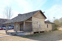
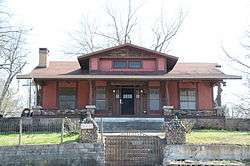
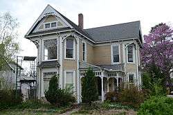
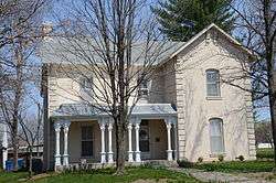
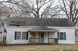
| 1 |
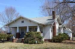
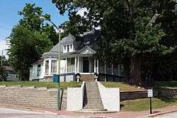
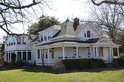
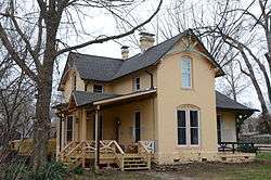
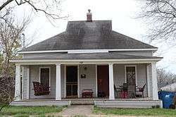
Adar House |
|
March 25, 1988
(#87002358) |
Off Highway 59
36°29′30″N 94°28′30″W / 36.491667°N 94.475°W / 36.491667; -94.475 (Adar House) |
Sulphur Springs |
|
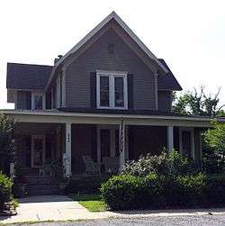
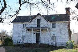
| 2 |
Alden House |
|
January 28, 1988
(#87002378) |
Route 1
36°17′24″N 94°16′23″W / 36.29°N 94.273056°W / 36.29; -94.273056 (Alden House) |
Bentonville |
|
| 3 |
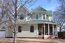
Alfrey-Brown House |
|
October 4, 1984
(#84000003) |
1001 S. Washington St.
36°10′25″N 94°32′11″W / 36.173611°N 94.536389°W / 36.173611; -94.536389 (Alfrey-Brown House) |
Siloam Springs |
|
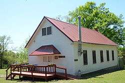
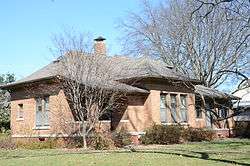
| 4 |
Applegate Drugstore |
|
June 23, 1982
(#82002095) |
116 1st St.
36°19′57″N 94°06′58″W / 36.3325°N 94.116111°W / 36.3325; -94.116111 (Applegate Drugstore) |
Rogers |
|
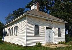
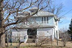
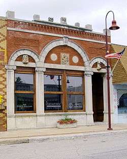
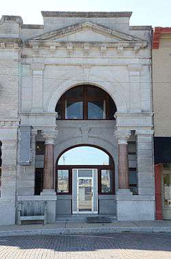
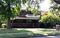
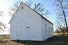
| 5 |
Bank of Gentry |
|
January 28, 1988
(#87002416) |
Main St.
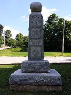
36°16′03″N 94°28′58″W / 36.2675°N 94.482778°W / 36.2675; -94.482778 (Bank of Gentry) |
Gentry |
|
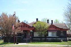
| 6 |
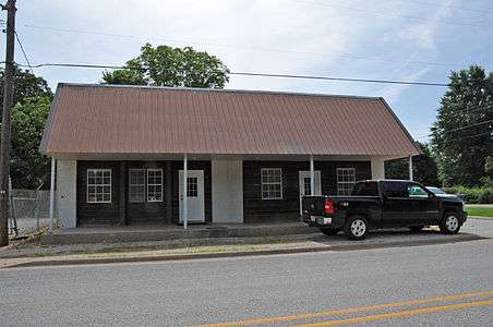
Bank of Rogers Building |
|
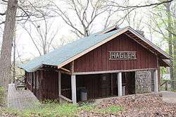
June 23, 1980
(#80000773) |
114 S. 1st St.
36°19′57″N 94°06′58″W / 36.3325°N 94.116111°W / 36.3325; -94.116111 (Bank of Rogers Building) |
Rogers |
|
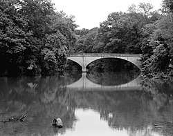
| 7 |
Banks House |
|
January 28, 1988
(#87002365) |
Highway 72, west of Hiwasse
36°25′55″N 94°20′48″W / 36.431944°N 94.346667°W / 36.431944; -94.346667 (Banks House) |
Hiwasse |
|
| 8 |
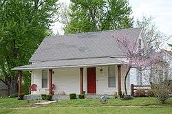
Fred Bartell House |
|
January 28, 1988
(#87002429) |
324 E. Twin Springs St.
36°10′57″N 94°32′19″W / 36.1825°N 94.538611°W / 36.1825; -94.538611 (Fred Bartell House) |
Siloam Springs |
|
| 9 |
Beasley Homestead |
|
January 28, 1988
(#87002375) |
U.S. Highway 71B
36°13′11″N 94°08′12″W / 36.219722°N 94.136667°W / 36.219722; -94.136667 (Beasley Homestead) |
Bethel Heights |
|
| 10 |
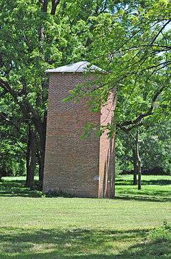
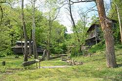
Bella Vista Water Tank |
|
August 14, 1992
(#92000985) |
Junction of Cunningham Dr. and Cedar Crest Dr.
36°25′43″N 94°14′47″W / 36.428611°N 94.246389°W / 36.428611; -94.246389 (Bella Vista Water Tank) |
Bella Vista |
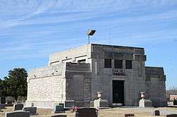
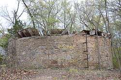
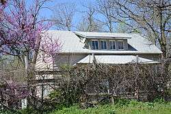
1920s stone tank |
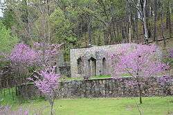
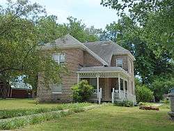
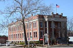
| 11 |
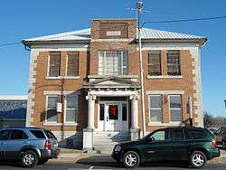
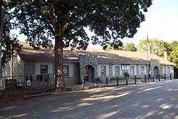
Benton County Courthouse |
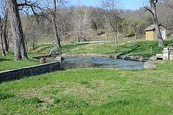
|
January 28, 1988
(#87002340) |
106 SE. A St.
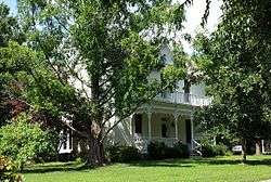
36°22′21″N 94°12′27″W / 36.3725°N 94.2075°W / 36.3725; -94.2075 (Benton County Courthouse) |
Bentonville |
|
| 12 |
Benton County Jail |
|
January 28, 1988
(#87002334) |
212 N. Main St.
36°22′25″N 94°12′30″W / 36.373611°N 94.208333°W / 36.373611; -94.208333 (Benton County Jail) |
Bentonville |
|
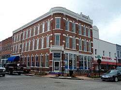
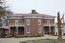
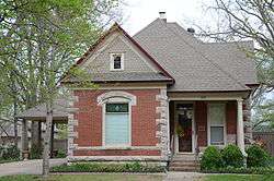
| 13 |
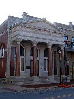
Benton County National Bank |
|
September 1, 1983
(#83001156) |
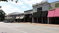
123 W. Central
36°22′19″N 94°12′34″W / 36.371944°N 94.209444°W / 36.371944; -94.209444 (Benton County National Bank) |
Bentonville |
NRHP listing says located in "Benton City", but both address and coordinates point to a block in downtown Bentonville just off the town square. |
| 14 |
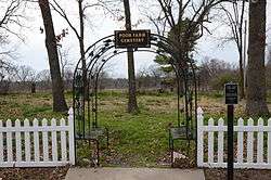
Benton County Poor Farm Cemetery |
|
May 20, 2008
(#08000431) |
Western side of NE. Young Ave., approximately 200 feet north of NE. Carnahan Ct.
36°23′27″N 94°11′58″W / 36.390869°N 94.199519°W / 36.390869; -94.199519 (Benton County Poor Farm Cemetery) |
Bentonville |
|
| 15 |
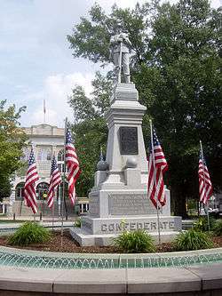
Bentonville Confederate Monument |
|
April 26, 1996
(#96000459) |
Public Sq. Park., near the junction of 2nd and Main Sts.
36°22′19″N 94°12′25″W / 36.371944°N 94.206944°W / 36.371944; -94.206944 (Bentonville Confederate Monument) |
Bentonville |
|
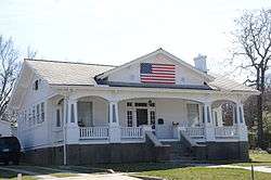
| 16 |
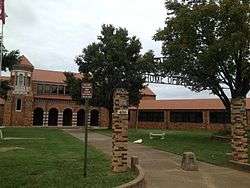
Bentonville High School |
|
January 28, 1988
(#87002339) |
410 N.W. 2nd St.
36°22′25″N 94°12′49″W / 36.373611°N 94.213611°W / 36.373611; -94.213611 (Bentonville High School) |
Bentonville |
Built in 1928; Spanish Colonial, Mission and Mediterranean style elements; currently known as Old High Middle School |
| 17 |
Bentonville Third Street Historic District |
|
November 12, 1993
(#93001202) |
Roughly 3rd St., SE. from Main St. to C St., SE.
36°22′10″N 94°12′25″W / 36.369444°N 94.206944°W / 36.369444; -94.206944 (Bentonville Third Street Historic District) |
Bentonville |
|
| 18 |
Bentonville Train Station |
|
January 28, 1988
(#87002337) |
414 S. Main St.
36°22′01″N 94°12′33″W / 36.366944°N 94.209167°W / 36.366944; -94.209167 (Bentonville Train Station) |
Bentonville |
|
| 19 |
Bentonville West Central Avenue Historic District |
|
October 22, 1992
(#92001349) |
W. Central Ave. between SW. A and SW. G Sts.
36°22′20″N 94°12′54″W / 36.372222°N 94.215°W / 36.372222; -94.215 (Bentonville West Central Avenue Historic District) |
Bentonville |
|
| 20 |
Bertschy House |
|
January 28, 1988
(#87002336) |
507 N.W. 5th St.
36°22′39″N 94°12′56″W / 36.3775°N 94.215556°W / 36.3775; -94.215556 (Bertschy House) |
Bentonville |
|
| 21 |
Blackburn House |
|
January 28, 1988
(#87002402) |
220 N. 4th St.
36°20′06″N 94°07′11″W / 36.335°N 94.119722°W / 36.335; -94.119722 (Blackburn House) |
Rogers |
|
| 22 |
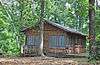
Blackwell-Paisley Cabin |
|
January 28, 1988
(#87002351) |
Suits-Us Dr.
36°25′49″N 94°13′59″W / 36.430278°N 94.233056°W / 36.430278; -94.233056 (Blackwell-Paisley Cabin) |
Bella Vista |
|
| 23 |
Bogan Cabin |
|
January 28, 1988
(#87002352) |
Cedarcrest Mountain
36°25′40″N 94°14′02″W / 36.427778°N 94.233889°W / 36.427778; -94.233889 (Bogan Cabin) |
Bella Vista |
|
| 24 |
Bogart Hardware Building |
|
January 28, 1988
(#87002329) |
112 E. Central
36°22′20″N 94°12′29″W / 36.372222°N 94.208056°W / 36.372222; -94.208056 (Bogart Hardware Building) |
Bentonville |
|
| 25 |
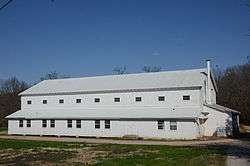
Bolin Barn and Smokehouse |
|
January 28, 1988
(#87002359) |
Southeast of Gravette on Spavinaw Creek Rd.
36°23′55″N 94°23′11″W / 36.398611°N 94.386389°W / 36.398611; -94.386389 (Bolin Barn and Smokehouse) |
Gravette |
|
| 26 |
Braithwaite House |
|
January 28, 1988
(#87002314) |
Old Bella Vista Highway
36°23′23″N 94°13′02″W / 36.389722°N 94.217222°W / 36.389722; -94.217222 (Braithwaite House) |
Bentonville |
|
| 27 |
Bratt-Smiley House |
|
January 28, 1988
(#87002428) |
University and Broadway
36°11′13″N 94°32′26″W / 36.186944°N 94.540556°W / 36.186944; -94.540556 (Bratt-Smiley House) |
Siloam Springs |
|
| 28 |
Breedlove House and Water Tower |
|
January 28, 1988
(#87002326) |
Route 4
36°22′13″N 94°10′37″W / 36.370278°N 94.176944°W / 36.370278; -94.176944 (Breedlove House and Water Tower) |
Bentonville |
|
| 29 |
Bryan House No. 2 |
|
January 28, 1988
(#87002396) |
321 E. Locust St.
36°20′07″N 94°06′43″W / 36.335278°N 94.111944°W / 36.335278; -94.111944 (Bryan House No. 2) |
Rogers |
|
| 30 |
Camp Crowder Gymnasium |
|
September 23, 2011
(#11000685) |
205 Shiloh Dr.
36°28′44″N 94°27′27″W / 36.478889°N 94.4575°W / 36.478889; -94.4575 (Camp Crowder Gymnasium) |
Sulphur Springs |
|
| 31 |
Campbell House |
|
January 28, 1988
(#87002391) |
714 W. 3rd St.
36°19′38″N 94°07′10″W / 36.327222°N 94.119444°W / 36.327222; -94.119444 (Campbell House) |
Rogers |
|
| 32 |
Carl House |
|
January 28, 1988
(#87002422) |
70 Main St.
36°16′02″N 94°29′06″W / 36.267222°N 94.485°W / 36.267222; -94.485 (Carl House) |
Gentry |
|
| 33 |
Carl's Addition Historic District |
|
July 17, 1997
(#97000791) |
Along S. College, W. Alpine, and S. Wright Sts., bounded by Sager Creek and W. Twin Springs Ave.
36°11′01″N 94°32′33″W / 36.183611°N 94.5425°W / 36.183611; -94.5425 (Carl's Addition Historic District) |
Siloam Springs |
|
| 34 |
Carpenter Building |
|
May 18, 2018
(#100002447) |
136 E Main
36°16′03″N 94°29′00″W / 36.2675°N 94.4832°W / 36.2675; -94.4832 (Carpenter Building) |
Gentry |
|
| 35 |
Coal Gap School |
|
September 4, 1992
(#92001123) |
County Road 920
36°21′55″N 93°55′26″W / 36.365278°N 93.923889°W / 36.365278; -93.923889 (Coal Gap School) |
Larue |
|
| 36 |
Coats School |
|
January 28, 1988
(#87002370) |
Spavinaw Creek Rd.
36°21′08″N 94°34′04″W / 36.352222°N 94.567778°W / 36.352222; -94.567778 (Coats School) |
Maysville |
|
| 37 |
Connelly-Harrington House |
|
January 28, 1988
(#87002386) |
115 E. University
36°11′14″N 94°32′26″W / 36.187222°N 94.540556°W / 36.187222; -94.540556 (Connelly-Harrington House) |
Siloam Springs |
|
| 38 |
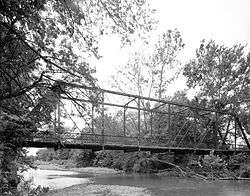
Coon Creek Bridge |
|
January 24, 2007
(#06001264) |
County Road 24
36°19′29″N 94°33′14″W / 36.324722°N 94.553889°W / 36.324722; -94.553889 (Coon Creek Bridge) |
Cherokee City |
|
| 39 |
Council Grove Methodist Church |
|
January 28, 1988
(#87002377) |
Osage Mills Rd.
36°16′53″N 94°16′05″W / 36.281389°N 94.268056°W / 36.281389; -94.268056 (Council Grove Methodist Church) |
Osage Mills |
|
| 40 |
Charles R. Craig Building |
|
September 27, 2003
(#03000957) |
113 S. Main St.
36°22′16″N 94°12′30″W / 36.371111°N 94.208333°W / 36.371111; -94.208333 (Charles R. Craig Building) |
Bentonville |
|
| 41 |
Craig-Bryan House |
|
January 28, 1988
(#87002320) |
307 W. Central
36°22′19″N 94°12′44″W / 36.371944°N 94.212222°W / 36.371944; -94.212222 (Craig-Bryan House) |
Bentonville |
|
| 42 |
Deaton Cabin |
|
January 28, 1988
(#87002348) |
Suits Us Rd.
36°25′49″N 94°13′59″W / 36.430278°N 94.233056°W / 36.430278; -94.233056 (Deaton Cabin) |
Bella Vista |
|
| 43 |
Douglas House |
|
January 28, 1988
(#87002372) |
8 miles off of Highway 12
36°15′20″N 94°20′10″W / 36.255556°N 94.336111°W / 36.255556; -94.336111 (Douglas House) |
Vaughn |
|
| 44 |
Duckworth-Williams House |
|
January 28, 1988
(#87002385) |
103 S. College
36°11′06″N 94°32′34″W / 36.185°N 94.542778°W / 36.185; -94.542778 (Duckworth-Williams House) |
Siloam Springs |
|
| 45 |
Elliott House |
|
January 20, 1978
(#78000573) |
303 SE. 3rd St.
36°22′11″N 94°12′17″W / 36.369722°N 94.204722°W / 36.369722; -94.204722 (Elliott House) |
Bentonville |
|
| 46 |
First National Bank |
|
January 28, 1988
(#87002431) |
109 E. University
36°11′10″N 94°32′26″W / 36.186111°N 94.540556°W / 36.186111; -94.540556 (First National Bank) |
Siloam Springs |
|
| 47 |
Freeman-Felker House |
|
January 28, 1988
(#87002399) |
318 W. Elm St.
36°19′55″N 94°07′11″W / 36.331944°N 94.119722°W / 36.331944; -94.119722 (Freeman-Felker House) |
Rogers |
|
| 48 |
Gailey Hollow Farmstead |
|
January 28, 1988
(#87002381) |
¼ mile east of the Logan intersection
36°12′42″N 94°22′56″W / 36.211667°N 94.382222°W / 36.211667; -94.382222 (Gailey Hollow Farmstead) |
Logan |
|
| 49 |
Garfield Elementary School |
|
June 28, 1996
(#96000693) |
18432 Marshall St.[6]
36°26′55″N 93°58′17″W / 36.448611°N 93.971389°W / 36.448611; -93.971389 (Garfield Elementary School) |
Garfield |
|
| 50 |
Gentry Grand Army of the Republic Monument |
|
January 26, 2016
(#100001990) |
NE Sec. of Gentry Cemetery, Pioneer Ln.
36°15′14″N 94°29′39″W / 36.254016°N 94.494267°W / 36.254016; -94.494267 (Gentry Grand Army of the Republic Monument) |
Gentry |
|
| 51 |
German Builder's House |
|
January 28, 1988
(#87002426) |
315 E. Central
36°11′07″N 94°32′20″W / 36.185278°N 94.538889°W / 36.185278; -94.538889 (German Builder's House) |
Siloam Springs |
|
| 52 |
Goforth-Saindon Mound Group |
|
January 23, 1986
(#86000099) |
Address Restricted
|
Siloam Springs |
|
| 53 |
Grand Army of the Republic Memorial |
|
May 3, 1996
(#96000506) |
Southern end of Twin Springs Park, east of the junction of Highway 43 and Twin Springs St.
36°10′59″N 94°32′25″W / 36.183056°N 94.540278°W / 36.183056; -94.540278 (Grand Army of the Republic Memorial) |
Siloam Springs |
|
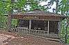
| 54 |
Green Barn |
|
January 28, 1988
(#87002368) |
McClure St.
36°15′25″N 94°07′27″W / 36.256944°N 94.124167°W / 36.256944; -94.124167 (Green Barn) |
Lowell |
Demolition was confirmed by Dr. Gaye Bland, director of the Rogers Historical Museum in 2013. |
| 55 |
Gypsy Camp Historic District |
|
January 28, 1988
(#87002425) |
Off Highway 59
36°06′44″N 94°32′15″W / 36.1123°N 94.5376°W / 36.1123; -94.5376 (Gypsy Camp Historic District) |
Siloam Springs |
|
| 56 |
Hagler-Cole Cabin |
|
January 28, 1988
(#87002342) |
Mt. Pisqua Dr.
36°25′45″N 94°13′25″W / 36.429167°N 94.223611°W / 36.429167; -94.223611 (Hagler-Cole Cabin) |
Bella Vista |
|
| 57 |
Henry Furniture Store Building |
|
July 15, 1994
(#94000725) |
107 W. University
36°11′10″N 94°32′30″W / 36.186111°N 94.541667°W / 36.186111; -94.541667 (Henry Furniture Store Building) |
Siloam Springs |
|
| 58 |
Henry-Thompson House |
|
January 28, 1988
(#87002327) |
302 SE. 2nd St.
36°22′16″N 94°12′21″W / 36.371111°N 94.205833°W / 36.371111; -94.205833 (Henry-Thompson House) |
Bentonville |
|
| 59 |
Highfill School (No. 71) |
|
January 26, 2018
(#100001991) |
11978 Highfill Ave.
36°15′30″N 94°21′02″W / 36.258345°N 94.350604°W / 36.258345; -94.350604 (Highfill School (No. 71)) |
Highfill |
|
| 60 |
Hiwasse Bank Building |
|
January 28, 1988
(#87002366) |
Main St., Highway 279
36°25′53″N 94°20′02″W / 36.431389°N 94.333889°W / 36.431389; -94.333889 (Hiwasse Bank Building) |
Hiwasse |
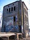
Demolished or extensively renovated. Photo shows building currently on the site. |
| 61 |
House at 305 E. Ashley |
|
January 28, 1988
(#87002427) |
305 E. Ashley
36°11′13″N 94°32′16″W / 36.186944°N 94.537778°W / 36.186944; -94.537778 (House at 305 E. Ashley) |
Siloam Springs |
|
| 62 |
Illinois River Bridge |
|
January 19, 2005
(#04001503) |
County Road 196 (Kincheloe Rd.) approximately 0.25 miles south of Old Highway 68
36°10′39″N 94°23′31″W / 36.177500°N 94.391944°W / 36.177500; -94.391944 (Illinois River Bridge) |
Pedro |
|
| 63 |
Illinois River Bridge |
|
January 28, 1988
(#87002420) |
6 miles east of Siloam Springs
36°09′59″N 94°26′01″W / 36.166389°N 94.433611°W / 36.166389; -94.433611 (Illinois River Bridge) |
Siloam Springs |
|
| 64 |
Jackson House |
|
January 28, 1988
(#87002331) |
207 W. Central
36°22′19″N 94°12′40″W / 36.371944°N 94.211111°W / 36.371944; -94.211111 (Jackson House) |
Bentonville |
|
| 65 |
James House |
|
January 28, 1988
(#87002332) |
CR 51
36°18′27″N 94°12′29″W / 36.3075°N 94.208056°W / 36.3075; -94.208056 (James House) |
Rogers |
|
| 66 |
Jones House |
|
January 28, 1988
(#87002363) |
220 Bush St.
36°28′48″N 94°27′34″W / 36.48°N 94.459444°W / 36.48; -94.459444 (Jones House) |
Sulphur Springs |
|
| 67 |
Charles Juhre House |
|
February 25, 1993
(#93000091) |
406 N. 4th St.
36°20′12″N 94°07′10″W / 36.336667°N 94.119444°W / 36.336667; -94.119444 (Charles Juhre House) |
Rogers |
|
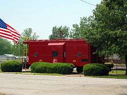
| 68 |
Kansas City Southern Railway Caboose No. 383 |
|
September 23, 2010
(#10000782) |
Northwest of the Arkansas Highway 72 and Arkansas Highway 59 intersection
36°25′17″N 94°27′12″W / 36.421389°N 94.453333°W / 36.421389; -94.453333 (Kansas City Southern Railway Caboose No. 383) |
Gravette |
|
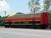
| 69 |
Kansas City Southern Railway Locomotive #73D and Caboose #385 |
|
February 21, 2006
(#06000072) |
Highway 59 south of Church Ave.
36°20′13″N 94°27′40″W / 36.336944°N 94.461111°W / 36.336944; -94.461111 (Kansas City Southern Railway Locomotive #73D and Caboose #385) |
Decatur |
|
| 70 |
Kansas City-Southern Depot-Decatur |
|
June 11, 1992
(#92000606) |
Highway 59
36°20′07″N 94°27′39″W / 36.335278°N 94.460833°W / 36.335278; -94.460833 (Kansas City-Southern Depot-Decatur) |
Decatur |
|
| 71 |
Kefauver House |
|
January 28, 1988
(#87002405) |
224 W. Cherry St.
36°19′47″N 94°07′08″W / 36.329722°N 94.118889°W / 36.329722; -94.118889 (Kefauver House) |
Rogers |
|
| 72 |
Kindley House |
|
January 28, 1988
(#87002356) |
503 Charlotte St.
36°25′09″N 94°26′52″W / 36.419167°N 94.447778°W / 36.419167; -94.447778 (Kindley House) |
Gravette |
|
| 73 |
Koons House |
|
January 22, 1988
(#87002330) |
409 5th St.
36°22′39″N 94°12′52″W / 36.3775°N 94.214444°W / 36.3775; -94.214444 (Koons House) |
Bentonville |
|
| 74 |
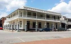
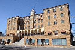
Lakeside Hotel |
|
November 15, 1979
(#79000432) |
119 W. University St.
36°11′10″N 94°32′30″W / 36.186111°N 94.541667°W / 36.186111; -94.541667 (Lakeside Hotel) |
Siloam Springs |
|
| 75 |
Lamberton Cabin |
|
January 28, 1988
(#87002343) |
8 N. Mountain
36°26′07″N 94°13′30″W / 36.435278°N 94.225°W / 36.435278; -94.225 (Lamberton Cabin) |
Bella Vista |
|
| 76 |
Lane Hotel |
|
January 28, 1988
(#87002411) |
121 W. Poplar St.
36°19′52″N 94°07′02″W / 36.331111°N 94.117222°W / 36.331111; -94.117222 (Lane Hotel) |
Rogers |
|
| 77 |
Lillard-Sprague House |
|
January 28, 1988
(#87002398) |
Pleasant Grove Rd.
36°17′22″N 94°11′21″W / 36.289444°N 94.189167°W / 36.289444; -94.189167 (Lillard-Sprague House) |
Rogers |
2015 photo show the house destroyed |
| 78 |
Linebarger House |
|
January 28, 1988
(#87002335) |
606 W. Central
36°22′21″N 94°12′58″W / 36.3725°N 94.216111°W / 36.3725; -94.216111 (Linebarger House) |
Bentonville |
|
| 79 |
Macon-Harrison House |
|
January 28, 1988
(#87002333) |
209 NE. 2nd St.
36°22′23″N 94°12′21″W / 36.373056°N 94.205833°W / 36.373056; -94.205833 (Macon-Harrison House) |
Bentonville |
|
| 80 |
Markey House |
|
January 28, 1988
(#87002354) |
Route 1
36°25′39″N 93°57′16″W / 36.4275°N 93.954444°W / 36.4275; -93.954444 (Markey House) |
Garfield |
|
| 81 |
Massey Hotel |
|
December 1, 1978
(#78000574) |
U.S. Highway 71B
36°22′19″N 94°12′35″W / 36.371944°N 94.209722°W / 36.371944; -94.209722 (Massey Hotel) |
Bentonville |
|
| 82 |
Maxwell-Hinman House |
|
January 28, 1988
(#87002322) |
902 N.W. 2nd St.
36°22′23″N 94°13′18″W / 36.373056°N 94.221667°W / 36.373056; -94.221667 (Maxwell-Hinman House) |
Bentonville |
|
| 83 |
Maxwell-Sweet House |
|
January 28, 1988
(#87002388) |
114 S. College
36°11′05″N 94°32′35″W / 36.184722°N 94.543056°W / 36.184722; -94.543056 (Maxwell-Sweet House) |
Siloam Springs |
|
| 84 |
McCleod House |
|
January 28, 1988
(#87002355) |
Route 1
36°16′05″N 94°09′50″W / 36.268056°N 94.163889°W / 36.268056; -94.163889 (McCleod House) |
Springdale |
|
| 85 |
McIntyre House |
|
January 28, 1988
(#87002382) |
Logan Rd.
36°12′13″N 94°22′11″W / 36.203611°N 94.369722°W / 36.203611; -94.369722 (McIntyre House) |
Logan |
|
| 86 |
Merrill House |
|
January 28, 1988
(#87002404) |
617 S. 6th
36°19′42″N 94°07′22″W / 36.328333°N 94.122778°W / 36.328333; -94.122778 (Merrill House) |
Rogers |
|
| 87 |
Miller Homestead |
|
January 28, 1988
(#87002362) |
½ mile east of Highway 94
36°26′29″N 94°06′17″W / 36.441389°N 94.104722°W / 36.441389; -94.104722 (Miller Homestead) |
Pea Ridge |
|
| 88 |
Mitchell House |
|
January 28, 1988
(#87002423) |
115 N. Nelson
36°16′09″N 94°28′55″W / 36.269167°N 94.481944°W / 36.269167; -94.481944 (Mitchell House) |
Gentry |
|
| 89 |
Mitchell-Ward House |
|
June 1, 2005
(#05000486) |
201 N. Nelson
36°16′16″N 94°29′04″W / 36.271111°N 94.484444°W / 36.271111; -94.484444 (Mitchell-Ward House) |
Gentry |
|
| 90 |
Monte Ne |
|
February 17, 1978
(#78000575) |
Off Highway 94
36°16′59″N 94°04′22″W / 36.283056°N 94.072778°W / 36.283056; -94.072778 (Monte Ne) |
Monte Ne |
|
| 91 |
Morris House |
|
January 28, 1988
(#87002316) |
407 S.W. 4th St.
36°22′04″N 94°12′48″W / 36.367778°N 94.213333°W / 36.367778; -94.213333 (Morris House) |
Bentonville |
|
| 92 |
Mt. Hebron M.E. Church South and Cemetery |
|
September 27, 2003
(#03000958) |
1079 Mt. Hebron Rd.
36°16′33″N 94°11′43″W / 36.275833°N 94.195278°W / 36.275833; -94.195278 (Mt. Hebron M.E. Church South and Cemetery) |
Colville |
|
| 93 |
Mutual Aid Union Building |
|
October 14, 1976
(#76000385) |
2nd and Poplar Sts.
36°19′53″N 94°07′04″W / 36.331389°N 94.117778°W / 36.331389; -94.117778 (Mutual Aid Union Building) |
Rogers |
|
| 94 |
Myler House |
|
January 28, 1988
(#87002393) |
315 N. 3rd St.
36°20′08″N 94°07′05″W / 36.335556°N 94.118056°W / 36.335556; -94.118056 (Myler House) |
Rogers |
|
| 95 |
New Home School and Church |
|
January 28, 1988
(#87002357) |
South of Bella Vista on McKisic Creek Rd.
36°24′53″N 94°13′42″W / 36.414722°N 94.228333°W / 36.414722; -94.228333 (New Home School and Church) |
Bella Vista |
|
| 96 |
Norwood School |
|
January 28, 1988
(#87002384) |
Norwood Rd. and Highway 16
36°07′05″N 94°27′58″W / 36.118056°N 94.466111°W / 36.118056; -94.466111 (Norwood School) |
Norwood |
|
| 97 |
Oak Hill Mausoleum |
|
December 6, 1996
(#96001412) |
Oak Hill Cemetery, west of the junction of Benton St. and Highway 43
36°11′16″N 94°33′38″W / 36.187778°N 94.560556°W / 36.187778; -94.560556 (Oak Hill Mausoleum) |
Siloam Springs |
|
| 98 |
Oklahoma Row Hotel Site |
|
May 20, 1992
(#91001668) |
Highway 94S at the shores of Beaver Lake
36°17′08″N 94°04′11″W / 36.285556°N 94.069722°W / 36.285556; -94.069722 (Oklahoma Row Hotel Site) |
Monte Ne |
|
| 99 |
Osage Creek Bridge |
|
January 28, 1988
(#87002418) |
4½ miles north of Tontitown
36°14′26″N 94°15′12″W / 36.240556°N 94.253333°W / 36.240556; -94.253333 (Osage Creek Bridge) |
Tontitown |
Demolished in 2015 and replaced with new bridge. |
| 100 |
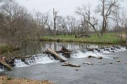
Osage Mills Dam |
|
January 28, 1988
(#87002376) |
North of Osage Mills on Little Osage Creek
36°17′40″N 94°16′03″W / 36.294444°N 94.2675°W / 36.294444; -94.2675 (Osage Mills Dam) |
Osage Mills |
|
| 101 |
Parks-Reagan House |
|
January 28, 1988
(#87002395) |
410 W. Poplar St.
36°19′52″N 94°07′15″W / 36.331111°N 94.120833°W / 36.331111; -94.120833 (Parks-Reagan House) |
Rogers |
|
| 102 |
Pea Ridge Commercial Historic District |
|
May 22, 2007
(#07000445) |
Pickens St. roughly between Greene and Davis Sts., and Curtis Ave. roughly between Pike and Macintosh Sts.
36°27′20″N 94°06′52″W / 36.455556°N 94.114444°W / 36.455556; -94.114444 (Pea Ridge Commercial Historic District) |
Pea Ridge |
|
| 103 |
Pea Ridge National Military Park |
|
October 15, 1966
(#66000199) |
U.S. Highway 62
36°26′12″N 94°01′35″W / 36.436667°N 94.026389°W / 36.436667; -94.026389 (Pea Ridge National Military Park) |
Pea Ridge |
|
| 104 |
Col. Samuel W. Peel House |
|
May 4, 1995
(#95000571) |
400 S. Walton Boulevard
36°22′09″N 94°13′18″W / 36.369167°N 94.221667°W / 36.369167; -94.221667 (Col. Samuel W. Peel House) |
Bentonville |
|
| 105 |
Pharr Cabin |
|
January 28, 1988
(#87002346) |
2 N. Mountain
36°26′07″N 94°13′40″W / 36.435278°N 94.227778°W / 36.435278; -94.227778 (Pharr Cabin) |
Bella Vista |
|
| 106 |
Piercy Farmstead |
|
January 28, 1988
(#87002379) |
Osage Mills Rd.
36°16′25″N 94°16′01″W / 36.273611°N 94.266944°W / 36.273611; -94.266944 (Piercy Farmstead) |
Osage Mills |
|
| 107 |
Pinkston-Mays Store Building |
|
January 28, 1988
(#87002367) |
107-109 Lackston St.
36°15′24″N 94°07′51″W / 36.256667°N 94.130833°W / 36.256667; -94.130833 (Pinkston-Mays Store Building) |
Lowell |
|
| 108 |
Princedom Cabin |
|
January 28, 1988
(#87002347) |
Lookout Dr.
36°25′39″N 94°13′52″W / 36.4275°N 94.231111°W / 36.4275; -94.231111 (Princedom Cabin) |
Bella Vista |
|
| 109 |
Putman Cemetery |
|
May 24, 2004
(#04000510) |
3504 Magellan Boulevard
36°20′11″N 94°11′17″W / 36.336389°N 94.188056°W / 36.336389; -94.188056 (Putman Cemetery) |
Bentonville |
|
| 110 |
Pyeatte House |
|
November 29, 1995
(#95001382) |
311 S. Mt. Olive St.
36°10′53″N 94°32′29″W / 36.181389°N 94.541389°W / 36.181389; -94.541389 (Pyeatte House) |
Siloam Springs |
|
| 111 |
Quell House |
|
January 28, 1988
(#87002387) |
222 S. Wright
36°11′01″N 94°32′32″W / 36.183611°N 94.542222°W / 36.183611; -94.542222 (Quell House) |
Siloam Springs |
|
| 112 |
Railroad Cottage |
|
January 19, 2005
(#04001509) |
208 N. Rust
36°16′16″N 94°29′01″W / 36.271111°N 94.483611°W / 36.271111; -94.483611 (Railroad Cottage) |
Gentry |
|
| 113 |
Raney House |
|
January 28, 1988
(#87002403) |
1331 Monte Ne
36°19′10″N 94°06′21″W / 36.319444°N 94.105833°W / 36.319444; -94.105833 (Raney House) |
Rogers |
|
| 114 |
Reeves House |
|
September 7, 1995
(#95001091) |
321 S. Wright St.
36°10′58″N 94°32′30″W / 36.182778°N 94.541667°W / 36.182778; -94.541667 (Reeves House) |
Siloam Springs |
|
| 115 |
Rice House |
|
January 28, 1988
(#87002325) |
501 NW. A St.
36°22′40″N 94°12′37″W / 36.377778°N 94.210278°W / 36.377778; -94.210278 (Rice House) |
Bentonville |
|
| 116 |
James A. Rice House |
|
November 1, 1984
(#84000177) |
204 SE. 3rd St.
36°22′09″N 94°12′28″W / 36.369167°N 94.207778°W / 36.369167; -94.207778 (James A. Rice House) |
Bentonville |
|
| 117 |
Rife Farmstead |
|
January 28, 1988
(#87002380) |
Osage Mills Rd.
36°16′10″N 94°15′57″W / 36.269444°N 94.265833°W / 36.269444; -94.265833 (Rife Farmstead) |
Osage Mills |
|
| 118 |
Rife House |
|
January 28, 1988
(#87002406) |
1515 S. 8th St.
36°19′09″N 94°13′33″W / 36.319167°N 94.225833°W / 36.319167; -94.225833 (Rife House) |
Rogers |
Demolition was confirmed by Dr. Gaye Bland, director of the Rogers Historical Museum in 2013. |
| 119 |
Rocky Branch School |
|
March 25, 1988
(#87002360) |
200 N. Highway 303
36°19′34″N 93°56′29″W / 36.326111°N 93.941389°W / 36.326111; -93.941389 (Rocky Branch School) |
Prairie Creek |
|
| 120 |
Rogers City Hall |
|
January 28, 1988
(#87002409) |
202 W. Elm St.
36°19′55″N 94°07′05″W / 36.331944°N 94.118056°W / 36.331944; -94.118056 (Rogers City Hall) |
Rogers |
The old Rogers City Hall, not the modern one at 301 West Chestnut. |
| 121 |
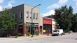
Rogers Commercial Historic District |
|
January 28, 1988
(#87002412) |
Walnut St.; also roughly bounded by Walnut, 1st, Poplar, and 2nd Sts.; also 120 S. 2nd St.; also 116 S. 2nd St.; also the 300 block of S. 1st St., the 100 block of S. 2nd St., the 200 block of W. Walnut St., and the 200 block of W. Elm St.
36°19′59″N 94°07′00″W / 36.333056°N 94.116667°W / 36.333056; -94.116667 (Rogers Commercial Historic District) |
Rogers |
Semicolons separate the original boundaries and boundary increases of September 30, 1993, December 9, 1998, October 4, 2002, and October 17, 2012. Originally listed in 1988 as the Walnut Street Historic District; with the first boundary increase, it was renamed the Rogers Commercial Historic District |
| 122 |
Rogers Post Office Building |
|
January 28, 1988
(#87002408) |
120 W. Poplar St.
36°19′51″N 94°07′02″W / 36.330833°N 94.117222°W / 36.330833; -94.117222 (Rogers Post Office Building) |
Rogers |
Rogers' main post office building 1917-1940s. |
| 123 |
Roy's Office Supply Building |
|
January 28, 1988
(#87002328) |
110 E. Central
36°22′20″N 94°12′30″W / 36.372222°N 94.208333°W / 36.372222; -94.208333 (Roy's Office Supply Building) |
Bentonville |
|
| 124 |
Simon Sager Cabin |
|
January 30, 1976
(#76000386) |
John Brown University campus
36°11′28″N 94°33′30″W / 36.191111°N 94.558333°W / 36.191111; -94.558333 (Simon Sager Cabin) |
Siloam Springs |
|
| 125 |
Sellers Farm |
|
January 28, 1988
(#87002369) |
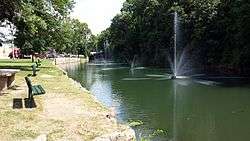
Old highway on the state line
36°24′20″N 94°36′07″W / 36.405556°N 94.601944°W / 36.405556; -94.601944 (Sellers Farm) |
Maysville |
Burned Down |
| 126 |
Shady Grove School |
|
January 28, 1988
(#87002361) |
Highway 94
36°28′43″N 94°08′23″W / 36.478611°N 94.139722°W / 36.478611; -94.139722 (Shady Grove School) |
Pea Ridge |
|
| 127 |
Shiloh House |
|
January 28, 1988
(#87002364) |
Off Kibler St.
36°28′34″N 94°27′16″W / 36.476111°N 94.454444°W / 36.476111; -94.454444 (Shiloh House) |
Sulphur Springs |
|
| 128 |
Shores Warehouse |
|
January 28, 1988
(#87002374) |
Main St.
36°15′44″N 94°13′55″W / 36.262222°N 94.231944°W / 36.262222; -94.231944 (Shores Warehouse) |
Cave Springs |
|
| 129 |
Siloam Springs City Park |
|
January 28, 1988
(#87002383) |
Downtown Siloam Springs
36°11′06″N 94°32′31″W / 36.185°N 94.541944°W / 36.185; -94.541944 (Siloam Springs City Park) |
Siloam Springs |
|
| 130 |
Siloam Springs Downtown Historic District |
|
May 26, 1995
(#94001338) |
Roughly bounded by Sager Creek, Ashley St., Madison Ave., and Twin Springs St.
36°11′06″N 94°32′25″W / 36.185°N 94.540278°W / 36.185; -94.540278 (Siloam Springs Downtown Historic District) |
Siloam Springs |
|
| 131 |
Smith House |
|
November 7, 1996
(#96001273) |
806 NW. A St.
36°22′51″N 94°12′33″W / 36.380833°N 94.209167°W / 36.380833; -94.209167 (Smith House) |
Bentonville |
|
| 132 |
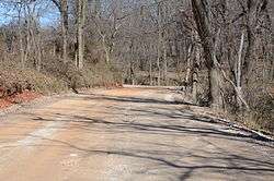
Springfield to Fayetteville Road-Cross Hollow Segment |
|
January 19, 2005
(#04001511) |
County Road 83 through Cross Hollow
36°15′54″N 94°07′03″W / 36.265°N 94.1175°W / 36.265; -94.1175 (Springfield to Fayetteville Road-Cross Hollow Segment) |
Lowell |
|
| 133 |
Springfield to Fayetteville Road-Elkhorn Tavern Segment |
|
May 26, 2005
(#05000484) |
Northwest of Elkhorn Tavern within Pea Ridge National Park
36°28′07″N 94°00′41″W / 36.468611°N 94.011389°W / 36.468611; -94.011389 (Springfield to Fayetteville Road-Elkhorn Tavern Segment) |
Garfield |
|
| 134 |
Stack Barn |
|
January 28, 1988
(#87002353) |
Highway 94S
36°17′38″N 94°02′57″W / 36.293889°N 94.049167°W / 36.293889; -94.049167 (Stack Barn) |
Monte Ne |
|
| 135 |
Stockton Building |
|
January 28, 1988
(#87002432) |
113 N. Broadway
36°11′08″N 94°32′24″W / 36.185556°N 94.54°W / 36.185556; -94.54 (Stockton Building) |
Siloam Springs |
|
| 136 |
Stroud House |
|
May 10, 1996
(#96000527) |
Southeastern corner of the junction of SE. F St. and E. Central Ave.
36°22′18″N 94°12′04″W / 36.371667°N 94.201111°W / 36.371667; -94.201111 (Stroud House) |
Bentonville |
|
| 137 |
Sulphur Springs Old School Complex Historic District |
|
February 16, 2001
(#01000113) |
512 Black St.
36°28′39″N 94°27′41″W / 36.4775°N 94.461389°W / 36.4775; -94.461389 (Sulphur Springs Old School Complex Historic District) |
Sulphur Springs |
|
| 138 |
Sulphur Springs Park Reserve |
|
July 8, 1999
(#99000791) |
Highway 59
36°28′59″N 94°27′21″W / 36.483056°N 94.455833°W / 36.483056; -94.455833 (Sulphur Springs Park Reserve) |
Sulphur Springs |
|
| 139 |
Sutherlin Cabin |
|
January 28, 1988
(#87002344) |
4 N. Mountain
36°26′06″N 94°13′39″W / 36.435°N 94.2275°W / 36.435; -94.2275 (Sutherlin Cabin) |
Bella Vista |
|
| 140 |
Terry Block Building |
|
May 13, 1982
(#82004613) |
101-103 N. Main St.
36°22′21″N 94°12′32″W / 36.3725°N 94.208889°W / 36.3725; -94.208889 (Terry Block Building) |
Bentonville |
|
| 141 |
Thurmond House |
|
January 28, 1988
(#87002430) |
407 Britt
36°10′57″N 94°32′03″W / 36.1825°N 94.534167°W / 36.1825; -94.534167 (Thurmond House) |
Siloam Springs |
|
| 142 |
Van Winkle's Mill Site |
|
November 15, 2007
(#07001175) |
21392 E. Highway 12
36°17′04″N 93°54′20″W / 36.2845°N 93.9056°W / 36.2845; -93.9056 (Van Winkle's Mill Site) |
Rogers |
|
| 143 |
Vinson House |
|
January 28, 1988
(#87002392) |
1016 S. 4th
36°19′28″N 94°07′14″W / 36.324444°N 94.120556°W / 36.324444; -94.120556 (Vinson House) |
Rogers |
|
| 144 |
War Eagle Bridge |
|
November 19, 1985
(#85003497) |
Carries County Road 98 over War Eagle Creek
36°16′02″N 93°56′35″W / 36.267222°N 93.943056°W / 36.267222; -93.943056 (War Eagle Bridge) |
War Eagle |
|
| 145 |
Wasson House |
|
January 28, 1988
(#87002371) |
Main St.
36°15′37″N 94°25′30″W / 36.260278°N 94.425°W / 36.260278; -94.425 (Wasson House) |
Springtown |
|
| 146 |
Wee Pine Knot |
|
January 21, 1999
(#98001632) |
319 Spring St.
36°29′16″N 94°27′42″W / 36.487778°N 94.461667°W / 36.487778; -94.461667 (Wee Pine Knot) |
Sulphur Springs |
|
| 147 |
Wonderland Cave |
|
January 28, 1988
(#87002313) |
Dertmoor Rd.
36°26′08″N 94°13′24″W / 36.435556°N 94.223333°W / 36.435556; -94.223333 (Wonderland Cave) |
Bella Vista |
|
| 148 |
Col. Young House |
|
January 28, 1988
(#87002319) |
1007 SE. 5th St.
36°22′04″N 94°11′51″W / 36.367778°N 94.1975°W / 36.367778; -94.1975 (Col. Young House) |
Bentonville |
|

.JPG)

.jpg)