National Register of Historic Places listings in Crawford County, Arkansas
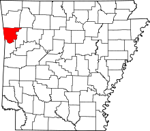
Location of Crawford County in Arkansas
This is a list of the National Register of Historic Places listings in Crawford County, Arkansas.
This is intended to be a complete list of the properties and districts on the National Register of Historic Places in Crawford County, Arkansas, United States. The locations of National Register properties and districts for which the latitude and longitude coordinates are included below, may be seen in a map.[1]
There are 31 properties and districts listed on the National Register in the county. Another five properties were once listed but have been removed.
- This National Park Service list is complete through NPS recent listings posted October 4, 2018.[2]
Current listings


Former listing
| [3] | Name on the Register | Image | Date listed | Date removed | Location | City or town | Summary |
|---|---|---|---|---|---|---|---|
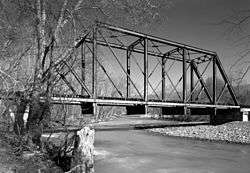
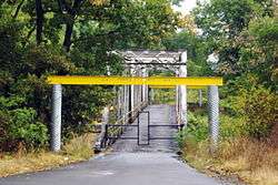
| 1 | Cedar Creek Bridge | May 10, 1995 (#95000649) | September 24, 2004 | AR 348 over Cedar Creek |
Rudy vicinity | ||
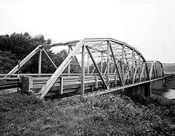
| 2 | Crawford County Road 32D Bridge | May 10, 1995 (#95000650) | September 24, 2004 | County Road 32D over Cove Creek |
Natural Dam vicinity | ||
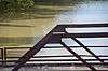
| 3 | Lee Creek Bridge | 1990 (#90000504) | September 24, 2004 | AR 220 |
Cove City vicinity | ||
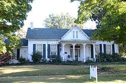
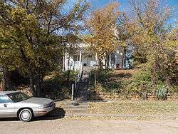
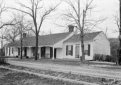
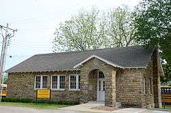
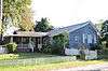
| 4 | Henry Clay Mills House | 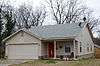 |
December 16, 1977 (#77000250) | January 26, 2018 | 425 N. 15th St. 35°26′30″N 94°20′33″W / 35.441667°N 94.3425°W |
Van Buren | |
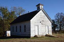
| 5 | Mountainburg High School | 1992 (#92001216) | October 19, 2001 | US 71 |
Mountainburg |
See also
| Wikimedia Commons has media related to National Register of Historic Places in Crawford County, Arkansas. |
References
- ↑ The latitude and longitude information provided in this table was derived originally from the National Register Information System, which has been found to be fairly accurate for about 99% of listings. For about 1% of NRIS original coordinates, experience has shown that one or both coordinates are typos or otherwise extremely far off; some corrections may have been made. A more subtle problem causes many locations to be off by up to 150 yards, depending on location in the country: most NRIS coordinates were derived from tracing out latitude and longitudes from USGS topographical quadrant maps created under the North American Datum of 1927, which differs from the current, highly accurate WGS84 GPS system used by most on-line maps. Chicago is about right, but NRIS longitudes in Washington are higher by about 4.5 seconds, and are lower by about 2.0 seconds in Maine. Latitudes differ by about 1.0 second in Florida. Some locations in this table may have been corrected to current GPS standards.
- ↑ "National Register of Historic Places: Weekly List Actions". National Park Service, United States Department of the Interior. Retrieved on October 4, 2018.
- 1 2 Numbers represent an ordering by significant words. Various colorings, defined here, differentiate National Historic Landmarks and historic districts from other NRHP buildings, structures, sites or objects.
- ↑ National Park Service (2009-03-13). "National Register Information System". National Register of Historic Places. National Park Service.
- ↑ The eight-digit number below each date is the number assigned to each location in the National Register Information System database, which can be viewed by clicking the number.
- ↑ "Trail Of Tears National Historic Trail: National Register Research". National Park Service. Retrieved January 22, 2013.
| Topics | |
|---|---|
| Lists by states |
|
| Lists by insular areas | |
| Lists by associated states | |
| Other areas | |
| |
Municipalities and communities of Crawford County, Arkansas, United States | ||
|---|---|---|
| Cities | | |
| Towns | ||
| Unincorporated communities | ||
| Ghost towns | ||
This article is issued from
Wikipedia.
The text is licensed under Creative Commons - Attribution - Sharealike.
Additional terms may apply for the media files.