| [3] |
Name on the Register[4] |
Image |
Date listed[5] |
Location |
City or town |
Description |
|---|
| 1 |
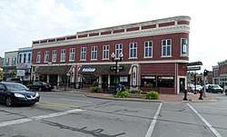
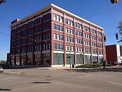
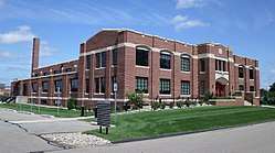
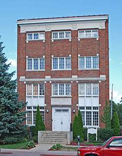
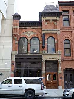
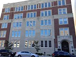
Arbaugh's Department Store Building |
|
July 20, 2007
(#07000748) |
401 S. Washington
42°43′46″N 84°33′07″W / 42.729444°N 84.551944°W / 42.729444; -84.551944 (Arbaugh's Department Store Building) |
Lansing |
|
| 2 |
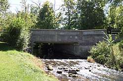
Ash Street-Sycamore Creek Bridge |
|
January 14, 2000
(#99001673) |
M-36 over Sycamore Creek
42°34′45″N 84°26′51″W / 42.579167°N 84.4475°W / 42.579167; -84.4475 (Ash Street-Sycamore Creek Bridge) |
Mason |
|
| 3 |
Brown-Price House |
|
March 22, 1984
(#84001429) |
1003 N. Washington Ave.
42°44′42″N 84°33′09″W / 42.745°N 84.5525°W / 42.745; -84.5525 (Brown-Price House) |
Lansing |
|
| 4 |
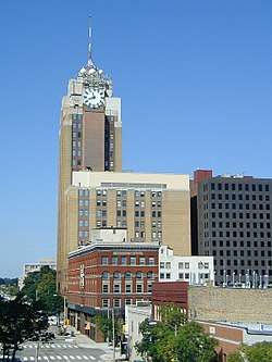
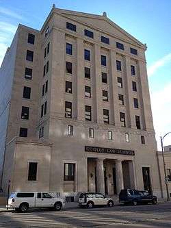
Capital Bank Tower |
|
December 6, 2005
(#05001357) |
124 W. Allegan St.
42°43′58″N 84°33′11″W / 42.732778°N 84.553056°W / 42.732778; -84.553056 (Capital Bank Tower) |
Lansing |
Now known as Boji Tower |
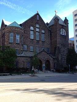
| 5 |
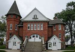
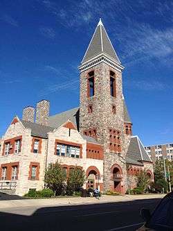
Central Methodist Episcopal Church |
|
September 17, 1980
(#80001864) |
215 N. Capitol Ave.
42°44′06″N 84°33′16″W / 42.735°N 84.554444°W / 42.735; -84.554444 (Central Methodist Episcopal Church) |
Lansing |
|
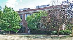
| 6 |
Central School |
|
April 10, 1986
(#86000709) |
325 W. Grand River Ave.
42°44′11″N 84°29′20″W / 42.736389°N 84.488889°W / 42.736389; -84.488889 (Central School) |
East Lansing |
|
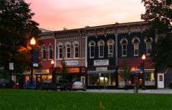
| 7 |
Courthouse Square Historic District |
|
June 6, 1985
(#85001243) |
Bounded by Park, E. Columbia, Rodgers and South
42°34′43″N 84°26′31″W / 42.578611°N 84.441944°W / 42.578611; -84.441944 (Courthouse Square Historic District) |
Mason |
|
| 8 |
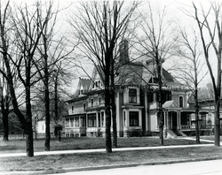
Dodge Mansion |
|
September 14, 1972
(#72000621) |
106 E. North St.
42°45′03″N 84°33′08″W / 42.750833°N 84.552222°W / 42.750833; -84.552222 (Dodge Mansion) |
Lansing |
|
| 9 |
Emery Houses |
|
December 10, 1993
(#93001409) |
320-322 and 326-328 W. Ottawa
42°44′05″N 84°33′25″W / 42.734722°N 84.556944°W / 42.734722; -84.556944 (Emery Houses) |
Lansing |
|
| 10 |
Eustace Hall |
|
September 3, 1971
(#71000395) |
Michigan State University campus
42°43′57″N 84°28′47″W / 42.7325°N 84.479722°W / 42.7325; -84.479722 (Eustace Hall) |
East Lansing |
|
| 11 |
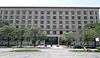
Federal Building |
|
September 17, 1980
(#80001865) |
315 W. Allegan St.
42°43′55″N 84°33′23″W / 42.731944°N 84.556389°W / 42.731944; -84.556389 (Federal Building) |
Lansing |
|
| 12 |
First Baptist Church |
|
September 17, 1980
(#80001866) |
227 N. Capitol Ave.
42°44′08″N 84°33′16″W / 42.735556°N 84.554444°W / 42.735556; -84.554444 (First Baptist Church) |
Lansing |
|
| 13 |
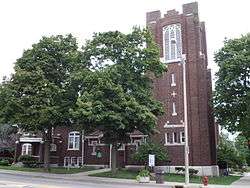
Franklin Avenue Presbyterian Church |
|
May 27, 1988
(#88000564) |
108 W. Grand River Ave.
42°44′53″N 84°33′08″W / 42.748056°N 84.552222°W / 42.748056; -84.552222 (Franklin Avenue Presbyterian Church) |
Lansing |
|
| 14 |
Walter H. French Junior High School |
|
December 30, 2014
(#14001097) |
1900 S. Cedar St.
42°42′40″N 84°32′54″W / 42.7112°N 84.5483°W / 42.7112; -84.5483 (Walter H. French Junior High School) |
Lansing |
|
| 15 |
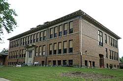
Genesee Street School |
|
April 7, 2014
(#14000124) |
835 W. Genesee St.
42°44′19″N 84°33′49″W / 42.738595°N 84.563609°W / 42.738595; -84.563609 (Genesee Street School) |
Lansing |
|
| 16 |
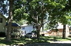
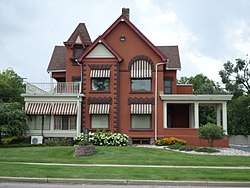
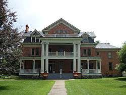
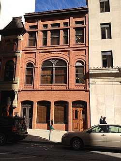
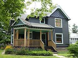
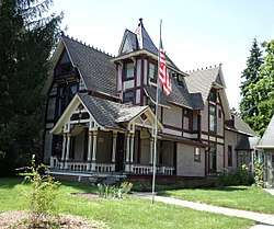
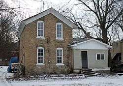
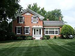
Richard and Deborah (Brough) Glaister House |
|
March 21, 2017
(#100000763) |
402 S. Walnut St.
42°43′47″N 84°33′26″W / 42.729765°N 84.557334°W / 42.729765; -84.557334 (Richard and Deborah (Brough) Glaister House) |
Lansing |
|
| 17 |
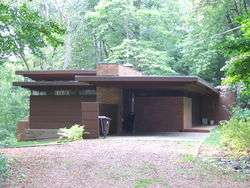
Goetsch-Winckler House |
|
December 13, 1995
(#95001423) |
2410 Hulett Rd., Meridian Township
42°42′29″N 84°26′21″W / 42.708056°N 84.439167°W / 42.708056; -84.439167 (Goetsch-Winckler House) |
Okemos |
|
| 18 |
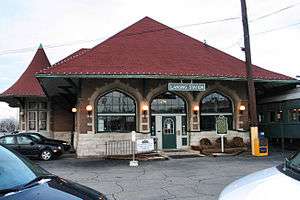
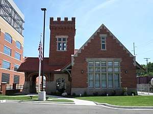
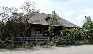
Grand Trunk Western Rail Station/Lansing Depot |
|
July 3, 1980
(#80004605) |
1203 S. Washington Ave.
42°43′10″N 84°33′05″W / 42.719444°N 84.551389°W / 42.719444; -84.551389 (Grand Trunk Western Rail Station/Lansing Depot) |
Lansing |
|
| 19 |
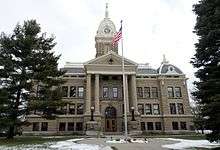
Ingham County Courthouse |
|
December 13, 1971
(#71000397) |
315 S. Jefferson St.
42°34′47″N 84°26′33″W / 42.5797°N 84.4425°W / 42.5797; -84.4425 (Ingham County Courthouse) |
Mason |
|
| 20 |
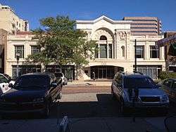
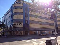
J.W. Knapp Company Building |
|
May 21, 1983
(#83000851) |
300 S. Washington Ave.
42°43′52″N 84°33′10″W / 42.731111°N 84.552778°W / 42.731111; -84.552778 (J.W. Knapp Company Building) |
Lansing |
|
| 21 |
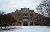
Lansing Artillery Michigan National Guard Armory |
|
December 13, 2010
(#10001025) |
330 Marshall St.
42°44′14″N 84°31′31″W / 42.7373°N 84.5253°W / 42.7373; -84.5253 (Lansing Artillery Michigan National Guard Armory) |
Lansing |
|
| 22 |
Lansing Downtown Historic District |
|
July 22, 2009
(#09000551) |
N. and S. Washington, Grand, N. and S. Capitol, Michigan Ave., Allegan, Washtenaw, Kalamazoo, Lenawee, and Townsend
42°43′53″N 84°33′11″W / 42.731331°N 84.553039°W / 42.731331; -84.553039 (Lansing Downtown Historic District) |
Lansing |
|
| 23 |
Lansing Woman's Club Building |
|
September 17, 1980
(#80001867) |
118 W. Ottawa St.
42°44′05″N 84°33′11″W / 42.734722°N 84.553056°W / 42.734722; -84.553056 (Lansing Woman's Club Building) |
Lansing |
|
| 24 |
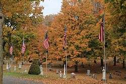
Maple Grove Cemetery |
|
June 6, 1985
(#85001237) |
W. Columbia St.
42°35′03″N 84°26′44″W / 42.584167°N 84.445556°W / 42.584167; -84.445556 (Maple Grove Cemetery) |
Mason |
|
| 25 |
Masonic Temple Building |
|
March 29, 1999
(#98001083) |
314 M.A.C. Ave.
42°44′10″N 84°28′49″W / 42.736111°N 84.480278°W / 42.736111; -84.480278 (Masonic Temple Building) |
East Lansing |
|
| 26 |
Masonic Temple Building |
|
September 17, 1980
(#80001868) |
217 S. Capitol Ave.
42°43′55″N 84°33′12″W / 42.731944°N 84.553333°W / 42.731944; -84.553333 (Masonic Temple Building) |
Lansing |
|
| 27 |
Merrylees-Post House |
|
June 6, 1985
(#85001238) |
519 W. Ash St.
42°34′44″N 84°27′04″W / 42.578889°N 84.451111°W / 42.578889; -84.451111 (Merrylees-Post House) |
Mason |
|
| 28 |
Michigan Central Railroad Mason Depot |
|
June 6, 1985
(#85001239) |
111 N. Mason St.
42°34′58″N 84°26′55″W / 42.582778°N 84.448611°W / 42.582778; -84.448611 (Michigan Central Railroad Mason Depot) |
Mason |
|
| 29 |
Michigan Millers Mutual Fire Insurance Company Building |
|
September 17, 1980
(#80001869) |
120-122 W. Ottawa St.
42°44′05″N 84°33′12″W / 42.734722°N 84.553333°W / 42.734722; -84.553333 (Michigan Millers Mutual Fire Insurance Company Building) |
Lansing |
|
| 30 |
Michigan School for the Blind |
|
July 26, 2018
(#100002714) |
715 W. Willow St.
42°44′54″N 84°33′53″W / 42.7483°N 84.5647°W / 42.7483; -84.5647 (Michigan School for the Blind) |
Lansing |
|
| 31 |
Michigan State Capitol |
|
January 25, 1971
(#71000396) |
Capitol and Michigan Aves.
42°44′01″N 84°33′20″W / 42.733611°N 84.555556°W / 42.733611; -84.555556 (Michigan State Capitol) |
Lansing |
|
| 32 |
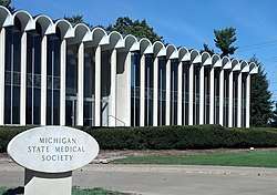
Michigan State Medical Society Building |
|
November 30, 2011
(#11000864) |
120 W. Saginaw St.
42°44′49″N 84°29′05″W / 42.746823°N 84.484606°W / 42.746823; -84.484606 (Michigan State Medical Society Building) |
East Lansing |
|
| 33 |
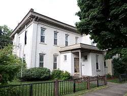
Darius B. Moon House |
|
November 30, 1982
(#82000535) |
216 Huron St.
42°43′56″N 84°34′18″W / 42.7321°N 84.5718°W / 42.7321; -84.5718 (Darius B. Moon House) |
Lansing |
|
| 34 |
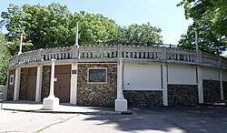
J.H. Moores Memorial Natatorium |
|
January 14, 1985
(#85000096) |
420 Moores River Dr.
42°43′01″N 84°33′23″W / 42.716944°N 84.556389°W / 42.716944; -84.556389 (J.H. Moores Memorial Natatorium) |
Lansing |
|
| 35 |
Mutual Building |
|
September 17, 1980
(#80001870) |
208 N. Capitol Ave.
42°44′07″N 84°33′13″W / 42.735278°N 84.553611°W / 42.735278; -84.553611 (Mutual Building) |
Lansing |
|
| 36 |
Philip Nice House |
|
June 6, 1985
(#85001240) |
321 Center St.
42°34′59″N 84°26′52″W / 42.583056°N 84.447778°W / 42.583056; -84.447778 (Philip Nice House) |
Mason |
|
| 37 |
North Lansing Historic Commercial District |
|
April 30, 1976
(#76001029) |
E. Grand River Ave. and Turner St.
42°44′52″N 84°33′00″W / 42.747778°N 84.55°W / 42.747778; -84.55 (North Lansing Historic Commercial District) |
Lansing |
|
| 38 |
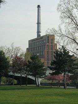
Ottawa Street Power Station |
|
November 26, 2008
(#08001103) |
217 E. Ottawa St.
42°44′05″N 84°33′02″W / 42.734639°N 84.550444°W / 42.734639; -84.550444 (Ottawa Street Power Station) |
Lansing |
|
| 39 |
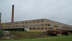
Prudden Wheel Company Building |
|
May 30, 2007
(#07000478) |
707 Prudden St.
42°44′27″N 84°32′33″W / 42.740833°N 84.5425°W / 42.740833; -84.5425 (Prudden Wheel Company Building) |
Lansing |
|
| 40 |
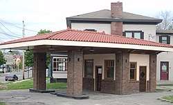
Pulver Brothers Filling Station |
|
August 4, 2016
(#16000507) |
127 W. Grand River Ave.
42°44′50″N 84°33′12″W / 42.747214°N 84.553469°W / 42.747214; -84.553469 (Pulver Brothers Filling Station) |
Lansing |
|
| 41 |
John Raynor House |
|
June 6, 1985
(#85001241) |
725 E. Ash St.
42°34′42″N 84°25′53″W / 42.578333°N 84.431389°W / 42.578333; -84.431389 (John Raynor House) |
Mason |
|
| 42 |
Smith-Turner House |
|
July 11, 1980
(#80004604) |
326 W. Grand River Ave.
42°44′51″N 84°33′24″W / 42.7475°N 84.556667°W / 42.7475; -84.556667 (Smith-Turner House) |
Lansing |
|
| 43 |
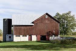
Somerville Barn |
|
March 17, 2005
(#05000152) |
1050 N. College Rd.
42°36′45″N 84°28′59″W / 42.6125°N 84.483056°W / 42.6125; -84.483056 (Somerville Barn) |
Alaiedon Township |
|
| 44 |
St. Katherine's Chapel |
|
July 8, 1970
(#70000272) |
4650 Meridian Rd.,
42°43′07″N 84°21′43″W / 42.718611°N 84.361944°W / 42.718611; -84.361944 (St. Katherine's Chapel) |
Williamstown Township |
|
| 45 |
St. Mary Cathedral |
|
November 2, 1990
(#90001716) |
229 Seymour St.
42°44′08″N 84°33′22″W / 42.735556°N 84.556111°W / 42.735556; -84.556111 (St. Mary Cathedral) |
Lansing |
|
| 46 |
State Office Building |
|
May 17, 1984
(#84001432) |
320 S. Walnut St.
42°43′50″N 84°33′28″W / 42.730556°N 84.557778°W / 42.730556; -84.557778 (State Office Building) |
Lansing |
|
| 47 |
Stockbridge Town Hall |
|
March 10, 1980
(#80001872) |
101 S. Clinton St.
42°27′02″N 84°10′46″W / 42.450556°N 84.179444°W / 42.450556; -84.179444 (Stockbridge Town Hall) |
Stockbridge |
|
| 48 |
Strand Theatre and Arcade |
|
September 17, 1980
(#80001871) |
211-219 S. Washington Ave.
42°43′55″N 84°33′05″W / 42.731944°N 84.551389°W / 42.731944; -84.551389 (Strand Theatre and Arcade) |
Lansing |
|
| 49 |
Union Depot |
|
July 21, 1995
(#95000869) |
637 E. Michigan Ave.
42°44′04″N 84°32′36″W / 42.734444°N 84.543333°W / 42.734444; -84.543333 (Union Depot) |
Lansing |
|
| 50 |
Westside Neighborhood Historic District |
|
June 6, 1985
(#85001242) |
Roughly bounded by W. Maple, W. Ash, Lansing and McRoberts Sts.
42°34′47″N 84°26′56″W / 42.579722°N 84.448889°W / 42.579722; -84.448889 (Westside Neighborhood Historic District) |
Mason |
|
| 51 |
Williamston Downtown Historic District |
|
December 12, 2012
(#12001029) |
1st blks. of E. & W. Grand River Ave. & S. Putnam St.
42°41′21″N 84°17′00″W / 42.68923°N 84.2832°W / 42.68923; -84.2832 (Williamston Downtown Historic District) |
Williamston |
|

_Glaister_House.jpg)

.jpg)
.jpg)
.jpg)