| [2] |
Name on the Register |
Image |
Date listed[3] |
Location |
City or town |
Description |
|---|
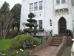
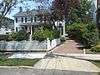
| 1 |
Barkin House |
|
May 18, 2015
(#15000234) |
84 E. Olive St.
40°35′12″N 73°39′49″W / 40.5867753°N 73.6636377°W / 40.5867753; -73.6636377 (Barkin House) |
Long Beach |
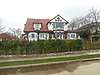
Late 1940s International Style beach house |
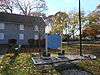
| 2 |
Bellerose Village Municipal Complex |
|
September 28, 2006
(#06000889) |
50 Superior Road and Magee Plaza
40°43′21″N 73°43′01″W / 40.7225°N 73.716944°W / 40.7225; -73.716944 (Bellerose Village Municipal Complex) |
Bellerose |
|
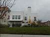
| 3 |
Cobble Villa |
|
January 27, 2015
(#14001214) |
657 Laurelton Blvd
40°35′33″N 73°40′31″W / 40.592585°N 73.6752757°W / 40.592585; -73.6752757 (Cobble Villa) |
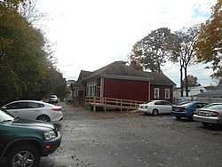
Long Beach |
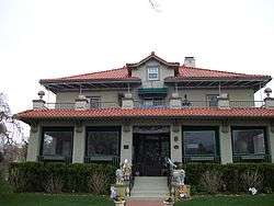
1912 Mediterranean Revival villa is one of the few remaining properties from seaside resort community developed by William H. Reynolds |
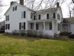
| 4 |
Denton Homestead |
|
November 12, 2014
(#14000913) |
60 Denton Ave.
40°38′33″N 73°39′54″W / 40.642454°N 73.6649957°W / 40.642454; -73.6649957 (Denton Homestead) |
East Rockaway |
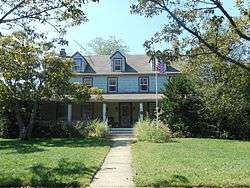
Built Ca 1795 as a tavern, it later become a residence |
| 5 |
Pauline Felix House |
|
February 24, 2005
(#05000090) |
151 West Penn Street
40°35′08″N 73°40′20″W / 40.585556°N 73.672222°W / 40.585556; -73.672222 (Pauline Felix House) |
Long Beach |
|
| 6 |
Granada Towers |
|
May 31, 1984
(#84002750) |
310 Riverside Boulevard
40°35′17″N 73°39′40″W / 40.588056°N 73.661111°W / 40.588056; -73.661111 (Granada Towers) |
Long Beach |
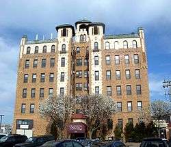
|
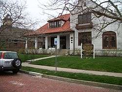
| 7 |
Haviland-Davison Grist Mill |
|
April 21, 1998
(#98000352) |
Jct. of Woods and Denton Avenues
40°38′47″N 73°39′49″W / 40.646389°N 73.663611°W / 40.646389; -73.663611 (Haviland-Davison Grist Mill) |
East Rockaway |
|
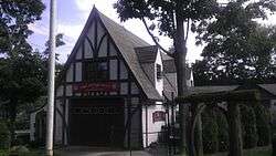
| 8 |
House at 226 West Penn Street |
|
September 24, 2008
(#08000932) |
226 West Penn Street
40°35′07″N 73°40′15″W / 40.585258°N 73.670942°W / 40.585258; -73.670942 (House at 226 West Penn Street) |
Long Beach |
Headquarters for the Long Beach Historical Society. |
| 9 |
House at 251 Rocklyn Avenue |
|
November 7, 2008
(#07001454) |
251 Rocklyn Avenue
40°39′07″N 73°39′54″W / 40.651817°N 73.665092°W / 40.651817; -73.665092 (House at 251 Rocklyn Avenue) |
Lynbrook |
|
| 10 |
House at 474 Ocean Avenue |
|
November 7, 2008
(#07001455) |
474 Ocean Avenue
40°39′15″N 73°39′29″W / 40.654139°N 73.658194°W / 40.654139; -73.658194 (House at 474 Ocean Avenue) |
Lynbrook |
|
| 11 |
House at 73 Grove Street |
|
January 23, 2008
(#07001453) |
73 Grove Street
40°39′54″N 73°40′02″W / 40.665°N 73.667222°W / 40.665; -73.667222 (House at 73 Grove Street) |
Lynbrook |
|
| 12 |
Samuel and Elbert Jackson House |
|
July 14, 2006
(#06000563) |
1542 Wantagh Avenue
40°41′04″N 73°30′39″W / 40.684444°N 73.510833°W / 40.684444; -73.510833 (Samuel and Elbert Jackson House) |
Wantagh |
|
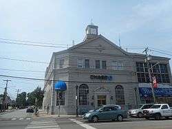
| 13 |
Franklin Square National Bank |
|
November 10, 2015
(#15000776) |
952 Hempstead Turnpike
40°42′27″N 73°40′39″W / 40.7075078°N 73.6774418°W / 40.7075078; -73.6774418 (Franklin Square National Bank) |
Franklin Square |
1926 bank building expanded at midcentury under leadership of Arthur T. Roth, who made many consumer-friendly innovations such as an outdoor teller's window and a bank credit card |
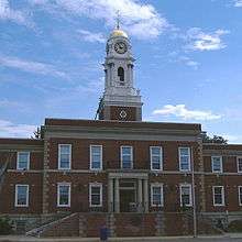
| 14 |
Hempstead Town Hall |
|
May 7, 2018
(#100002384) |
1 Washington St.
40°42′23″N 73°37′12″W / 40.7063°N 73.6201°W / 40.7063; -73.6201 (Hempstead Town Hall) |
Hempstead |
|
| 15 |
Jerusalem District No. 5 Schoolhouse |
|
March 1, 1996
(#96000204) |
Old Jerusalem Road
40°42′08″N 73°30′27″W / 40.702222°N 73.5075°W / 40.702222; -73.5075 (Jerusalem District No. 5 Schoolhouse) |
Levittown |
One room schoolhouse |
| 16 |
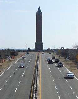
Jones Beach State Park, Causeway and Parkway System |
|
April 28, 2005
(#05000358) |
Ocean, Wantagh, Meadowbrook and Loop State Parkways
40°36′51″N 73°32′10″W / 40.614167°N 73.536111°W / 40.614167; -73.536111 (Jones Beach State Park, Causeway and Parkway System) |
Wantagh |
Early Robert Moses project in late 1920s opened Long Island beaches to public and led to many more Long Island state parks and parkways |
| 17 |
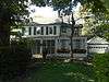
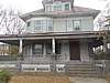
George Sumner Kellogg House |
|
August 18, 2017
(#100001486) |
960 Merrick Rd.
40°39′03″N 73°36′31″W / 40.650855°N 73.608631°W / 40.650855; -73.608631 (George Sumner Kellogg House) |
Baldwin |
|
| 18 |
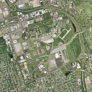
Mitchel Air Base and Flight Line |
|
May 4, 2018
(#100002385) |
Roughly Charles Lindbergh Blvd., Ellington Ave., East & West Rds.
40°43′51″N 73°35′46″W / 40.7309°N 73.5961°W / 40.7309; -73.5961 (Mitchel Air Base and Flight Line) |
Garden City |
One of the first U.S. airbases established in 1918; since decommissioning in 1961 has been redeveloped into part of Nassau Community College campus and Cradle of Aviation Museum |
| 19 |
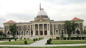
Old Nassau County Courthouse |
|
February 17, 1978
(#78001863) |
1550 Franklin Avenue
40°44′16″N 73°38′24″W / 40.737778°N 73.64°W / 40.737778; -73.64 (Old Nassau County Courthouse) |
Garden City |
|
| 20 |
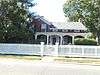
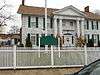
Pagan-Fletcher House |
|
September 8, 1983
(#83001715) |
143 Hendrickson Avenue
40°40′12″N 73°41′52″W / 40.67°N 73.697778°W / 40.67; -73.697778 (Pagan-Fletcher House) |
Valley Stream |
|
| 21 |
Rectory of St. George's Episcopal Church |
|
May 3, 1988
(#88000510) |
217 Peninsula Boulevard
40°42′18″N 73°37′18″W / 40.705°N 73.621667°W / 40.705; -73.621667 (Rectory of St. George's Episcopal Church) |
Hempstead |
|
| 22 |
Rock Hall |
|
November 21, 1976
(#76001230) |
199 Broadway
40°36′32″N 73°44′05″W / 40.608889°N 73.734722°W / 40.608889; -73.734722 (Rock Hall) |
Lawrence |
|
| 23 |
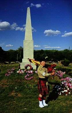
Rockville Cemetery and Bristol and Mexico Monument |
|
November 16, 2015
(#15000801) |
45 Merrick Road
40°39′31″N 73°39′41″W / 40.6587273°N 73.6613503°W / 40.6587273; -73.6613503 (Rockville Cemetery and Bristol and Mexico Monument) |
Lynbrook |
Burial ground started in 1799, for many early Near Rockaway settlers. Monuments to two nearby 1840s shipwrecks mark mass grave of 139 passengers, mostly Irish immigrants. |
| 24 |
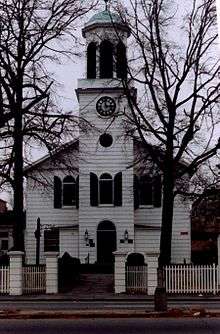
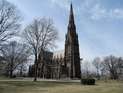
St. George's Church |
|
March 7, 1973
(#73001211) |
319 Front Street
40°42′24″N 73°37′23″W / 40.706667°N 73.623056°W / 40.706667; -73.623056 (St. George's Church) |
Hempstead |
|
| 25 |
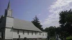
St. Paul's German Presbyterian Church and Cemetery |
|
September 26, 2008
(#08000931) |
525 Elmont Rd.
40°41′48″N 73°42′54″W / 40.6968°N 73.7151°W / 40.6968; -73.7151 (St. Paul's German Presbyterian Church and Cemetery) |
Elmont |
|
| 26 |
A. T. Stewart Era Buildings |
|
November 14, 1978
(#78001864) |
4th, 5th, and 6th Streets, Cathedral and Cherry Valley Avenues
40°43′21″N 73°38′27″W / 40.7225°N 73.640833°W / 40.7225; -73.640833 (A. T. Stewart Era Buildings) |
Garden City |
|
| 27 |
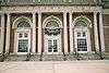
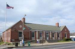
US Post Office-Freeport |
|
May 11, 1989
(#88002517) |
132 West Merrick Road
40°39′13″N 73°35′10″W / 40.653611°N 73.586111°W / 40.653611; -73.586111 (US Post Office-Freeport) |
Freeport |
|
| 28 |
US Post Office-Garden City |
|
May 11, 1989
(#88002521) |
600 Franklin Street
40°43′29″N 73°38′04″W / 40.724722°N 73.634444°W / 40.724722; -73.634444 (US Post Office-Garden City) |
Garden City |
|
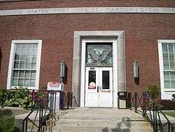
| 29 |
US Post Office-Hempstead |
|
November 17, 1988
(#88002499) |
200 Fulton Avenue
40°42′26″N 73°37′43″W / 40.707222°N 73.628611°W / 40.707222; -73.628611 (US Post Office-Hempstead) |
Hempstead |
|
| 30 |
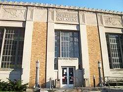
US Post Office-Long Beach |
|
May 11, 1989
(#88002347) |
101 East Park Avenue
40°35′19″N 73°39′39″W / 40.588611°N 73.660833°W / 40.588611; -73.660833 (US Post Office-Long Beach) |
Long Beach |
|
| 31 |
US Post Office-Rockville Centre |
|
May 11, 1989
(#88002425) |
250 Merrick Road
40°39′22″N 73°38′48″W / 40.656111°N 73.646667°W / 40.656111; -73.646667 (US Post Office-Rockville Centre) |
Rockville Centre |
|
| 32 |
Samuel Vaisberg House |
|
October 5, 2005
(#05001137) |
257 West Olive Street
40°35′13″N 73°40′22″W / 40.586944°N 73.672778°W / 40.586944; -73.672778 (Samuel Vaisberg House) |
Long Beach |
|
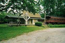
| 33 |
Wantagh Railroad Complex |
|
June 30, 1983
(#83001716) |
1700 Wantagh Avenue
40°40′49″N 73°30′38″W / 40.680278°N 73.510556°W / 40.680278; -73.510556 (Wantagh Railroad Complex) |
Wantagh |
|
.jpg)
.jpg)
.JPG)