Cherokee City, Arkansas
| Cherokee City, Arkansas | |
|---|---|
| Census-designated place | |
 Cherokee City southern limits, February 2013 | |
 Location of Cherokee City in Benton County, Arkansas. | |
 Cherokee City, Arkansas Location of Cherokee City in Benton County, Arkansas. | |
| Coordinates: 36°17′54″N 94°34′40″W / 36.29833°N 94.57778°W | |
| Country | United States |
| State | Arkansas |
| County | Benton |
| Area[1] | |
| • Total | 0.47 sq mi (1.21 km2) |
| • Land | 0.47 sq mi (1.21 km2) |
| • Water | 0.00 sq mi (0.00 km2) |
| Elevation | 1,155 ft (352 m) |
| Population (2010)[2] | |
| • Total | 2,522 |
| • Estimate (2016)[3] | N/A |
| Time zone | UTC-6 (Central (CST)) |
| • Summer (DST) | UTC-5 (CDT) |
| Area code(s) | 479 |
| GNIS feature ID | 76597[4] |
Cherokee City is an unincorporated census-designated place in Benton County, Arkansas, United States. As of the 2010 census, its population is 72.[2] It is the location of (or is the nearest community to) Coon Creek Bridge, which is located on Cty Rd. 24 and is listed on the National Register of Historic Places.[5] The community was named for the Cherokee Indians, since the Trail of Tears crossed the landscape when the Cherokee migrated west to Indian territory, now Oklahoma in the late 1830s. The town is about 5 miles east of Oklahoma and 4 miles south of the Missouri state line.
History
Cherokee City was platted in 1880.[6] A post office called Cherokee City was established in 1871, and remained in operation until 1953.[7]
| Historical population | |||
|---|---|---|---|
| Census | Pop. | %± | |
| U.S. Decennial Census[8] | |||
Education
Public education is available from the Gentry School District that leads to graduation from Gentry High School.
References
- ↑ "2016 U.S. Gazetteer Files". United States Census Bureau. Retrieved Jul 18, 2017.
- 1 2 "American FactFinder". U.S. Census Bureau. Retrieved 26 April 2011.
- ↑ "Population and Housing Unit Estimates". Retrieved June 9, 2017.
- ↑ U.S. Geological Survey Geographic Names Information System: Cherokee City, Arkansas
- ↑ National Park Service (2009-03-13). "National Register Information System". National Register of Historic Places. National Park Service.
- ↑ History of Benton, Washington, Carroll, Madison, Crawford, Franklin, and Sebastian Counties, Arkansas. Higginson Book Company. 1889. p. 104.
- ↑ "Post Offices". Jim Forte Postal History. Retrieved 5 January 2017.
- ↑ "Census of Population and Housing". Census.gov. Retrieved June 4, 2016.
Municipalities and communities of Benton County, Arkansas, United States | ||
|---|---|---|
| Cities | 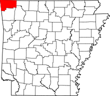 | |
| Towns | ||
| Townships | ||
| CDPs | ||
| Other communities |
| |
| Ghost towns | ||
| Footnotes | ‡This populated place also has portions in an adjacent county or counties | |
Coordinates: 36°17′54″N 94°34′40″W / 36.29833°N 94.57778°W