Accident, Arkansas
| Accident, Arkansas | |
|---|---|
| Unincorporated community | |
 Accident, Arkansas Accident's position in Arkansas  Accident, Arkansas Accident, Arkansas (the US) | |
| Coordinates: 36°13′40″N 94°6′6″W / 36.22778°N 94.10167°WCoordinates: 36°13′40″N 94°6′6″W / 36.22778°N 94.10167°W | |
| Country |
|
| State |
|
| County | Washington |
| Township | 2 |
| Elevation[1] | 421 m (1,381 ft) |
| Time zone | UTC-6 (Central (CST)) |
| • Summer (DST) | UTC-5 (CDT) |
| ZIP code | 72745 |
| Area code(s) | 479 |
| GNIS feature ID | 75359 |
| U.S. Geological Survey Geographic Names Information System: Accident, Arkansas | |
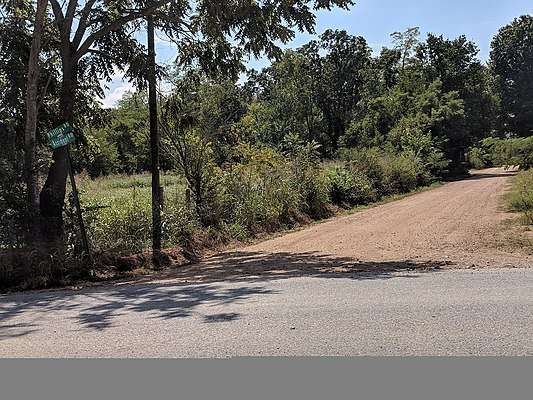
Accident Road, Township 2, Benton County, Arkansas
Accident is an unincorporated community in Township 2, Benton County, Arkansas, United States.[1] It is located near Highway 264 north of Bethel Heights.[2]
References
- 1 2 "Accident, Arkansas". Geographic Names Information System. United States Geological Survey. Retrieved February 24, 2012.
- ↑ Arkansas Atlas and Gazetteer (Map) (Second ed.). DeLorme. § 22.
Municipalities and communities of Benton County, Arkansas, United States | ||
|---|---|---|
| Cities | 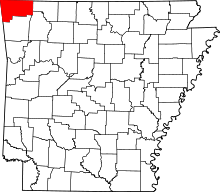 | |
| Towns | ||
| Townships | ||
| CDPs | ||
| Other communities |
| |
| Ghost towns | ||
| Footnotes | ‡This populated place also has portions in an adjacent county or counties | |
This article is issued from
Wikipedia.
The text is licensed under Creative Commons - Attribution - Sharealike.
Additional terms may apply for the media files.