Morningside, Maryland
| Morningside, Maryland | ||
|---|---|---|
| Town | ||
| Town of Morningside | ||
| ||
| Nickname(s): "Gateway to the Nation's Capital" | ||
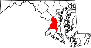
 Location of Morningside, Maryland | ||
| Coordinates: 38°49′32″N 76°53′25″W / 38.82556°N 76.89028°WCoordinates: 38°49′32″N 76°53′25″W / 38.82556°N 76.89028°W | ||
| Country |
| |
| State |
| |
| County |
| |
| Incorporated | 1949[1] | |
| Area[2] | ||
| • Total | 0.56 sq mi (1.45 km2) | |
| • Land | 0.56 sq mi (1.45 km2) | |
| • Water | 0 sq mi (0 km2) | |
| Elevation | 262 ft (80 m) | |
| Population (2010)[3] | ||
| • Total | 2,015 | |
| • Estimate (2016)[4] | 2,046 | |
| • Density | 3,600/sq mi (1,400/km2) | |
| Time zone | UTC-5 (Eastern (EST)) | |
| • Summer (DST) | UTC-4 (EDT) | |
| ZIP code | 20746 | |
| Area code(s) | 301 | |
| FIPS code | 24-53625 | |
| GNIS feature ID | 0597767 | |
| Website | http://www.morningsidemd.gov | |

Morningside is an incorporated town in Prince George's County, Maryland, United States.[5] The population was 2,015 at the 2010 census.[6] The town developed with the establishment of nearby Andrews Air Force Base and the federal Census Bureau. The government of the town is led by a mayor and town council. Morningside Elementary School and Benjamin Foulois Junior High School/Elementary/Creative and Performing Arts Academy (current) as well as Michael J Polley Neighborhood Park are located within the town limits. Morningside has one of the largest Veterans of Foreign Wars posts (chapters) in the entire country. Morningside is also the city of license of one of Washington, D.C.'s most prominent radio stations, from the 1960s to the present, WJFK and WPGC-FM. Additionally, Morningside is home to one of the busiest volunteer fire departments in Prince George's county, Morningside VFD Station 827. In 2015, station 827 ran over 8,000 calls for service with 150 working fires in Morningside and the adjacent communities, and has garnered national recognition for their service to the community.
Geography
Morningside is located at 38°49′32″N 76°53′25″W / 38.82556°N 76.89028°W (38.825563, -76.890219).[7]
According to the United States Census Bureau, the town has a total area of 0.56 square miles (1.45 km2), all of it land.[2]
Bordering areas
- Joint Base Andrews (southeast)
- Forestville (northwest)
- Camp Springs (southwest)
- District Heights (north)
Demographics
| Historical population | |||
|---|---|---|---|
| Census | Pop. | %± | |
| 1950 | 1,520 | — | |
| 1960 | 1,708 | 12.4% | |
| 1970 | 1,659 | −2.9% | |
| 1980 | 1,395 | −15.9% | |
| 1990 | 930 | −33.3% | |
| 2000 | 1,295 | 39.2% | |
| 2010 | 2,015 | 55.6% | |
| Est. 2016 | 2,046 | [4] | 1.5% |
| U.S. Decennial Census[8] | |||
2010 census
As of the census[3] of 2010, there were 2,015 people, 851 households, and 465 families residing in the town. The population density was 3,598.2 inhabitants per square mile (1,389.3/km2). There were 922 housing units at an average density of 1,646.4 per square mile (635.7/km2). The racial makeup of the town was 20.6% White, 67.3% African American, 0.3% Native American, 3.9% Asian, 0.1% Pacific Islander, 4.9% from other races, and 2.8% from two or more races. Hispanic or Latino of any race were 8.6% of the population.
There were 851 households of which 29.4% had children under the age of 18 living with them, 30.3% were married couples living together, 18.6% had a female householder with no husband present, 5.8% had a male householder with no wife present, and 45.4% were non-families. 36.4% of all households were made up of individuals and 4.7% had someone living alone who was 65 years of age or older. The average household size was 2.37 and the average family size was 3.15.
The median age in the town was 34.6 years. 22.2% of residents were under the age of 18; 8.8% were between the ages of 18 and 24; 36.8% were from 25 to 44; 24.6% were from 45 to 64; and 7.7% were 65 years of age or older. The gender makeup of the town was 46.2% male and 53.8% female.
2000 census
As of the census[9] of 2000, there were 1,295 people, 459 households, and 335 families residing in the town. The population density was 2,251.8 people per square mile (862.1/km²). There were 494 housing units at an average density of 859.0 per square mile (328.9/km²). The racial makeup of the town was 42.55% White, 51.27% African American, 0.31% Native American, 2.08% Asian, 0.62% from other races, and 3.17% from two or more races. Hispanic or Latino of any race were 3.09% of the population.
There were 459 households out of which 27.5% had children under the age of 18 living with them, 48.8% were married couples living together, 18.3% had a female householder with no husband present, and 26.8% were non-families. 20.7% of all households were made up of individuals and 9.8% had someone living alone who was 65 years of age or older. The average household size was 2.82 and the average family size was 3.27.
In the town, the population was spread out with 24.9% under the age of 18, 7.3% from 18 to 24, 28.0% from 25 to 44, 27.6% from 45 to 64, and 12.3% who were 65 years of age or older. The median age was 39 years. For every 100 females, there were 93.0 males. For every 100 females age 18 and over, there were 93.1 males.
The median income for a household in the town was $56,429, and the median income for a family was $61,364. Males had a median income of $38,958 versus $35,694 for females. The per capita income for the town was $22,333. About 3.3% of families and 6.4% of the population were below the poverty line, including 9.6% of those under age 18 and 2.7% of those age 65 or over.
Government
Prince George's County Police Department District 4 Station in Glassmanor CDP, with an Oxon Hill postal address, serves the community.[10]
Education
Residents are zoned to Prince George's County Public Schools (PGCPS):[11]
- William Beanes Elementary School[12]
- Drew-Freeman Middle School[13]
- Dr. Henry A. Wise, Jr. High School[14]
It was formerly served by PGCPS Morningside Elementary, which opened in 1956 was in the town limits.[15][11] The school, which had a capacity of 300 students,[15] closed in 2009.[16] At the end of its life it was one of the few PGCPS schools in which significant numbers of students traveled to school on foot.[17] A report made by a non-PGCPS authority generated around 2009 stated that the condition of Morningside Elementary's building was one of the poorest of any school in Prince George's County.[18] By 2011 Imagine Schools was scheduled to open a campus in the former Morningside Elementary,[16] now known as Imagine Foundations at Morningside Public Charter School, which serves grades PK-8.[19]
Notable people
- Gerald Glaubitz, former Mayor[20]
- Bennard J. Cann, Current Mayor
- Kenneth C Wade, Former Mayor
References
- ↑ "Morningside". Maryland Manual. Retrieved 27 June 2017.
- 1 2 "US Gazetteer files 2010". United States Census Bureau. Archived from the original on 2012-01-24. Retrieved 2013-01-25.
- 1 2 "American FactFinder". United States Census Bureau. Retrieved 2013-01-25.
- 1 2 "Population and Housing Unit Estimates". Retrieved June 9, 2017.
- ↑ U.S. Geological Survey Geographic Names Information System: Morningside, Maryland
- ↑ "Profile of General Population and Housing Characteristics: 2010 Demographic Profile Data (DP-1): Morningside town, Maryland". U.S. Census Bureau, American Factfinder. Retrieved December 13, 2011.
- ↑ "US Gazetteer files: 2010, 2000, and 1990". United States Census Bureau. 2011-02-12. Retrieved 2011-04-23.
- ↑ "Census of Population and Housing". Census.gov. Retrieved June 4, 2015.
- ↑ "American FactFinder". United States Census Bureau. Retrieved 2008-01-31.
- ↑ "District 4 Station - Oxon Hill." Prince George's County Police Department. Retrieved on September 9, 2018. " 5135 Indian Head Highway Oxon Hill, MD 20745". Beat map. See 2010 U.S. Census Map of Glassmanor CDP.
- 1 2 "2010 CENSUS - CENSUS BLOCK MAP (INDEX): Morningside town, MD." U.S. Census Bureau. Retrieved on August 29, 2018. Pages: 1 and 2.
- ↑ "NEIGHBORHOOD ELEMENTARY SCHOOLS AND BOUNDARIES SCHOOL YEAR 2018-2019." Prince George's County Public Schools. Retrieved on August 29, 2018.
- ↑ "NEIGHBORHOOD MIDDLE SCHOOLS AND BOUNDARIES SCHOOL YEAR 2018-2019." Prince George's County Public Schools. Retrieved on August 29, 2018.
- ↑ "NEIGHBORHOOD HIGH SCHOOLS AND BOUNDARIES SCHOOL YEAR 2018-2019." Prince George's County Public Schools. Retrieved on August 29, 2018.
- 1 2 "About Our School." Morningside Elemenatary School. Retrieved on August 29, 2018. "6900 Ames Street, Suitland, Maryland 20746" and "Situated in the town of Morningside,[...]"
- 1 2 Waite, Andrew (2011-04-19). "Imagine to take over Queen Anne School in Upper Marlboro". The Gazette. Retrieved 2018-08-29.
- ↑ McKeever, Megan; Joshua Garner (2009-06-25). "Parents, students, staff reflect on consolidations, closures". The Gazette. Retrieved 2018-09-08.
- ↑ "12 Pr. George's Schools Identified for Closing". Washington Post. 2009-01-22. Retrieved 2018-08-29.
- ↑ Home. Imagine Foundations at Morningside Public Charter School. Retrieved on August 29, 2018. "6900 Ames Street Morningside, MD 20746 "
- ↑ https://www.washingtonpost.com/wp-dyn/content/article/2005/04/29/AR2005042901554.html
External links
| Wikimedia Commons has media related to Morningside, Maryland. |
- Official website
- Municipal government in Maryland
- Town of Morningside at the Maryland State Archives
- History of the Town of Morningside
- Who was Benjamin D. Foulois
- Morningside Town Charter
- Town of Morningside at the Wayback Machine (archived July 8, 2001)