Mitchellville, Maryland
| Mitchellville, Maryland | |
|---|---|
| Census-designated place | |
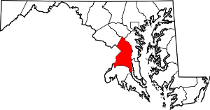
 Location of Mitchellville, Maryland | |
| Coordinates: 38°56′29″N 76°48′49″W / 38.94139°N 76.81361°WCoordinates: 38°56′29″N 76°48′49″W / 38.94139°N 76.81361°W | |
| Country |
|
| State |
|
| County |
|
| Area | |
| • Total | 5.0 sq mi (12.9 km2) |
| • Land | 5.0 sq mi (12.9 km2) |
| • Water | 0.0 sq mi (0.0 km2) |
| Elevation | 105 ft (32 m) |
| Population (2010) | |
| • Total | 10,967 |
| • Density | 2,200/sq mi (850/km2) |
| Time zone | UTC−5 (Eastern (EST)) |
| • Summer (DST) | UTC−4 (EDT) |
| ZIP codes | 20716, 20717, 20721, 20720 |
| Area code(s) | 301 |
| FIPS code | 24-52975 |
| GNIS feature ID | 0597758 |
Mitchellville is an unincorporated area and census-designated place (CDP) in Prince George's County, Maryland, United States.[1] The population was 10,967 at the 2010 census.[2]
Geography
Mitchellville is located at 38°56′29″N 76°48′49″W / 38.941300°N 76.813616°W.[3]
According to the United States Census Bureau, the CDP has a total area of 5.0 square miles (13 km2), all of it land.
Demographics
| Historical population | |||
|---|---|---|---|
| Census | Pop. | %± | |
| 1990 | 12,593 | — | |
| 2000 | 9,611 | −23.7% | |
| 2010 | 10,967 | 14.1% | |
| source:[2][4] | |||
As of the United States Census[5] of 2000, there were 9,611 people, 3,148 households, and 2,556 families residing in the CDP. The population density was 1,930.4 people per square mile (745.1/km²). There were 3,243 housing units at an average density of 651.4/sq mi (251.4/km²). The racial makeup of the CDP was 13.29% White, 78.50% Black, 0.26% Native American, 3.93% Asian, 0.06% Pacific Islander, 0.80% from other races, and 3.15% from two or more races. 2.09% of the population were Hispanic or Latino of any race.
There were 3,148 households out of which 41.1% had children under the age of 18 living with them, 61.8% were married couples living together, 15.3% had a female householder with no husband present, and 18.8% were non-families. 15.2% of all households were made up of individuals and 1.8% had someone living alone who was 65 years of age or older. The average household size was 3.02 and the average family size was 3.34.
In the CDP, the population was spread out with 27.5% under the age of 18, 7.7% from 18 to 24, 28.5% from 25 to 44, 30.1% from 45 to 64, and 6.3% who were 65 years of age or older. The median age was 38 years. For every 100 females, there were 86.9 males. For every 100 females age 18 and over, there were 82.8 males.
The median income for a household in the CDP was $84,687, and the median income for a family was $91,297. Males had a median income of $52,228 versus $46,648 for females. The per capita income for the CDP was $30,801. About 1.9% of families and 2.8% of the population were below the poverty line, including 3.7% of those under age 18 and 7.3% of those age 65 or over.
History
Mitchellville was named for John Mitchell (1788–1862), who owned Essington Hall, the plantation that encompassed much of the area. He and his wife Mary Lanham are buried in the Mitchell Family Cemetery on Mitchellville and Mount Oak Road.[6] This location is now South Bowie, and the Bowie CDP 08775 [7] An 1878 G.M. Hopkins Atlas shows "Mitchellville P.O." near the same corner of what is today Mitchellville and Mount Oak Road. In its original cataloging the name and place "Mitchellville", the USGS used the railroad guide "Mitchellville (Mulliki'n) G. S. Owensville sheet Mitchellville P. G. 614 Mulliken R.'R. Guide, 314." as a basis in its decision card documentation[8] where a Mullikin/Mitchellville railroad stop served also as the post office. This is also seen in other historic maps[9]
As of 2010, the Census designated place ("CDP") Mitchellville is no longer encompassing of the original Mitchellville, location of the old Essington Hall, but is drawn one CDP tract over on the west of the Woodmore CDP.[10]
Economy
When it existed, Crown Books had its headquarters in what was delineated as Mitchellville CDP in the 1990s and was delineated as Lake Arbor CDP in 2000.[12][13][14]
The shopping complex The Boulevard at the Capital Centre formerly occupied an area now known as Lake Arbor.[14][15] The Mitchellville CDP was also home to the former Capital Centre (USAir Arena/US Airways Arena),[16] which was demolished, with the Boulevard at the Capital Centre built on the same site.[17]
Government and infrastructure
Prince George's County Police Department District 2 Station in Brock Hall CDP, with a Bowie postal address, serves the community.[18]
Education
Prince George's County Public Schools serves Mitchellville.[19]
Kingsford, Ardmore, Woodmore, and Lake Arbor elementary schools serve sections of Mitchellville CDP.[20] Most of Mitchellville CDP is served by Ernest Everett Just Middle School while a portion is zoned to Thomas Johnson Middle School.[21] Most of Mitchellville CDP is served by Charles Herbert Flowers High School while a portion is zoned to DuVal High School.[22]
References
- ↑ U.S. Geological Survey Geographic Names Information System: Mitchellville, Maryland
- 1 2 "Profile of General Population and Housing Characteristics: 2010 Demographic Profile Data (DP-1): Mitchellville CDP, Maryland". U.S. Census Bureau, American Factfinder. Retrieved December 23, 2011.
- ↑ "US Gazetteer files: 2010, 2000, and 1990". United States Census Bureau. 2011-02-12. Retrieved 2011-04-23.
- ↑ "CENSUS OF POPULATION AND HOUSING (1790-2000)". U.S. Census Bureau. Retrieved 2010-07-18.
- ↑ "American FactFinder". United States Census Bureau. Retrieved 2008-01-31.
- ↑ Dwyer,, Michael F. "Mitchell Cemetery" (PDF). Inventory Form for State Historic Sites #PG-71B-8. Maryland Historical Trust. Retrieved 16 September 2013.
- ↑ "Bowie CDP". http://www2.census.gov/geo/maps/dc10map/tract/st24_md/c24033_prince_georges/DC10CT_C24033_000.pdf. External link in
|website=(help); Missing or empty|url=(help) - ↑ ""Mitchellville" ID: 597758 search term". http://geonames.usgs.gov/. External link in
|website=(help); Missing or empty|url=(help) - ↑ "G.M. Hopkins Atlas, 1878" (PDF).
- ↑ "CDP Map" (PDF).
- ↑ Woodmore, Maryland
- ↑ Directory of Corporate Affiliations, Volume 5. National Register Pub. Co., 2001. 455. Retrieved on January 18, 2011. "CROWN BOOKS CORPORATION 1601 McCormick Dr. Largo, MD "
- ↑ "1990 COUNTY BLOCK MAP" for Prince George's County (see index map). U.S. Census Bureau. Retrieved on September 9, 2018. Pages showing what is now Lake Arbor as being in Mitchellville are: 18 and 19.
- 1 2 "CENSUS 2000 BLOCK MAP: LAKE ARBOR CDP." U.S. Census Bureau. Retrieved on September 9, 2018.
- ↑ Contact Us." The Boulevard at the Capital Centre. Retrieved on September 9, 2018. "Boulevard at the Capital Centre 900 Capital Centre Boulevard Largo, MD 20774"
- ↑ "NBA Addresses." Boys' Life. Boy Scouts of America, Inc., December 1993. Volume 83, Number 12 ISSN 0006-8608. p. 80. "U.S. Air Arena 1 Harry S. Truman Drive Landover, MD 20785"
- ↑ Bredemeier, Kenneth (2003-06-30). "The Rejuvenation Of Capital Centre". Washington Post. Retrieved 2018-09-09.
And stark gray concrete outlines of modest buildings have replaced the saddle-shaped Capital Centre arena that stood as a monument to graceless utility for nearly three decades before it was imploded last fall. In its place, and scheduled for a Nov. 15 opening, will be the Boulevard at the Capital Centre,[...]
- ↑ "District 2 Station - Bowie." Prince George's County Police Department. Retrieved on September 9, 2018. "District 2 Station - Bowie 601 SW Crain Highway Bowie, MD 20715 ". Beat map. 2010 U.S. Census Bureau index map of Brock Hall CDP as well as the detail on Page 1.
- ↑ "2010 CENSUS - CENSUS BLOCK MAP (INDEX): Mitchellville CDP, MD." U.S. Census Bureau. Retrieved on September 1, 2018. Pages: 1, 2, and 3. Note the CDP was previously larger: "CENSUS 2000 BLOCK MAP: MITCHELLVILLE CDP." The 1990 Prince George's County Map (index map here) shows Mitchellville CDP on pages 14, 15, 18, and 19.
- ↑ "NEIGHBORHOOD ELEMENTARY SCHOOLS AND BOUNDARIES SCHOOL YEAR 2018-2019." Prince George's County Public Schools. Retrieved on September 1, 2018. - Detail of Lake Arbor Elementary Zone (see "Boundary")
- ↑ "NEIGHBORHOOD MIDDLE SCHOOLS AND BOUNDARIES SCHOOL YEAR 2018-2019." Prince George's County Public Schools. Retrieved on September 1, 2018.
- ↑ "NEIGHBORHOOD HIGH SCHOOLS AND BOUNDARIES SCHOOL YEAR 2018-2019." Prince George's County Public Schools. Retrieved on September 1, 2018.