Marlboro Village, Maryland
| Marlboro Village | |
|---|---|
| Census-designated place | |
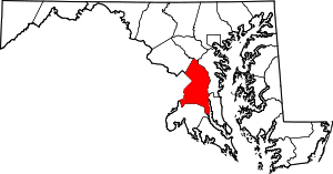
 Marlboro Village Location within the state of Maryland  Marlboro Village Marlboro Village (the US) | |
| Coordinates: 38°49′50″N 76°46′11″W / 38.83056°N 76.76972°WCoordinates: 38°49′50″N 76°46′11″W / 38.83056°N 76.76972°W | |
| Country |
|
| State |
|
| County |
|
| Area | |
| • Total | 10.1 km2 (3.9 sq mi) |
| • Land | 10.0 km2 (3.9 sq mi) |
| • Water | 0.1 km2 (0.04 sq mi) |
| Population (2010) | |
| • Total | 9,438 |
| • Density | 930/km2 (2,400/sq mi) |
| Time zone | UTC−5 (Eastern (EST)) |
| • Summer (DST) | UTC−4 (EDT) |
Marlboro Village is an unincorporated community and census-designated place (CDP) in Prince George's County, Maryland, in the United States. It was newly delineated for the 2010 census, at which time its population was 9,438.[1] Prior to 2010, the area was part of the Greater Upper Marlboro census-designated place.[2]
Geography
According to the U.S. Census Bureau, Marlboro Village has a total area of 3.9 square miles (10.1 km2), of which 3.9 square miles (10.0 km2) is land and 0.04 square miles (0.1 km2), or 1.09%, is water.[3]
Government and infrastructure
Marlboro Village houses the Prince George's County Correctional Center.[4][5]
Education
Prince George's County Public Schools operates public schools serving the census-designated place.[4] Barack Obama and Perrywood elementary schools serve sections of the CDP.[6] James Madison and Kettering middle schools serve sections of the CDP.[7] The zoned high school is Dr. Henry A Wise, Jr. High School.[8]
References
- ↑ "Profile of General Population and Housing Characteristics: 2010 Demographic Profile Data (DP-1): Marlboro Village CDP, Maryland". U.S. Census Bureau, American Factfinder. Retrieved December 20, 2011.
- ↑ "CENSUS 2000 BLOCK MAP: GREATER UPPER MARLBORO CDP." U.S. Census Bureau. Retrieved on August 27, 2018. Pages: 1, 2, 3, and 4. 1990 U.S. Census maps of Prince George's County (index map) show Greater Upper Marlboro on pages: 18, 19, 20, 23, 24, 25, 29, 30, and 31.
- ↑ "Geographic Identifiers: 2010 Demographic Profile Data (G001): Marlboro Village CDP, Maryland". U.S. Census Bureau, American Factfinder. Retrieved December 22, 2011.
- 1 2 "2010 CENSUS - CENSUS BLOCK MAP (INDEX): Marlboro Village CDP, MD." U.S. Census Bureau. Retrieved on August 27, 2018. Pages: 1, 2, and 3.
- ↑ "Corrections Mail." Prince George's County. Retrieved on August 28, 2018. "Prince George’s County Correctional Center 13400 Dille Drive, Upper Marlboro, MD 20772"
- ↑ "NEIGHBORHOOD ELEMENTARY SCHOOLS AND BOUNDARIES SCHOOL YEAR 2018-2019." Prince George's County Public Schools. Retrieved on August 26, 2018.
- ↑ "NEIGHBORHOOD MIDDLE SCHOOLS AND BOUNDARIES SCHOOL YEAR 2018-2019." Prince George's County Public Schools. Retrieved on August 26, 2018.
- ↑ "NEIGHBORHOOD HIGH SCHOOLS AND BOUNDARIES SCHOOL YEAR 2018-2019." Prince George's County Public Schools. Retrieved on August 26, 2018.