Fairwood, Maryland
| Fairwood, Maryland | |
|---|---|
| CDP | |
| Coordinates: 38°57′22″N 76°46′25″W / 38.95611°N 76.77361°WCoordinates: 38°57′22″N 76°46′25″W / 38.95611°N 76.77361°W | |
| Country |
|
| State |
|
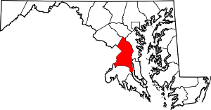
| County |
|
| Area | |
| • Total | 9.7 km2 (3.7 sq mi) |
| • Land | 9.6 km2 (3.7 sq mi) |
| • Water | 0.0 km2 (0.0 sq mi) |
| Elevation | 11 m (36 ft) |
| Population (2010) | |
| • Total | 5,031 |
| • Density | 520/km2 (1,300/sq mi) |
| Time zone | UTC−5 (Eastern (EST)) |
| • Summer (DST) | UTC−4 (EDT) |
Fairwood is an unincorporated area and census-designated place (CDP) in Prince George's County, Maryland, United States. The population was 5,031 at the 2010 census.[1]
Geography
Fairwood is located at 38°57′22″N 76°46′25″W / 38.95611°N 76.77361°W (38.9562, −76.7735). According to the United States Census Bureau, the CDP has a total area of 3.7 square miles (9.6 km2), all of it land.[2]
Education
Fairwood is in the Prince George's County Public School System.[3]
- Elementary school: Woodmore, Glenn Dale, Whitehall, and High Bridge[4]
- Middle school: Thomas Johnson, Samuel Ogle, and Benjamin Tasker[5]
- High school: DuVal High School and Bowie High School[6]
References
- ↑ "Profile of General Population and Housing Characteristics: 2010 Demographic Profile Data (DP-1): Fairwood CDP, Maryland". U.S. Census Bureau, American Factfinder. Archived from the original on September 11, 2013. Retrieved December 19, 2011.
- ↑ "Geographic Identifiers: 2010 Demographic Profile Data (DP-1): Fairwood CDP, Maryland". U.S. Census Bureau, American Factfinder. Archived from the original on September 11, 2013. Retrieved December 19, 2011.
- ↑ "2010 CENSUS - CENSUS BLOCK MAP: Fairwood CDP, MD." U.S. Census Bureau. Retrieved on August 28, 2018.
- ↑ "NEIGHBORHOOD ELEMENTARY SCHOOLS AND BOUNDARIES SCHOOL YEAR 2018-2019." Prince George's County Public Schools. Retrieved on August 26, 2018.
- ↑ "NEIGHBORHOOD MIDDLE SCHOOLS AND BOUNDARIES SCHOOL YEAR 2018-2019." Prince George's County Public Schools. Retrieved on August 26, 2018.
- ↑ "NEIGHBORHOOD HIGH SCHOOLS AND BOUNDARIES SCHOOL YEAR 2018-2019." Prince George's County Public Schools. Retrieved on August 26, 2018.
This article is issued from
Wikipedia.
The text is licensed under Creative Commons - Attribution - Sharealike.
Additional terms may apply for the media files.