Queenland, Maryland
| Queenland, Maryland | |
|---|---|
| Census-designated place | |
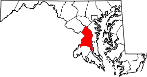
 Queenland, Maryland Location within the state of Maryland  Queenland, Maryland Queenland, Maryland (the US) | |
| Coordinates: 38°48′18″N 76°47′28″W / 38.80500°N 76.79111°WCoordinates: 38°48′18″N 76°47′28″W / 38.80500°N 76.79111°W | |
| Country |
|
| State |
|
| County |
|
| Area | |
| • Total | 4.9 sq mi (12.6 km2) |
| • Land | 4.9 sq mi (12.6 km2) |
| • Water | 0.0 sq mi (0.0 km2) |
| Elevation | 120 ft (40 m) |
| Population (2010) | |
| • Total | 1,929 |
| • Density | 400/sq mi (150/km2) |
| Time zone | UTC−5 (Eastern (EST)) |
| • Summer (DST) | UTC−4 (EDT) |
| Area code(s) | 301 |
Queenland is a census-designated place near Upper Marlboro in Prince George's County, Maryland, in the United States. The population of the CDP was 1,929 at the 2010 census.[1]
Geography
According to the U.S. Census Bureau, Queenland has a total area of 4.9 square miles (12.6 km2), of which 0.012 square miles (0.03 km2), or 0.26%, is water.[2] The CDP is bordered to
north by Maryland Route 4, to the south and east by U.S. Route 301, and to the west by Marlboro Pike and South Osborne Road. The CDPs of Westphalia and Marlboro Village border Queenland to the north, Croom is to the southeast, Marlton is to the south, and Rosaryville is to the southwest.
Education
Prince George's County Public Schools operates public schools serving the census-designated place.[3] Most of the CDP is zoned to Marlton Elementary School, with a section instead zoned to Melwood Elementary School.[4]
Residents are zoned to James Madison Middle School,[5] and Dr. Henry A Wise, Jr. High School.[6]
References
- ↑ "Profile of General Population and Housing Characteristics: 2010 Demographic Profile Data (DP-1): Queenland CDP, Maryland". U.S. Census Bureau, American Factfinder. Archived from the original on September 11, 2013. Retrieved December 23, 2011.
- ↑ "Geographic Identifiers: 2010 Demographic Profile Data (G001): Queenland CDP, Maryland". U.S. Census Bureau, American Factfinder. Archived from the original on September 11, 2013. Retrieved December 16, 2011.
- ↑ "2010 CENSUS - CENSUS BLOCK MAP: Queenland CDP, MD." U.S. Census Bureau. Retrieved on August 28, 2018.
- ↑ "NEIGHBORHOOD ELEMENTARY SCHOOLS AND BOUNDARIES SCHOOL YEAR 2018-2019." Prince George's County Public Schools. Retrieved on August 26, 2018.
- ↑ "NEIGHBORHOOD MIDDLE SCHOOLS AND BOUNDARIES SCHOOL YEAR 2018-2019." Prince George's County Public Schools. Retrieved on August 26, 2018.
- ↑ "NEIGHBORHOOD HIGH SCHOOLS AND BOUNDARIES SCHOOL YEAR 2018-2019." Prince George's County Public Schools. Retrieved on August 26, 2018.