Southwestern Ontario
| Southwestern Ontario | |
|---|---|
| Secondary region | |
 | |
| Coordinates: 43°30′N 81°00′W / 43.500°N 81.000°WCoordinates: 43°30′N 81°00′W / 43.500°N 81.000°W | |
| Country |
|
| Province |
|
| Area | |
| • Total | 36,797.54 km2 (14,207.61 sq mi) |
| Population (2016) | |
| • Total | 2,583,544 |
| • Density | 70/km2 (180/sq mi) |
| Time zone | UTC−5 (EST) |
| • Summer (DST) | UTC−4 (EDT) |
| Postal code prefixes | N |
| Area code(s) | 519, 226, 548, 905, 289, 365 |
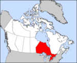
Southwestern Ontario is a secondary region of Southern Ontario in the Canadian province of Ontario. It occupies most of the Ontario Peninsula bounded by Lake Huron, including Georgian Bay, to the north and northwest; the St. Clair River, Lake St. Clair, and Detroit River, to the west; and Lake Erie to the south. To the east, on land, Southwestern Ontario is bounded by Central Ontario and the Golden Horseshoe. The region had a population of 2,583,544 in 2016.
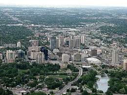
The largest cities in Southwestern Ontario, in order of population (2016), are: London, Kitchener, Windsor, Guelph, Cambridge, Waterloo, Brantford, Sarnia, Stratford, Woodstock, and St. Thomas. Chatham is also a major population centre, but is not an independent municipality and is part of Chatham-Kent. Cities within Southwestern Ontario located on or near the Grand River, such as Kitchener, Guelph, Cambridge, Waterloo and Brantford, are also considered to be part of the Greater Golden Horseshoe region that surrounds western Lake Ontario.
Southwestern Ontario was first settled by Europeans in the early 18th century, when it was part of the Royal Province of New France. One of the oldest continuous settlements in the region is Windsor, which originated as a southerly extension of the settlement of Fort Detroit in 1701. With the transfer of New France to British control in 1763, the region was part of the British Province of Quebec, 1774 to 1791; the Province of Upper Canada, 1791 to 1841; and the Canada West division of the Province of United Canada, 1841 to Confederation in 1867, when United Canada was formally partitioned into the provinces of Ontario and Quebec.
During the 19th century and early 20th century, the largest city in Southwestern Ontario was Windsor; however, as both cities grew, Windsor was outpaced by the faster growth of London, and passed the mantle of regional anchor to that city in the 1960s. Late in the 20th century the Kitchener–Cambridge–Waterloo metropolitan area became the most populous metropolitan area in southwestern Ontario surpassing the London-St. Thomas metropolitan area.
Southwestern Ontario is a prosperous agricultural region whose chief crops are tobacco, sweet corn, soybean, winter wheat, canola, and tomatoes. Dairy and beef farming, breeding and training of standardbred horses and wine growing and production are also important industries. Its climate is among the mildest in Canada. Although brief periods of winter can be severe, summers are hot and humid with a longer growing season than in most of the country.
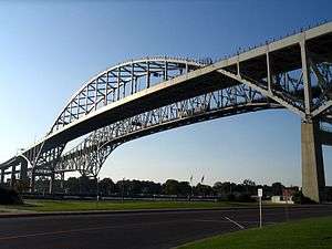
A large section of Southwestern Ontario was part of the Talbot Settlement, and the region has benefited from the settlement’s facilitation of agriculture and of trade in general. Its economy is heavily tied in with that of the midwestern United States, in particular the border state of Michigan. Auto manufacturing and parts, agriculture and hi-tech industries are key components of the region’s economy. The region also provides important transportation routes for commercial trucking, railway and tanker shipping from Detroit-Windsor and Port Huron, Michigan-Sarnia linking Canada with major markets in the eastern and midwestern United States.
Weather and climate
Like other parts of southern Canada, the region brings warm or hot summers with normal thunderstorm occurrences. Some of these storms are severe, with damaging winds, hail and tornadoes all possible during peak season, May through September. The most likely areas for these kinds of weather events is within the Windsor - London corridor and north up to about Huron County. Winters are cold with less snowfall in the south towards Essex County and higher amounts north towards Bruce County. London receives approximately 30% more snowfall than Windsor, owing to its relative position to Lake Huron and the resulting snowbelt in Bruce and Middlesex counties.
Under the Köppen climate classification, much of this area has a humid continental climate (Köppen Dfa/Dfb borderline).
Subdivisions
Single-tier municipalities
Separated municipalities
Regional municipalities
Counties
- Bruce County
- Dufferin County (partially extended)
- Elgin County
- Essex County
- Grey County
- Huron County
- Lambton County
- Middlesex County
- Perth County
- Wellington County
Places adjacent to Southwestern Ontario | |
|---|---|
Province of Ontario | ||
|---|---|---|
| Government |
|  |
| Geography |
| |
| Culture |
| |
| Economy |
| |
| Transportation | ||
| History |
| |
| ||
| Regions | |
|---|---|
| Counties | |
| Districts | |
| Regional municipalities | |
| Single-tier municipalities | |
| Separated municipalities | |
| |