Lipulekh Pass
| Lipu-Lekh Pass | |
|---|---|
  | |
| Elevation | 5,200 m (17,060 ft) |
| Location | Border between Uttarakhand, India and Tibet, China[1] |
| Range | Himalayas |
| Coordinates | 30°14′03″N 81°01′44″E / 30.234080°N 81.028805°ECoordinates: 30°14′03″N 81°01′44″E / 30.234080°N 81.028805°E |
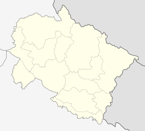
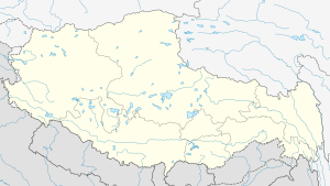
Lipulekh (elevation 5,200 m or 17,060 ft) is a Himalayan pass on the border between Uttarakhand, India and Tibet, China.[1] The southern side of the pass is controlled by India but claimed by Nepal.[2][3] It is near their tripoint with Chinese trading town of Taklakot (Purang) in Tibet. It has been used since ancient times by traders, mendicants and pilgrims transiting between India and Tibet. It is also used by Manasarovar pilgrims.
Nepal regards Limpiyadhura as the source; India claims Lipu Lekh as the source. Nepal has reportedly tabled an 1856 map from the British India Office to support its position.[4] Kalapani has been controlled by India's Indo-Tibetan border security forces since the Sino-Indian War in 1962.[5] Nepal has called for the withdrawal of the Indian border forces from Kalapani area.[6] In 2015, the Nepalese parliament objected the agreement between India and China to trade through Lipu-Lekh stating that 'It violates Nepal's sovereign rights over the disputed territory'.[7] After the Indian prime minister's visit to China in 2015, India and China agreed to open a trading post in Lipulekh, which was not welcomed by Nepal. Nepal now intends to solve the issue via diplomatic means with China and India. Nepal further considered the decision taken by the neighboring nations as a hegemonic step.[8]
Tourism
This pass links the Chaudans valley of India with the Tibet Autonomous Region of China, and forms the last territorial point in Indian territory. The Kailash Mansarovar Yatra, a Hinduism pilgrimage to Mount Kailash and Lake Manasarovar, traverses this pass. Lipulekh pass is connected to Chang Lobochahela, near the old trading town of Purang (Taklakot), in Tibet.
India-China Trading Post
The pass is first Indian border post to be opened for trade with China in 1992. This was followed by the opening of Shipki La, Himachal Pradesh in 1994 and Nathu La, Sikkim in 2006. Presently, Lipulekh pass is open for cross-border trade every year from June through September.
The items cleared for export from India include gur, misri, Tobacco, Spices, pulse, Fafar flour, Coffee, Vegetable oil, ghee and various miscellaneous consumable items, whereas the main imports into India include Sheep Wool, Passam, Sheep, Goats, borax, Yak tails, Chhirbi (butter) and raw Silk.
India-China BPM (Border Personnel Meeting) point
In 2014, India and China discussed using the pass as an additional official Border Personnel Meeting point between the Indian Army and the People's Liberation Army of China for regular consultations and interactions between the two armies to improve relations.[9]
See also
References
- 1 2 Ling, L.H.M.; Abdenur, Adriana Erthal; Banerjee, Payal (19 September 2016). India China: Rethinking Borders and Security. University of Michigan Press. pp. 49–50. ISBN 978-0-472-13006-1.
- ↑ http://admin.myrepublica.com/politics/story/22453/resolve-lipu-lekh-pass-dispute-house-panel-to-govt.html
- ↑ https://kathmandupost.ekantipur.com/ampnews/2015-07-09/lipulekh-dispute-ucpn-m-writes-to-pm-koirala-indian-pm-modi-chinese-prez-xi.html
- ↑ "International Boundary Consultants".
- ↑ "India's Boundary Disputes with China, Nepal, and Pakistan". International Boundary Consultants website. Retrieved 2007-03-23.
- ↑ "Defining Himalayan borders an uphill battle".
- ↑ http://economictimes.indiatimes.com/news/politics-and-nation/nepal-objects-to-india-china-trade-pact-via-lipu-lekh-pass/articleshow/47604908.cms
- ↑ चन्द्रशेखर अधिकारी (2015-06-09). "'लिपुलेकबारे नेपाललाई नसोध्नु दुवै छिमेकीको 'हेपाहा' प्रवृत्ति'". kantipur.ekantipur.com (in Nepali). Retrieved 2017-02-05.
- ↑ "Indian soldiers prevent Chinese troops from constructing road in Arunachal". The Times of India. Oct 28, 2014. Retrieved Nov 11, 2017.