Mintaka Pass
| Mintaka Pass | |
|---|---|
 A Pakistani border marker near Mintaka Pass | |
| Elevation | 4,709 m (15,449 ft) |
| Location | China–Pakistan border |
| Range | Karakorum Mountains |
| Coordinates | 37°00′14″N 74°51′04″E / 37.0039°N 74.8511°ECoordinates: 37°00′14″N 74°51′04″E / 37.0039°N 74.8511°E |
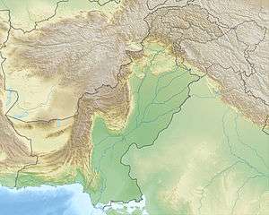 Location in Pakistan 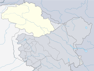 Mintaka Pass (Gilgit Baltistan) 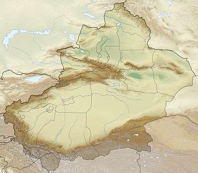 Mintaka Pass (Xinjiang) | |
| Mintaka Pass | |||||||
| Traditional Chinese | 明鐵蓋達坂 | ||||||
|---|---|---|---|---|---|---|---|
| Simplified Chinese | 明铁盖达坂 | ||||||
| |||||||
The Mintaka Pass or Mingteke Pass[1] or Mintika Pass[2](Chinese: 明铁盖达坂[3]) is a mountain pass in the Karakorum Mountains, between Pakistan and Xinjiang in China. In ancient times, the Mintaka Pass and the nearby Kilik Pass, 30 km (19 mi) to the west, were the two main access points into Gojal (Upper Hunza Valley) from the north. The Hunza Valley is the mountainous valley near Gilgit in Gilgit-Baltistan, Pakistan. In addition, the two passes were also the routes used to reach Chalachigu Valley and Taghdumbash Pamir from the south. The name of the pass – Mintaka means "a thousand goats" in Kyrgyz.[4]
History
During ancient times, Mintaka Pass and Kilik Pass were the shortest and quickest ways into Northern India from the Tarim Basin and were usually open all year, but extremely dangerous and only suited for travellers on foot. From Tashkurgan one travelled just over 70 km (43 mi) south to the junction of the Minteke River, modern day Chalachigu River. Heading some 80 km (50 mi) west up this valley one reached the Mintaka Pass, (and 30 km further, the alternative Kilik Pass), which both led into upper Hunza, from where one could travel over the infamous rafiqs or "hanging passages" to Gilgit and, from there, on to either to Kashmir, or the Gandharan plains.[5]
Laden animals could be taken over the Mintaka and Kilik passes into upper Hunza (both open all year), but then loads would have to be carried by coolie (porters) to Gilgit (an expensive and dangerous operation). From there, cargoes could be reloaded onto pack animals again and taken either east to Kashmir and then on to Taxila (a long route), or west to Chitral which provided relatively easy access to either Jalalabad, or Peshawar via Swat.
The Mintaka Pass was the main one used until the fairly recent advance of glacier ice. After the glaciation of the Mintaka Pass, the Kilik Pass was favoured by caravans coming from China and Afghanistan as it is wider, free of glaciers and provided enough pasture for caravan animals.[6]
In 1966, when the Karakoram Highway connecting Pakistan and China was being constructed, Pakistan initially favored routing through Mintaka Pass. However, China citing the fact that Mintaka would be more susceptible to air strikes recommended the steeper Khunjerab Pass instead.[4] Ultimately, the new Karakoram Highway was built further south and west passing over the Khunjerab Pass.
As of late 2010s, on the Pakistani side, there are some trekking companies that offer tours to Mintaka Pass.[2] On the Chinese side, the entire valley around Mintaka Pass is closed to visitors; however, local residents and herders from the area are permitted to access.[7]

.jpg)

See also
Footnotes
- ↑ Dueck, Harold J. (2008-10-01). "Uncommon Providence". Xulon Press. p. 224. Retrieved 2017-02-07.
We were approaching the Mingteke Pass at 15,000 feet above sea level.
- 1 2 Nisar Ali Rozi. "Treks / Kilick". Hunza Adventure Tours. Retrieved 2017-02-07.
- ↑ (in Chinese)

- 1 2 刘欣 (2013-05-03). "重寻玄奘之路" [Rediscover the path taken by Xuanzang] (in Chinese). 东方早报 (Dongfang Daily). Retrieved 2017-02-02.
“明铁盖”在柯尔克孜语中是“一千只公黄羊”的意思...1966年,时任新疆军区副司令员的张希钦在主持修筑中巴公路时,为避敌国空袭,放弃了巴方主张的走宽阔的明铁盖达坂的方案,而取道地势高峻的红其拉甫山口。
- ↑ Hill, John E. (September 2003). "Section 20 The Kingdom of Suoche 莎車 (Yarkand).". The Western Regions according to the Hou Hanshu. University of Washington. Retrieved 2017-02-07.
- ↑ "Historical Kilik and Mintika Pass". www.gojal.net. 2006. Archived from the original on 2014-10-18. Retrieved 2017-02-02.
- ↑ 环球时报 (2009-05-07). "记者组在瓦罕走廊感受中国边防". china.huanqiu.com (in Chinese). Global Times. Retrieved 2017-02-04.
由于瓦罕走廊没有开放旅游,普通游客走到这里便无法继续前行。...据他介绍,该派出所海拔3900米,辖区内户籍75户,约300人,到七八月夏季牧场开放时,山下牧民会到高海拔地区放牧,走廊人口将达到1800人左右。
Mountain passes of China | |||||||||||||||
|---|---|---|---|---|---|---|---|---|---|---|---|---|---|---|---|
| On the border | |||||||||||||||
| In the interior |
| ||||||||||||||
| |||||||||||||||