Nezatash Pass
| Nezatash Pass | |
|---|---|
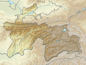 Location in Tajikistan | |
| Elevation | 4,476 m (14,685 ft) |
| Location | China–Tajikistan border |
| Range | Pamir Mountains |
| Coordinates | 37°35′40″N 74°56′07″E / 37.5944°N 74.9353°ECoordinates: 37°35′40″N 74°56′07″E / 37.5944°N 74.9353°E |
| Nezatash Pass | |||||||
| Chinese name | |||||||
|---|---|---|---|---|---|---|---|
| Traditional Chinese | 納茲塔什山口 | ||||||
| Simplified Chinese | 纳兹塔什山口 | ||||||
| |||||||
| Alternative Chinese name | |||||||
| Traditional Chinese | 奈扎塔什山隘 | ||||||
| Simplified Chinese | 奈扎塔什山隘 | ||||||
| |||||||
| Tajik language name | |||||||
| Tajik language | Ағбаи Найзатош | ||||||
The Nezatash Pass or Neza-Tash Pass (Tajik: Ағбаи Найзатош; Aghbai Nayzatosh) is a mountain pass in the Sarikol Range between Gorno-Badakhshan Autonomous Province in Tajikistan and Tashkurgan Tajik Autonomous County in Xinjiang, China. It is situated at an elevation of 4,476 metres (14,685 ft).[1] The name of the path means "spear stone" in Kyrgyz as it is named after a rock near the location.[2]
History
Neztash Pass is a minor path on the Silk Road. During ancient times, it was not a main Silk Road route due to the fact that it took traveler far from settlements, lacked sources of water, and had a relatively higher elevation.[3]
However, during the 19th century, Neztash Pass was frequently used by European explorers passing through the region.[3]
That path sits on the border between China and Tajikstan in the historic region of Badakhshan. In the 1890s, the Chinese, Russian, and Afghan governments signed a series of agreements that divided Badakhshan, but China contested the result of the division. The dispute was eventually settled in 2002 when Tajikistan and China signed a border agreement.[4][1]
See also
References
- 1 2 (in Chinese)

- ↑ Hill, John E. (September 2003). "Section 20 The Kingdom of Suoche 莎車 (Yarkand).". The Western Regions according to the Hou Hanshu. University of Washington. Retrieved 2017-02-07.
Neza Tash, meaning spear-stone, is named from a spear-like pointed rock near the place.
- 1 2 "穿越葱岭丝绸之路:帕米尔高原故道寻踪". Sina Corp (in Chinese). 2014-05-20. Retrieved 2017-02-10.
石头城西的纳兹塔什山口是19世纪欧洲探险家经常走的捷径...但此山口距离主要商路与定居区的喷赤河谷太远,且其间均为高海拔地区,因此它与纳兹塔什山口都不在丝绸之路常规路线上
- ↑ "China's Territorial and Boundary Affairs". Ministry of Foreign Affairs, the People's Republic of China. 2003-06-30. Retrieved 2009-11-27.
Mountain passes of China | |||||||||||||||
|---|---|---|---|---|---|---|---|---|---|---|---|---|---|---|---|
| On the border | |||||||||||||||
| In the interior |
| ||||||||||||||
| |||||||||||||||