Kumagaya, Saitama
| Kumagaya 熊谷市 | |||
|---|---|---|---|
| Special city | |||
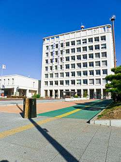 Kumagaya City office | |||
| |||
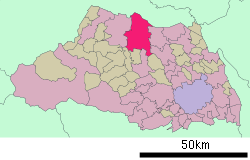 Location of Kumagaya in Saitama Prefecture | |||
 Kumagaya Location of Kumagaya in Saitama Prefecture | |||
| Coordinates: 36°8′50.6″N 139°23′19.1″E / 36.147389°N 139.388639°ECoordinates: 36°8′50.6″N 139°23′19.1″E / 36.147389°N 139.388639°E | |||
| Country | Japan | ||
| Region | Kantō | ||
| Prefecture | Saitama Prefecture | ||
| Government | |||
| • Mayor | Kiyoshi Tomioka | ||
| Area | |||
| • Total | 159.82 km2 (61.71 sq mi) | ||
| Population (February 2016) | |||
| • Total | 198,440 | ||
| • Density | 1,240/km2 (3,200/sq mi) | ||
| Time zone | UTC+9 (Japan Standard Time) | ||
| - Tree | Zelkova serrata | ||
| - Flower | Sakura | ||
| - Bird | Eurasian skylark | ||
| - Fish | Pungitius | ||
| Phone number | 048-524-111 | ||
| Address | 2-47-1 Miya-machi, Kumagaya-shi 360-8601 | ||
| Website | www.city.kumagaya.lg.jp | ||


Kumagaya (熊谷市 Kumagaya-shi) is a city located in Saitama Prefecture, Japan. As of 1 February 2016, the city had an estimated population of 198,440, and a population density of 1240 persons per km². Its total area is 159.82 square kilometres (61.71 sq mi).
Geography
Kumagaya is one of the largest cities in northern Saitama Prefecture. Eight national highways and three railway lines serve the city. While many people commute towards south Tokyo, its daytime population is larger than the night population thanks to commuters from surrounding towns. The city is located on the east edge of Arakawa River alluvial fan, approximately 60 km from central Tokyo and 45 km from Saitama City. The Tone River also flows through city.
Surrounding municipalities
Climate
Kumagaya has a humid subtropical climate (Köppen climate classification Cfa) and is known for being one of the hottest areas in summer in Japan. This is caused by very hot winds from Tokyo and the Chichibu basin in the west of the prefecture. In central Tokyo, the summer monsoon enhanced by sea breeze is heated by the urban heat island. Also, from the Chichibu Mountains, the Fohn blows. The two winds converge above the city at about 2 PM.
On August 16, 2007, the city recorded air temperature of 40.9 °C (105.6 °F), breaking the 74-year record for the highest temperature recorded in Japan. "Very Hot! Kumagaya" (あついぞ!熊谷) is a catch phrase of the city. On July 23, 2018, the national record was broken again with a temperature of 41.1 °C (106.0 °F),[1] surpassing the previous record of 41.0 °C (105.8 °F) recorded in Kōchi Prefecture in August 2013.[2]
There was a large hailstorm on June 29, 1917 at about 5 p.m. The hailstones had a diameter of 29.5 centimeters and weighed 3.4 kilograms.[3]
The Japan Meteorological Agency maintains a local meteorological observatory in Kumagaya.
| Climate data for Kumagaya, Saitama | |||||||||||||
|---|---|---|---|---|---|---|---|---|---|---|---|---|---|
| Month | Jan | Feb | Mar | Apr | May | Jun | Jul | Aug | Sep | Oct | Nov | Dec | Year |
| Average high °C (°F) | 9.1 (48.4) |
9.5 (49.1) |
12.8 (55) |
18.8 (65.8) |
23.5 (74.3) |
25.9 (78.6) |
29.2 (84.6) |
31.4 (88.5) |
26.3 (79.3) |
21.0 (69.8) |
16.2 (61.2) |
11.6 (52.9) |
19.6 (67.3) |
| Daily mean °C (°F) | 3.2 (37.8) |
3.9 (39) |
7.0 (44.6) |
12.9 (55.2) |
17.7 (63.9) |
21.1 (70) |
24.6 (76.3) |
26.2 (79.2) |
21.9 (71.4) |
16.0 (60.8) |
10.6 (51.1) |
5.6 (42.1) |
14.2 (57.6) |
| Average low °C (°F) | −1.8 (28.8) |
−0.9 (30.4) |
2.0 (35.6) |
7.8 (46) |
12.6 (54.7) |
17.3 (63.1) |
21.2 (70.2) |
22.6 (72.7) |
18.5 (65.3) |
11.9 (53.4) |
5.9 (42.6) |
0.6 (33.1) |
9.8 (49.7) |
| Average precipitation mm (inches) | 24.7 (0.972) |
40.8 (1.606) |
57.7 (2.272) |
86.3 (3.398) |
106.6 (4.197) |
169.8 (6.685) |
134.3 (5.287) |
159.2 (6.268) |
185.6 (7.307) |
116.8 (4.598) |
58.4 (2.299) |
27.3 (1.075) |
1,167.5 (45.964) |
| Average snowfall cm (inches) | 5 (2) |
9 (3.5) |
4 (1.6) |
0 (0) |
0 (0) |
0 (0) |
0 (0) |
0 (0) |
0 (0) |
0 (0) |
0 (0) |
0 (0) |
18 (7.1) |
| Average relative humidity (%) | 55 | 56 | 57 | 64 | 68 | 76 | 80 | 77 | 79 | 72 | 66 | 60 | 68 |
| Mean monthly sunshine hours | 206.5 | 179.1 | 197.6 | 175.2 | 193.2 | 123.0 | 129.3 | 170.8 | 116.0 | 149.4 | 162.7 | 195.0 | 1,997.8 |
| Source: NOAA (1961–1990)[4] | |||||||||||||
History
Kumagai-shuku developed as a post town on the Nakasendō highway during the Edo period.
- 1889: The modern town of Kumagaya was created with the establishment of the municipalities system.
- 1923: The village of Koizka (from Osato District) was annexed.
- 1927: The village of Narita (from Kita-Saitama District) was annexed.
- 1932: The village of Oohata (from Osato District) was annexed.
- 1933: Kumagaya was elevated to city status.
- 1941: The village of Sayada (from Osato District) was annexed.
- 1945: Bombing of Kumagaya in World War II
- 1954: The villages of Chujo, Beppu, Nara and Mishiri (all from Osato District) were annexed.
- 1955: The villages of Yoshioka, Ooi and Hoshimiya (all from Osato District) were annexed.
- 1967: 22nd National Sports Festival was held.
- 1973: New City Hall was opened.
- 1986: Central Park was opened.
- 1988: Saitama Exhibition was held.
- 1988: Sports Park was opened.
- 1994: Beppu-marsh Park was opened.
- 2004: 59th National Sports Festival was held.
- 2005: The city of Kumagaya annexed the towns of Ōsato and Menuma (both from Ōsato District)
- 2007: The town of Kōnan (from Ōsato District) was annexed.
Administration
- The city has one city hall and three branch offices.
- Kumagaya City Hall (熊谷市役所)
- Menuma Branch Office (妻沼行政センター)
- Ōsato Branch Office (大里行政センター)
- Kōnan Branch Office (江南行政センター)
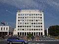 Kumagaya City Hall
 Kumagaya City Hall - Konan branch
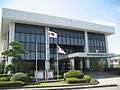 Kumagaya City Hall - Menuma branch
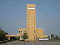 Kumagaya City Hall - Osato branch
Mayors
- Ryosaku Arai (新井良作): April 1933 to May 1939—1st, 2nd
- Moya Saitou (齋籐茂八): June 1936 to April 1942—3rd
- Takeo Yajima (矢島武男): April 1932 to November 1945—4th
- Tadashi Negishi (根岸忠): January 1946 to March 1947—5th
- Souichi Kamode (鴨田宗一): April 1947 to April 1958—6th to 8th
- Seiichi Kurihara (栗原正一): May 1958 to May 1962—9th
- Uminosuke Kuroda (黒田海之助): May 1962 to May 1982—10th to 14th
- Toshio Masuda (増田敏男): May 1982 to June 1986—15th, 16th
- Kazuo Kobayashi (小林一夫): August 1986 to August 2002—17th to 20th
- Kiyoshi Tomioka (富岡清): August 3, 2003 to September 30, 2005—21st
- Fumio Yoshihara (吉原文雄): October 1, 2005 to November 5, 2005—Interim mayor
- Kiyoshi Tomioka (富岡清): November 6, 2005 to present
Education
Universities
- Rissho University—Kumagaya campus
Senior high schools
- Kumagaya Boys' Senior High School (埼玉県立熊谷高等学校)
- Nishi-Kumagaya Senior High School (埼玉県立熊谷西高等学校)
- Kumagaya Girls' Senior High School (埼玉県立熊谷女子高等学校)
- Menuma Senior High School (埼玉県立妻沼高等学校)
- Kumagaya Industrial Senior High School (埼玉県立熊谷工業高等学校)
- Kumagaya Agricultural Senior High School (埼玉県立熊谷農業高等学校)
- Kumagaya Business Senior High School (埼玉県立熊谷商業高等学校)
- Kita-Saitama Nurses' Training School (埼玉県立北高等看護学校)
- Kumagaya Apparel School (学校法人熊谷文化服装専門学校)
Middle schools
- Arakawa Middle School (熊谷市立荒川中学校)
- Ōaso Middle School (熊谷市立大麻生中学校)
- Ōsato Middle School (熊谷市立大里中学校)
- Ōhata Middle School (熊谷市立大幡中学校)
- Ōhara Middle School (熊谷市立大原中学校)
- Higashi-Kumagaya Junior High School (熊谷市立熊谷東中学校)
- Kounan Middle School (熊谷市立江南中学校)
- Kojima Middle School (熊谷市立小島中学校)
- Tamai Middle School (熊谷市立玉井中学校)
- Chūjō Middle School (熊谷市立中条中学校)
- Nara Middle School (熊谷市立奈良中学校)
- Fujimi MIddle School (熊谷市立富士見中学校)
- Beppu Middle School (熊谷市立別府中学校)
- Mishiri Middle School (熊谷市立三尻中学校)
- Nishi-Menuma Middle School (熊谷市立妻沼西中学校)
- Higashi-Menuma Middle School (熊谷市立妻沼東中学校)
- Yoshioka Middle School (熊谷市立吉岡中学校)
Elementary schools
- Ishiwara Elementary School(熊谷市立石原小学校)
- Ōaso Elementary School (熊谷市立大麻生小学校)
- Ōta Elementary School (熊谷市立太田小学校)
- Ōhata Elementary School (熊谷市立大幡小学校)
- Onuma Elementary School (熊谷市立男沼小学校)
- Ichida Elementary School (熊谷市立市田小学校)
- Kagohara Elementary School (熊谷市立籠原小学校)
- Kuge Elementary School (熊谷市立久下小学校)
- Nishi-Kumagaya Elementary School (熊谷市立熊谷西小学校)
- Higashi-Kumagaya Elementary School (熊谷市立熊谷東小学校)
- Minami-Kumagaya Elementary School (熊谷市立熊谷南小学校)
- Kita-Kōnan Elementary School (熊谷市立江南北小学校)
- Minami-Kōnan Elementary School (熊谷市立江南南小学校)
- Kojima Elementary School (熊谷市立小島小学校)
- Sakuragi Elementary School (熊谷市立桜木小学校)
- Sayada Elementary School (熊谷市立佐谷田小学校)
- Tamai Elementary School (熊谷市立玉井小学校)
- Chūjō Elementary School (熊谷市立中条小学校)
- Nara Elementary School (熊谷市立奈良小学校)
- Nagai Elementary School (熊谷市立長井小学校)
- Narita Elementary School (熊谷市立成田小学校)
- Niibori Elementary School (熊谷市立新堀小学校)
- Hata Elementary School (熊谷市立秦小学校)
- Beppu Elementary School (熊谷市立別府小学校)
- Hoshimiya Elementary School (熊谷市立星宮小学校)
- Mishiri Elementary School (熊谷市立三尻小学校)
- Menuma Elementary School (熊谷市立妻沼小学校)
- Minami-Menuma Elementary School (熊谷市立妻沼南小学校)
- Yoshioka Elementary School (熊谷市立吉岡小学校)
- Yoshimi Elementary School (熊谷市立吉見小学校)
Transportation
Railway
Highway
Twin towns and sister cities
Kumagaya is twinned with:
Noted people from Kumagaya
- Kensei Hasegawa, Politician
References
- ↑ https://edition.cnn.com/2018/07/23/asia/japan-heatwave-deadly-intl/index.html
- ↑ "Japan heatwave: Temperature hits new historic record 41.1C, says Japanese weather agency". The Independent. 2018-07-23. Retrieved 2018-07-23.
- ↑ かぼちゃの大きさの雹(ひょう)について (in Japan Meteorological Agency). Retrieved January 14, 2018.
- ↑ "Kumagaya Climate Normals 1961–1990". National Oceanic and Atmospheric Administration. Retrieved December 31, 2012.
- ↑
External links
| Wikimedia Commons has media related to Kumagaya, Saitama. |
- Official Website (in Japanese)
| Wards of Saitama | ||
|---|---|---|
| Core cities | ||
| Special cities | ||
| Cities | ||
| Districts | ||
| Authority control |
|---|