Kuji River (Iwate)
| Kuji River | |
| 久慈川 | |
| River | |
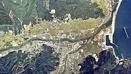 Aerial photograph of Kuji River running through Kuji City (1977) Made based on National Land Image Information (Color Aerial Photographs), Ministry of Land, Infrastructure, Transport and Tourism | |
| Country | Japan |
|---|---|
| State | Honshu |
| Region | Iwate |
| Source | Myojindake (明神岳)[1] |
| Mouth | Kuji Bay, Pacific Ocean[1] |
| - coordinates | 40°12′05″N 141°47′57″E / 40.20146°N 141.79908°ECoordinates: 40°12′05″N 141°47′57″E / 40.20146°N 141.79908°E |
| Length | 27.609[1] km (17 mi) |
.jpg)
Made based on National Land Image Information (Color Aerial Photographs), Ministry of Land, Infrastructure, Transport and Tourism
Kuji River (Japanese:
Kuji Valley (
Kuji Region used to contain characteristic Tatara furnaces, in which a water wheel was utilized to supply the air to the furnace, while in many other regions of the country man-power was utilized. Today some parts of the furnaces remain along a tributary river of Kuji River.[5]
The tributaries consist of Natsui River (夏井川), Nagauchi River (長内川), Sawa River (沢川), Tazawa River (田沢川), Tagonai River (田子内川), Heromachi River (戸呂町川), Hinosawa River (日野沢川), Enbetsu River (遠別川) and Futamata River (二又川).[1]
Taki Dam (滝ダム) is a concrete gravity dam situated on Nagauchi River, which is one of the tributaries. It has the total capacity of 7,600,000 m3 (9,900,000 cu yd) and the height of 70 m (230 ft). Construction of the dam started in 1969 and was completed in 1982.[6]
References
- 1 2 3 4 5 河川大事典 (in Japanese). Nichigai Associates. 1991. p. 340. ISBN 4816910174.
- 1 2 "久慈川(くじがわ)とは - コトバンク" (in Japanese). kotobank. Retrieved 2018-06-18.
- ↑ Shuji Sasaki (2006). "訪問記 名水を訪ねて(75)岩手県の名水". 地下水学会誌 (in Japanese). 48 (4): 297–310. doi:10.5917/jagh1987.48.297.
- ↑ "久慈川". ブリタニカ国際百科事典 小項目電子辞書版 (in Japanese). Britannica Japan Co. Ltd. / Encyclopedia Britannica, Inc. 2010.
- ↑ 岡田広吉 (1978). "岩手県戸呂町小学校所蔵の水車式製鉄法の模型について". 日本鉱業会誌 (in Japanese). 94 (1086): 555–558. doi:10.2473/shigentosozai1953.94.1086_555.
- ↑ "ダム便覧 滝ダム(岩手県)" (in Japanese). Japan Dam Foundation. Retrieved 2018-06-17.
See also
- Sanriku Geopark
| |||||||||||||||||
| |||||||||||||||||
| |||||||||||||||||
| |||||||||||||||||
| |||||||||||||||||