King County, New South Wales

King
New South Wales
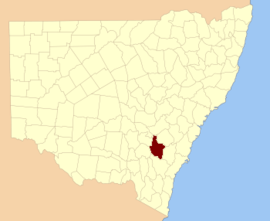
Location in New South Wales
Lands administrative divisions around King:
Forbes Bathurst Georgiana
Monteagle King Argyle
Harden Murray Argyle

King County was one of the original Nineteen Counties in New South Wales and is now one of the 141 Cadastral divisions of New South Wales. It is in the area to the east of Yass. The northern part of it lies between the Lachlan River and the Boorowa River, including the locations of Frogmore, Taylors Flat, Gunnary, Rugby and Rye Park. The Crookwell River is also part of the northern boundary. The Yass River is the southern boundary.

King County was named in honour of Governor Philip Gidley King (1758-1808).[1]

Parishes within this county

A full list of parishes found within this county; their current LGA and mapping coordinates to the approximate centre of each location is as follows:

ParishLGACoordinates
AltonBoorowa Council34°13′54″S 148°51′04″E / 34.23167°S 148.85111°E / -34.23167; 148.85111 (Alton Parish)
BalaBoorowa Council34°18′54″S 148°51′04″E / 34.31500°S 148.85111°E / -34.31500; 148.85111 (Bala Parish)
BangoUpper Lachlan Shire34°43′54″S 148°58′04″E / 34.73167°S 148.96778°E / -34.73167; 148.96778 (Bango Parish)
BarnettBoorowa Council34°19′54″S 148°58′04″E / 34.33167°S 148.96778°E / -34.33167; 148.96778 (Barnett Parish)
BialaUpper Lachlan Shire34°34′54″S 149°13′04″E / 34.58167°S 149.21778°E / -34.58167; 149.21778 (Biala Parish)
BlakneyUpper Lachlan Shire34°39′54″S 148°58′04″E / 34.66500°S 148.96778°E / -34.66500; 148.96778 (Blakney Parish)
BoorowaBoorowa Council34°28′54″S 148°45′04″E / 34.48167°S 148.75111°E / -34.48167; 148.75111 (Boorowa Parish)
BramahBoorowa Council34°15′54″S 149°02′04″E / 34.26500°S 149.03444°E / -34.26500; 149.03444 (Bramah Parish)
BuntonUpper Lachlan Shire34°41′54″S 149°06′04″E / 34.69833°S 149.10111°E / -34.69833; 149.10111 (Bunton Parish)
CrookwellUpper Lachlan Shire34°25′54″S 149°25′04″E / 34.43167°S 149.41778°E / -34.43167; 149.41778 (Crookwell Parish)
CrosbyBoorowa Council34°38′54″S 148°52′04″E / 34.64833°S 148.86778°E / -34.64833; 148.86778 (Crosby Parish)
CullarinUpper Lachlan Shire34°48′54″S 149°21′04″E / 34.81500°S 149.35111°E / -34.81500; 149.35111 (Cullarin Parish)
DaltonUpper Lachlan Shire34°42′54″S 149°12′04″E / 34.71500°S 149.20111°E / -34.71500; 149.20111 (Dalton Parish)
DerringullenYass Valley Council34°42′54″S 148°53′04″E / 34.71500°S 148.88444°E / -34.71500; 148.88444 (Derringullen Parish)
DixonUpper Lachlan Shire34°50′54″S 149°13′04″E / 34.84833°S 149.21778°E / -34.84833; 149.21778 (Dixon Parish)
GarwayUpper Lachlan Shire34°39′54″S 149°15′04″E / 34.66500°S 149.25111°E / -34.66500; 149.25111 (Garway Parish)
Grabben GullenUpper Lachlan Shire34°30′54″S 149°25′04″E / 34.51500°S 149.41778°E / -34.51500; 149.41778 (Grabben Gullen Parish)
GrahamBoorowa Council34°07′54″S 148°55′04″E / 34.13167°S 148.91778°E / -34.13167; 148.91778 (Graham Parish)
GunnaryBoorowa Council34°23′54″S 148°49′04″E / 34.39833°S 148.81778°E / -34.39833; 148.81778 (Gunnary Parish)
GunningUpper Lachlan Shire34°46′54″S 149°16′04″E / 34.78167°S 149.26778°E / -34.78167; 149.26778 (Gunning Parish)
HovellBoorowa Council34°13′54″S 148°57′04″E / 34.23167°S 148.95111°E / -34.23167; 148.95111 (Hovell Parish)
JerraraUpper Lachlan Shire34°28′54″S 149°11′04″E / 34.48167°S 149.18444°E / -34.48167; 149.18444 (Jerrara Parish)
JerrawaUpper Lachlan Shire34°45′54″S 149°05′04″E / 34.76500°S 149.08444°E / -34.76500; 149.08444 (Jerrawa Parish)
KemberBoorowa Council34°01′54″S 148°51′04″E / 34.03167°S 148.85111°E / -34.03167; 148.85111 (Kember Parish)
KenyuBoorowa Council34°07′54″S 148°50′04″E / 34.13167°S 148.83444°E / -34.13167; 148.83444 (Kenyu Parish)
KildareUpper Lachlan Shire34°36′54″S 149°07′04″E / 34.61500°S 149.11778°E / -34.61500; 149.11778 (Kildare Parish)
LamptonUpper Lachlan Shire34°36′54″S 149°21′04″E / 34.61500°S 149.35111°E / -34.61500; 149.35111 (Lampton Parish)
LeridaUpper Lachlan Shire34°52′54″S 149°20′04″E / 34.88167°S 149.33444°E / -34.88167; 149.33444 (Lerida Parish)
MantonYass Valley Council34°49′54″S 148°59′04″E / 34.83167°S 148.98444°E / -34.83167; 148.98444 (Manton Parish)
MerrillUpper Lachlan Shire34°41′54″S 149°20′04″E / 34.69833°S 149.33444°E / -34.69833; 149.33444 (Merrill Parish)
MundoonenUpper Lachlan Shire34°52′54″S 149°08′04″E / 34.88167°S 149.13444°E / -34.88167; 149.13444 (Mundoonen Parish)
NarrawaUpper Lachlan Shire34°21′54″S 149°09′04″E / 34.36500°S 149.15111°E / -34.36500; 149.15111 (Narrawa Parish)
NelangloYass Valley Council34°56′54″S 149°17′04″E / 34.94833°S 149.28444°E / -34.94833; 149.28444 (Nelanglo Parish)
NewhamBoorowa Council34°02′54″S 148°55′04″E / 34.04833°S 148.91778°E / -34.04833; 148.91778 (Newham Parish)
NumbyBoorowa Council34°08′54″S 148°58′04″E / 34.14833°S 148.96778°E / -34.14833; 148.96778 (Numby Parish)
OlneyBoorowa Council34°31′54″S 148°52′04″E / 34.53167°S 148.86778°E / -34.53167; 148.86778 (Olney Parish)
OptonBoorowa Council34°32′54″S 148°57′04″E / 34.54833°S 148.95111°E / -34.54833; 148.95111 (Opton Parish)
PrestonUpper Lachlan Shire34°33′54″S 149°05′04″E / 34.56500°S 149.08444°E / -34.56500; 149.08444 (Preston Parish)
RabnorUpper Lachlan Shire34°28′54″S 149°04′04″E / 34.48167°S 149.06778°E / -34.48167; 149.06778 (Rabnor Parish)
RomnerUpper Lachlan Shire34°21′54″S 149°18′04″E / 34.36500°S 149.30111°E / -34.36500; 149.30111 (Romner Parish)
RugbyBoorowa Council34°25′54″S 149°00′04″E / 34.43167°S 149.00111°E / -34.43167; 149.00111 (Rugby Parish)
TauntonBoorowa Council34°33′54″S 148°45′04″E / 34.56500°S 148.75111°E / -34.56500; 148.75111 (Taunton Parish)
WallahBoorowa Council34°21′54″S 149°03′04″E / 34.36500°S 149.05111°E / -34.36500; 149.05111 (Wallah Parish)
WareBoorowa Council34°25′54″S 148°54′04″E / 34.43167°S 148.90111°E / -34.43167; 148.90111 (Ware Parish)
WheeoUpper Lachlan Shire34°23′54″S 149°13′04″E / 34.39833°S 149.21778°E / -34.39833; 149.21778 (Wheeo Parish)
WinduellaUpper Lachlan Shire34°29′54″S 149°18′04″E / 34.49833°S 149.30111°E / -34.49833; 149.30111 (Winduella Parish)
WyangalaBoorowa Council34°02′54″S 148°59′04″E / 34.04833°S 148.98444°E / -34.04833; 148.98444 (Wyangala Parish)
YassYass Valley Council34°47′54″S 148°54′04″E / 34.79833°S 148.90111°E / -34.79833; 148.90111 (Yass Parish)

References

  1. "King". Geographical Names Register (GNR) of NSW. Geographical Names Board of New South Wales. Retrieved 4 August 2013.
This article is issued from Wikipedia. The text is licensed under Creative Commons - Attribution - Sharealike. Additional terms may apply for the media files.