Ularara County

Ularara
New South Wales
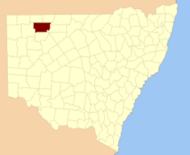
Location in New South Wales
Lands administrative divisions around Ularara:
Delalah Thoulcanna Irrara
Yantara Ularara Barrona
Yantara Fitzgerald Landsborough

Ularara County is one of the 141 Cadastral divisions of New South Wales. It is located to the west of the Paroo River.

The name Ularara is believed to be derived from a local Aboriginal word and is also the name of the local Ularara Station.[1]

Parishes within this county

A full list of parishes found within this county; their current LGA and mapping coordinates to the approximate centre of each location is as follows:

ParishLGACoordinates
AllundyUnincorporated29°53′05″S 143°34′02″E / 29.88472°S 143.56722°E / -29.88472; 143.56722 (Allundy)
BootraUnincorporated30°00′49″S 143°15′03″E / 30.01361°S 143.25083°E / -30.01361; 143.25083 (Bootra)
BuntiaraUnincorporated29°58′45″S 143°47′30″E / 29.97917°S 143.79167°E / -29.97917; 143.79167 (Buntiara)
CroombimbieUnincorporated29°56′19″S 143°14′03″E / 29.93861°S 143.23417°E / -29.93861; 143.23417 (Croombimbie)
DeriringaUnincorporated30°06′37″S 143°34′02″E / 30.11028°S 143.56722°E / -30.11028; 143.56722 (Deriringa)
DundagaUnincorporated29°57′35″S 143°24′02″E / 29.95972°S 143.40056°E / -29.95972; 143.40056 (Dundaga)
HebdenUnincorporated29°43′32″S 143°58′59″E / 29.72556°S 143.98306°E / -29.72556; 143.98306 (Hebden)
IndiUnincorporated29°48′45″S 143°24′00″E / 29.81250°S 143.40000°E / -29.81250; 143.40000 (Indi)
MombaUnincorporated30°02′08″S 144°03′03″E / 30.03556°S 144.05083°E / -30.03556; 144.05083 (Momba)
MorotherieUnincorporated29°40′04″S 143°33′49″E / 29.66778°S 143.56361°E / -29.66778; 143.56361 (Morotherie)
NarumerpyUnincorporated30°02′03″S 143°24′02″E / 30.03417°S 143.40056°E / -30.03417; 143.40056 (Narumerpy)
NeonUnincorporated29°39′46″S 143°56′04″E / 29.66278°S 143.93444°E / -29.66278; 143.93444 (Neon)
NocolecheUnincorporated29°52′17″S 144°06′07″E / 29.87139°S 144.10194°E / -29.87139; 144.10194 (Nocoleche)
NungoUnincorporated30°04′40″S 143°07′23″E / 30.07778°S 143.12306°E / -30.07778; 143.12306 (Nungo)
ParooingeeUnincorporated29°49′30″S 143°46′25″E / 29.82500°S 143.77361°E / -29.82500; 143.77361 (Parooingee)
PekaUnincorporated29°53′04″S 143°58′36″E / 29.88444°S 143.97667°E / -29.88444; 143.97667 (Peka)
PoriruaUnincorporated29°35′53″S 144°05′12″E / 29.59806°S 144.08667°E / -29.59806; 144.08667 (Porirua)
TaltaweiraUnincorporated29°35′30″S 143°23′57″E / 29.59167°S 143.39917°E / -29.59167; 143.39917 (Taltaweira)
TarrabandraUnincorporated29°40′07″S 143°14′06″E / 29.66861°S 143.23500°E / -29.66861; 143.23500 (Tarrabandra)
UrillaUnincorporated29°39′19″S 143°04′07″E / 29.65528°S 143.06861°E / -29.65528; 143.06861 (Urilla)
UrisinoUnincorporated29°41′27″S 143°45′03″E / 29.69083°S 143.75083°E / -29.69083; 143.75083 (Urisino)
WanaaringBourke Shire29°40′45″S 144°07′51″E / 29.67917°S 144.13083°E / -29.67917; 144.13083 (Wanaaring)
WaoonaUnincorporated29°44′20″S 143°14′05″E / 29.73889°S 143.23472°E / -29.73889; 143.23472 (Waoona)
WarrueraUnincorporated29°37′29″S 144°10′43″E / 29.62472°S 144.17861°E / -29.62472; 144.17861 (Warruera)
WillaraUnincorporated29°44′23″S 143°33′50″E / 29.73972°S 143.56389°E / -29.73972; 143.56389 (Willara)
WyarraUnincorporated29°56′16″S 143°06′23″E / 29.93778°S 143.10639°E / -29.93778; 143.10639 (Wyarra)
YailahUnincorporated29°36′44″S 143°45′01″E / 29.61222°S 143.75028°E / -29.61222; 143.75028 (Yailah)
YambunyaUnincorporated29°55′59″S 143°46′28″E / 29.93306°S 143.77444°E / -29.93306; 143.77444 (Yambunya)
YipunyahUnincorporated29°58′47″S 143°59′38″E / 29.97972°S 143.99389°E / -29.97972; 143.99389 (Yipunyah)

References

  1. "Ularara". Geographical Names Register (GNR) of NSW. Geographical Names Board of New South Wales. Retrieved 11 August 2013.
This article is issued from Wikipedia. The text is licensed under Creative Commons - Attribution - Sharealike. Additional terms may apply for the media files.