Shire of Isis
| Shire of Isis Queensland | |||||||||||||||
|---|---|---|---|---|---|---|---|---|---|---|---|---|---|---|---|
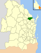 Location within Queensland | |||||||||||||||
| Population | 6,298 (2006 census)[1] | ||||||||||||||
| • Density | 3.6999/km2 (9.5827/sq mi) | ||||||||||||||
| Established | 1887 | ||||||||||||||
| Area | 1,702.2 km2 (657.2 sq mi) | ||||||||||||||
| Council seat | Childers | ||||||||||||||
| Region | Wide Bay–Burnett | ||||||||||||||
|
| |||||||||||||||
| Website | Shire of Isis | ||||||||||||||
| |||||||||||||||
The Shire of Isis was a local government area located in the Wide Bay–Burnett region of Queensland, Australia, to the south of Bundaberg. The Shire, administered from the town of Childers covered an area of 1,702.2 square kilometres (657.2 sq mi), and existed as a local government entity from 1887 until 2008, when it was amalgamated with the City of Bundaberg and the Shires of Burnett and Kolan to form the Bundaberg Region.
History

The Isis Division was established on 1 January 1887 under the Divisional Boards Act 1887, on land previously part of the Burrum Division.
With the passage of the Local Authorities Act 1902, Isis Division became the Shire of Isis on 31 March 1903.[2]
On 15 March 2008, under the Local Government (Reform Implementation) Act 2007 passed by the Parliament of Queensland on 10 August 2007, the Shire of Isis merged with the City of Bundaberg and the Shires of Burnett and Kolan to form the Bundaberg Region.[2][3]
Towns and localities
The Shire of Isis included the following settlements:
- Childers
- Apple Tree Creek
- Booyal
- Buxton
- Cordalba
- Doolbi
- Farnsfield
- Goodwood
- Horton
- Isis Central
- North Isis
- Redridge
- Woodgate
Chairmen
- 1927 - 1930 T. Gaydon [4]
- 1930 - 1939 A. Adie[5]
- 1939 - 1949 E. P. Noakes[5]
- 1949 - 1970 F. E. Eastaughffe[5]
- 1970 - 1988 A.W. Paith[5]
The above dates included multiple terms.
Population
| Year | Population |
|---|---|
| 1933 | 3,778 |
| 1947 | 3,639 |
| 1954 | 4,243 |
| 1961 | 3,951 |
| 1966 | 3,718 |
| 1971 | 3,666 |
| 1976 | 3,926 |
| 1981 | 4,023 |
| 1986 | 4,082 |
| 1991 | 4,825 |
| 1996 | 5,878 |
| 2001 | 6,045 |
| 2006 | 6,663 |
References
- ↑ Australian Bureau of Statistics (25 October 2007). "Isis (S) (Local Government Area)". 2006 Census QuickStats. Retrieved 14 June 2011.
- 1 2 "Agency ID1000, Isis Shire Council". Queensland State Archives. Retrieved 12 September 2013.
- ↑ "Agency ID11037, Bundaberg Region Council". Queensland State Archives. Retrieved 25 September 2013.
- ↑ Pugh, Theophilus Parsons (1927). Pugh's Almanac for 1927. Retrieved 13 June 2014.
- 1 2 3 4 O'Neill, B.W. (1987). Taming the Isis. Childers: Isis Shire Council. pp. 288–294.
External links
Coordinates: 25°14′16.4″S 152°16′37.2″E / 25.237889°S 152.277000°E