Simpson, Saskatchewan
| Simpson | |
|---|---|
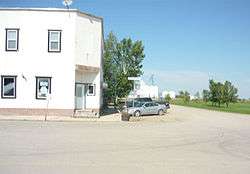 Railway Avenue | |
 Simpson | |
| Coordinates: 51°27′N 105°27′W / 51.450°N 105.450°WCoordinates: 51°27′N 105°27′W / 51.450°N 105.450°W | |
| Country |
|
| Province |
|
| Rural Municipalities (R.M.) | Wood Creek No. 281 |
| Post office Founded | 1911-04-01 |
| Area | |
| • Total | 1.41 km2 (0.54 sq mi) |
| Population (2016) | |
| • Total | 127[1] |
| • Density | 89.8/km2 (233/sq mi) |
| Time zone | UTC-6 (CST) |
| Website | Simpson |
| [2][3][4][5] | |
Simpson is a village in Saskatchewan, Canada between Regina and Saskatoon on Highway 2. Wood Creek No. 281 is the rural municipality which has its offices in the village. The post office was founded in 1911 by Herman Bergren and Joseph Newman during construction of the Canadian Pacific Railway. It is named after George Simpson, a governor of the Hudson's Bay Company.[6]
History
The early 1904 pioneer homestead settlers were George, John and Robert Simpson, Bill Grieve, William Cole, and E.C. Howie.
Geography
- Last Mountain Lake Sanctuary is a nearby tourist attraction. This is North America's oldest sanctuary for birds. Last Mountain Lake National Wildlife Area, Last Mountain Lake Wildlife Management Unit, and Last Mountain Regional Park are all conservation areas near Simpson on Long Lake or Last Mountain Lake.[7]
- Manitou Beach, located on a salt water lake - the land of healing waters - and the historic Danceland dance hall are located near to Simpson at Watrous. This is also a major tourist attraction for the area.[8]
Sites of interest
The previous Wood Creek No. 281 Rural Municipality Office was designated on April 5, 1982 as a municipal heritage site and now houses the Simpson district museum.[9]
Demographics
| Canada census – Simpson, Saskatchewan community profile | |||
|---|---|---|---|
| 2006 | |||
| Population: | 118 (-39.2% from 2001) | ||
| Land area: | 1.41 km2 (0.54 sq mi) | ||
| Population density: | 83.5/km2 (216/sq mi) | ||
| Median age: | N/A (M: N/A, F: N/A) | ||
| Total private dwellings: | 81 | ||
| Median household income: | $N/A | ||
| References: 2006[10] earlier[11] | |||
Area statistics
- Dominion Land Survey Section 3, Township 29, Range 25 West of the 2nd Meridian
Location
See also
References
- ↑ "Census Profile". 2016 Census. Statistics Canada.
- ↑ National Archives, Archivia Net, Post Offices and Postmasters, archived from the original on 2006-10-06
- ↑ Government of Saskatchewan, MRD Home, Municipal Directory System, archived from the original (– Scholar search) on November 21, 2008
- ↑ Canadian Textiles Institute. (2005), CTI Determine your provincial constituency, archived from the original on 2007-09-11
- ↑ Commissioner of Canada Elections, Chief Electoral Officer of Canada (2005), Elections Canada On-line, archived from the original on 2007-04-21
- ↑ Barry, Bill (2003), People Places: Contemporary Saskatchewan Placenames, Regina, Canada: Print West communications, p. 230, ISBN 1-894022-92-0
- ↑ Government of Canada, Natural Resources Canada, Geographical Names of Canada GeoNames Query, retrieved 2007-06-24
- ↑ Manitou Beach Online, archived from the original on 2007-09-29, retrieved 2007-06-24
- ↑ Culture Youth and Recreation, Heritage Properties Search (– Scholar search), retrieved 2007-06-24
- ↑ "2006 Community Profiles". Canada 2006 Census. Statistics Canada. March 30, 2011. Retrieved 2009-02-24.
- ↑ "2001 Community Profiles". Canada 2001 Census. Statistics Canada. February 17, 2012.
- ↑ Becquet's Custom Programming (August 17, 2005), Saskatchewan City & Town Maps - Directory, archived from the original (– Scholar search) on February 7, 2008, retrieved 2007-06-24
Published works
- Simpson and Imperial year book 1980.
External links
- Saskatchewan Gen Web - One Room School Project
- Post Offices and Postmasters - ArchiviaNet - Library and Archives Canada
- Saskatchewan Gen Web Region
- Online Historical Map Digitization Project
- GeoNames Query
- 2006 Community Profiles
| Subdivisions | |
|---|---|
| Communities | |
| Cities | |
| Topics |
|
| |
This article is issued from
Wikipedia.
The text is licensed under Creative Commons - Attribution - Sharealike.
Additional terms may apply for the media files.