Honda Fault
| Honda Fault | |
|---|---|
| Falla de Honda | |
 | |
| Etymology | Honda |
| Country |
|
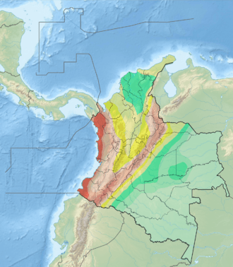
| Region | Andean |
| State | Caldas, Cundinamarca, Tolima |
| Cities | Honda |
| Characteristics | |
| Range | Middle Magdalena Valley |
| Part of | Andean oblique faults |
| Length | 187.3 km (116.4 mi) |
| Strike | 016.6 ± 12 |
| Dip | East |
| Dip angle | unknown |
| Displacement | <1 mm (0.039 in)/yr |
| Tectonics | |
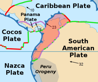
| Plate | North Andean |
| Status | Inactive |
| Type | Oblique strike-slip fault |
| Movement | Reverse sinistral |
| Rock units | Honda Group, Mesa Formation |
| Age | Quaternary |
| Orogeny | Andean |
The Honda Fault (Spanish: Falla de Honda is a reverse sinistral oblique strike-slip fault in the departments of Tolima, Caldas and Cundinamarca in central Colombia. The fault has a total length of 187.3 kilometres (116.4 mi) and runs along an average north-northeast to south-southwest strike of 016.6 ± 12 in the Middle Magdalena Valley.
Etymology
Description
The Honda Fault extends through the Middle Magdalena Valley, close to the Magdalena River and the cities of Ambalema, Honda, and La Dorada. It offsets beds of the Miocene Honda Group, Pliocene Mesa Formation, and Quaternary sediment in alluvial terraces. The fault trace is characterised by continuous prominent scarps, aligned drainages, fault saddles, linear ridges and valleys, sag ponds, degraded scarps, and localized uplifts. The southern half of the fault has a very low to low slip rate (less than 0.2 millimetres (0.0079 in) per year), while the northern half is low to medium at 0.2 to 1 millimetre (0.0079 to 0.0394 in) per year.[1]
See also
References
Bibliography
- Paris, Gabriel; Michael N. Machette; Richard L. Dart, and Kathleen M. Haller. 2000a. Map and Database of Quaternary Faults and Folds in Colombia and its Offshore Regions, 1–66. USGS. Accessed 2017-09-18.
Maps
- Paris, Gabriel; Michael N. Machette; Richard L. Dart, and Kathleen M. Haller. 2000b. Map of Quaternary Faults and Folds of Colombia and Its Offshore Regions, 1. USGS. Accessed 2017-09-18.