Santa Rita Fault
| Santa Rita Fault | |
|---|---|
| Falla de Santa Rita | |
 | |
| Etymology | Santa Rita de Ituango |
| Country |
|
| Region | Andean |
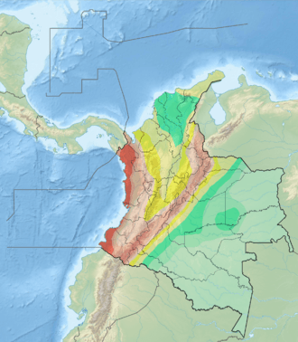
| State | Antioquia |
| Characteristics | |
| Range | Central Ranges, Andes |
| Part of | Andean strike-slip faults |
| Length | 81.0 km (50.3 mi) |
| Strike | 010.6 ± 6 |
| Dip | East |
| Dip angle | High |
| Displacement | ~0.01–0.1 mm (0.00039–0.00394 in)/yr |
| Tectonics | |
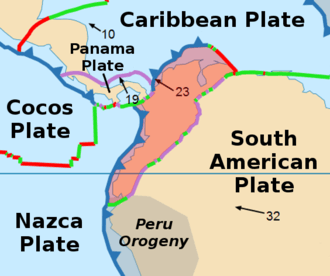
| Plate | North Andean |
| Status | Active? |
| Earthquakes | Possibly historic |
| Type | Strike-slip fault |
| Movement | Sinistral |
| Age | Quaternary |
| Orogeny | Andean |
The Santa Rita Fault (Spanish: Falla de Santa Rita) is a strike-slip fault in the department of Antioquia in northern Colombia. The fault has a total length of 81.0 kilometres (50.3 mi) and runs along an average north to south strike of 010.6 ± 6 in the Central Ranges of the Colombian Andes.
Etymology
The fault is named after Santa Rita de Ituango.[1]
Description
The Santa Rita Fault displaces metamorphosed volcanic and sedimentary rocks through most of its length; in the northern part, the fault places Cretaceous basic volcanic rocks against Tertiary and Quaternary sedimentary rocks. To the south, the Santa Rita Fault intercepts the Espíritu Santo Fault. The fault has a well-defined fault trace seen on satellite images. The trace is characterized by linear valleys, strong breaks in slope, offset alluvial fans and colluvial deposits, and local subsidence of the soil. The Santa Rita Fault might be the source of a historic magnitude 4.8 earthquake.[2]
See also
References
Bibliography
- Paris, Gabriel; Michael N. Machette; Richard L. Dart, and Kathleen M. Haller. 2000a. Map and Database of Quaternary Faults and Folds in Colombia and its Offshore Regions, 1–66. USGS. Accessed 2017-09-18.
Maps
- Paris, Gabriel; Michael N. Machette; Richard L. Dart, and Kathleen M. Haller. 2000b. Map of Quaternary Faults and Folds of Colombia and Its Offshore Regions, 1. USGS. Accessed 2017-09-18.
Further reading
- Page, W.D. 1986. Seismic geology and seismicity of Northwestern Colombia, 1–200. San Francisco, California, Woodward-Clyde Consultants Report for ISA and Integral Ltda., Medellín.