Murrí Fault
| Murrí Fault | |
|---|---|
| Falla Murrí | |
 | |
| Etymology | Murrí River |
| Country |
|
| Region | Andean |
| State | Antioquia |
| Characteristics | |
| Range | Central Ranges, Andes |
| Part of | Andean oblique faults |
| Length | 87.1 km (54.1 mi) |
| Strike | 001.4 ± 5 |
| Dip | unknown |
| Dip angle | unknown |
| Displacement | 0.2–1 mm (0.0079–0.0394 in)/yr |
| Tectonics | |
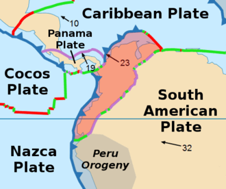
| Plate | North Andean |
| Status | Inactive |
| Type | Oblique thrust fault |
| Movement | Reverse sinistral |
| Age | Quaternary |
| Orogeny | Andean |
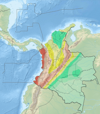
The Murrí Fault (Spanish: Falla Murrí) is an oblique thrust fault in the department of Antioquia in northwestern Colombia. The fault has a total length of 87.1 kilometres (54.1 mi) and runs along an average north-south strike of 001.4 ± 5 along the Central Ranges of the Colombian Andes.
Etymology
The fault is named after the Murrí River in Antioquia.[1]
Description
Located in the western limb of the Western Ranges of the Colombian Andes. The fault puts Cretaceous mafic igneous rocks to the east in contact with Tertiary marine sedimentary rocks to the west. The fault cuts mud flows dated at about 10,000 to 15,000 years. It causes strong lineaments and offsets terraces and alluvial deposits. The fault forms well-developed scarps of about 20 metres (66 ft) high on late Quaternary alluvial deposits.[1]
The fault forms the course of the Penderisco River and cuts perpendicular to the Ocaidó Valley.[2] Some authors consider the fault the southern part of the Murrí-Mutatá Fault.[3][4]
See also
References
Bibliography
- González, Humberto. 2001. Mapa Geológico del Departamento de Antioquia - 1:400,000 - Memoria explicativa, 1–120. INGEOMINAS.
- Paris, Gabriel; Michael N. Machette; Richard L. Dart, and Kathleen M. Haller. 2000a. Map and Database of Quaternary Faults and Folds in Colombia and its Offshore Regions, 1–66. USGS. Accessed 2017-09-18.
Maps
- Paris, Gabriel; Michael N. Machette; Richard L. Dart, and Kathleen M. Haller. 2000b. Map of Quaternary Faults and Folds of Colombia and Its Offshore Regions, 1. USGS. Accessed 2017-09-18.
- Londoño, Ana Cristina, and Humberto González. 2002. Plancha 129 - Cañasgordas - 1:100,000, 1. INGEOMINAS. Accessed 2017-06-06.
- González, Humberto. 2002. Plancha 145 - Urrao - 1:100,000, 1. INGEOMINAS. Accessed 2017-06-06.
Further reading
- Page, W.D. 1986. Seismic geology and seismicity of Northwestern Colombia, 1–200. San Francisco, California, Woodward-Clyde Consultants Report for ISA and Integral Ltda., Medellín.