Greenville, Wisconsin
| Town of Greenville, Wisconsin | |
|---|---|
| Town | |
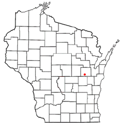 Location of Greenville within Wisconsin | |
| Country | United States |
| State | Wisconsin |
| Counties | Outagamie |
| Surrounding Towns | Clayton, Dale, Ellington, Grand Chute, Hortonia, Menasha |
| Settled | 1848 |
| Government | |
| • Type | Civil township |
| • Chairman | Jack Anderson |
| Area | |
| • Total | 35.8 sq mi (93 km2) |
| • Land | 35.8 sq mi (93 km2) |
| • Water | 0.04 sq mi (0.1 km2) 0.06% |
| Elevation | 827 ft (252 m) |
| Population (2010) | |
| • Total | 10,309 |
| • Density | 191.2/sq mi (73.8/km2) |
| Time zone | UTC-6 (CST) |
| • Summer (DST) | UTC-5 (CDT) |
| ZIP Code | 54913, 54915, 54942, 54944 |
| Area code(s) | 274 & 920 |
| FIPS code | 55-31550[1] |
| GNIS feature ID | 1583322[2] |
| Website | www.townofgreenville.com |
Greenville is a town in south central Outagamie County, Wisconsin, United States. It is one of 18 communities that form the basis of the Fox Cities, the third largest metropolitan area in Wisconsin. The population was 10,309 at the 2010 census.[1] The unincorporated community of Greenville and the ghost town of Wakefield are located in the town.
Geography
According to the United States Census Bureau, the town has a total area of 35.8 square miles (92.7 km²), of which, 35.8 square miles (92.7 km²) of it is land and 0.04 square miles (0.1 km²) of it (0.06%) is water.
Demographics
Greenville is a part of the Appleton, Wisconsin Metropolitan Statistical Area and the Appleton-Oshkosh-Neenah, Wisconsin Combined Statistical Area.
As of the census[1] of 2000, there were 6,844 people, 2,301 households, and 1,937 families residing in the town. The population density was 191.2 people per square mile (73.8/km²). There were 2,353 housing units at an average density of 65.7 per square mile (25.4/km²). The racial makeup of the town was 98.25% White, 0.22% African American, 0.29% Native American, 0.20% Asian, 0.07% Pacific Islander, 0.39% from other races, and 0.57% from two or more races. Hispanic or Latino of any race were 1.59% of the population.
There were 2,301 households out of which 48.4% had children under the age of 18 living with them, 75.4% were married couples living together, 5.6% had a female householder with no husband present, and 15.8% were non-families. 11.9% of all households were made up of individuals and 2.7% had someone living alone who was 65 years of age or older. The average household size was 2.97 and the average family size was 3.24.
In the town, the population was spread out with 32.5% under the age of 18, 5.2% from 18 to 24, 36.2% from 25 to 44, 20.9% from 45 to 64, and 5.2% who were 65 years of age or older. The median age was 34 years. For every 100 females, there were 106.1 males. For every 100 females age 18 and over, there were 103.5 males.
The median income for a household in the town was $61,381, and the median income for a family was $65,706. Males had a median income of $45,594 versus $29,360 for females. The per capita income for the town was $22,164. About 1.4% of families and 2.0% of the population were below the poverty line, including 0.9% of those under age 18 and 6.4% of those age 65 or over.
Economy
Appleton International Airport is the economic engine for the community. Many of the town's largest employers are located in business parks surrounding the airport. Air Wisconsin, the largest privately owned regional airline in the country, is headquartered in Greenville.[3][4] Other businesses include School Specialty, the town's largest employer; Federal Express; Gulfstream Aerospace; Jansport; Kimberly-Clark; Miller Electric; Plexus; Sonoco Products; and Zebra Technologies.[5]
Government
Local
Greenville is governed by an elected five-member town board consisting of a chairman and four supervisors. The town is represented on the Outagamie County Board with officials from Districts 32 & 33.
State
| Official | Party | Took office | Representing: |
|---|---|---|---|
| State Sen. Michael Ellis | Republican | 1982 | 19th State Senate District |
| Rep. Roger Roth | Republican | 2006 | 56th Assembly District |
Federal
| Official | Party | Took office | Representing: |
|---|---|---|---|
| Sen. Tammy Baldwin | Democratic | 2013 | State of Wisconsin |
| Sen. Ron Johnson | Republican | 2011 | State of Wisconsin |
| Rep. Mike Gallagher | Republican | 2017 | Wisconsin's 8th District |
Education
Public instruction is provided by the Hortonville Area School District.[6] The district maintains three elementary schools, three middle schools, a high school, and an independent learning center. Parochial schools include Immanuel Lutheran School[7] and St. Mary of the Immaculate Conception Catholic School.
The Fox Valley Technical College Public Safety Training Center is located in Greenville and provides training for law enforcement, firefighters, and emergency medical services personnel.
Religion
St. Mary of the Immaculate Conception, a Roman Catholic parish, and Immanuel Lutheran Church, affiliated with the Wisconsin Evangelical Lutheran Synod (WELS), are in Greenville.[8]
Transportation
Appleton International Airport is located in Greenville.[3] The airport is the headquarters for regional airline carrier, Air Wisconsin, and is the original home of Midwest Airlines, which grew out of a subsidiary of Kimberly-Clark, K-C Aviation.
| WIS 15, also marked Greenville Drive, is an east-west route connecting Greenville with the communities of Appleton, Hortonville, and New London. | |
| WIS 76, also marked Municipal Drive, is a north-south route connecting Greenville with the communities of Shiocton and Oshkosh. | |
| WIS 96, also marked Wisconsin Avenue, is an east-west route connecting Greenville with the communities of Appleton, Fremont, and Little Chute. | |
| County BB, also marked Prospect Avenue & Winnegamie Drive, is an east-west route connecting Greenville with the city of Appleton. | |
| County CA, also marked College Avenue, is an east-west route connecting Greenville with the city of Appleton where it becomes WIS 125. | |
| County CB, also known as the Westside Arterial, is a north-south route connecting Greenville with the city of Neenah. | |
| County JJ, also marked Broadway Drive, is an east-west route connecting Greenville with the city of Kaukauna. |
Greenville is located 1.5 miles (2.4 km) west of Interstate 41 ![]()
![]()
The Yellowstone Trail National Historic Automobile Route also passes through Greenville.
Parks and recreation
The Town of Greenville maintains approximately 210 acres (0.85 km2) of parkland at 10 facilities located throughout the town. These include:
- Amber Woods – a 7.6-acre (31,000 m2) undeveloped woodland site; a trail system is planned for this area in the future.
- Appletree Square – a 2-acre (8,100 m2) mini-park that includes a crab apple tree arboretum, access to the Greenville Trail System, and a connection to Jennerjohn Park.
- Community Park – a 20-acre (81,000 m2) community park that is the town's primary site for recreational activities. It includes four ball diamonds, bleachers, a pavilion, kitchen facilities, two restroom buildings, a concessions building, play equipment, a tennis court, two half-court basketball courts, and access to the Greenville Trail System.
- Field of Dreams – a 75-acre (300,000 m2) undeveloped parcel whose master plan calls for five ball diamonds, a heritage garden, soccer fields, tennis courts, basketball courts, picnic shelters, and a natural area with trails.
- Glen Valley Park – a 8.5-acre (34,000 m2) neighborhood park with a pond and a trail system
- Jennerjohn Park – a 25-acre (100,000 m2) neighborhood park with a baseball diamond, play equipment, two tennis courts, a heritage fountain, a sledding hill and ice rink, and access to the Greenville Trail System. It is also connected to Appletree Square.
- Kimberly Court Park – a 0.75-acre (3,000 m2) mini-park that includes a conifer arboretum and access to the Greenville Trail System
- Lions Park – a 57-acre (230,000 m2) community park that includes a pond, nature trails, four shelters, a 10,000-seat amphitheater, a playground, and access to the Greenville Trail System
- Memorial Square – a mini-park located in front of the Greenville Public Safety Building that has memorials dedicated to area veterans, firefighters, and police officers
- Pebble Ridge Park – a 13-acre (53,000 m2) neighborhood park that includes a mature woodland, pond, and walking trails
The Wisconsin Department of Natural Resources-managed Heath Van Handel Memorial Forest is located in Greenville. The 39-acre forest was previously a nursery, test area, and arboretum for the Institute of Paper Chemistry.[9]
Greenville events include:
Points of interest
Images
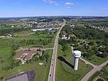 An aerial photo of Greenville, WI looking southeast down Hwy 15
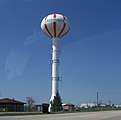 Water Tower, since repainted
References
- 1 2 3 "American FactFinder". United States Census Bureau. Archived from the original on 2013-09-11. Retrieved 2008-01-31.
- ↑ "US Board on Geographic Names". United States Geological Survey. 2007-10-25. Retrieved 2008-01-31.
- 1 2 Town of Greenville. Welcome to the Town of Greenville. Retrieved October 23, 2017.
- ↑ "Contact Air Wisconsin Archived 2011-06-04 at the Wayback Machine.." Air Wisconsin. Retrieved on May 19, 2009.
- ↑ http://www.eastcentralrpc.org/PlanGreenville/docs/Plan/Chapters/Ch_6_Economic%20Development.pdf
- ↑ Hortonville Area School District
- ↑ "Immanuel Lutheran School".
- ↑ "Immanuel Lutheran Church and School - WELS".
- ↑ http://dnr.wi.gov/news/weekly/article/print.asp?id=1942
- ↑ Greenville Lions Catfish Races
External links
| Core cities |  | |
|---|---|---|
| Largest municipalities over 10,000 in 2010 | ||
| Municipalities under 10,000 in 2010 |
| |
| Counties | ||
| ||
Municipalities and communities of Outagamie County, Wisconsin, United States | ||
|---|---|---|
| Cities | 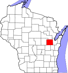 | |
| Villages | ||
| Towns | ||
| CDP | ||
| Unincorporated communities | ||
| Indian reservation | ||
| Ghost towns/neighborhoods | ||
| Footnotes | ‡This populated place also has portions in an adjacent county or counties | |
Coordinates: 44°18′01″N 88°32′11″W / 44.30028°N 88.53639°W