Shire of Glenelg
| Shire of Glenelg Victoria | |||||||||||||||
|---|---|---|---|---|---|---|---|---|---|---|---|---|---|---|---|
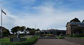 Municipal offices in Portland | |||||||||||||||
 Location in Victoria | |||||||||||||||
| Population | 19,557 (2016 census)[1] | ||||||||||||||
| • Density | 3.1483/km2 (8.1540/sq mi) | ||||||||||||||
| Established | 1994 | ||||||||||||||
| Gazetted | 23 September 1994[2] | ||||||||||||||
| Area | 6,212 km2 (2,398.5 sq mi) | ||||||||||||||
| Mayor | Cr Anita Rank | ||||||||||||||
| Council seat | Portland | ||||||||||||||
| Region | Barwon South West | ||||||||||||||
| State electorate(s) | |||||||||||||||
| Federal Division(s) | Wannon | ||||||||||||||
|
| |||||||||||||||
| Website | Shire of Glenelg | ||||||||||||||
| |||||||||||||||
The Shire of Glenelg is a local government area in the Barwon South West region of Victoria, Australia, located in the south-western part of the state. It covers an area of 6,212 square kilometres (2,398 sq mi) and at the 2016 Census had a population of over 19,000. It includes the towns of Casterton, Heywood, Merino and Portland. Although a shire of the same name existed before the amalgamations of the mid-1990s, the current Shire was formed in 1994 from the amalgamation of the former Shire of Glenelg with the Shire of Heywood and City of Portland.[2][3]
The Shire is governed and administered by the Glenelg Shire Council; its seat of local government and administrative centre is located at the council headquarters in Portland, it also has service centres located in Casterton and Heywood. The Shire is named after the Glenelg River, a major geographical feature that meanders through the LGA.
At the 2001 Census, the population of the Shire was distributed in the following way: Portland: 49.7%, Casterton: 8.7%, Heywood: 6.3%, Dartmoor: 1.3%, Merino: 1.1%, Narrawong: 0.9% and Rural Balance: 32%.
Council
Current composition
The council is composed of seven councillors elected to represent an unsubdivided municipality.[4]
| Ward | Councillor | Notes | |
|---|---|---|---|
| Unsubdivided | Robert Halliday | ||
| Alistair McDonald | |||
| Crissy Hawker | |||
| Anita Rank | Mayor | ||
| Karen Stephens | |||
| Geoff White | |||
| Gilbert Wilson | |||
Administration and governance
The council meets in the council chambers at the council headquarters in the Portland Municipal Offices, which is also the location of the council's administrative activities. It also provides customer services at both its administrative centre in Portland, and its service centres in Casterton and Heywood.
See also
References
- ↑ Australian Bureau of Statistics (27 June 2017). "Glenelg (S)". 2016 Census QuickStats. Retrieved 28 November 2017.

- 1 2 "Part 6—Shire of Glenelg". Victoria Government Gazette (1837-1997) (S63 ed.). Melbourne: Government of Victoria. 1994: 5. 23 September 1994. Retrieved 21 December 2015.
- ↑ "Part 7—Shire of Glenelg". Victoria Government Gazette (1837–1997) (S4 ed.). Melbourne: Government of Victoria. 1994: 4. 20 January 1995. Retrieved 10 January 2014.
- ↑ Local Government in Victoria. "Glenelg Shire Council". Department of Transport, Planning and Local Infrastructure. State Government of Victoria. Retrieved 12 January 2017.
External links
- Glenelg Shire Council official website
- Metlink local public transport map
- Link to Land Victoria interactive maps
Coordinates: 38°00′00″S 141°40′00″E / 38.00000°S 141.66667°E